Near Thurmont in Frederick County, Maryland — The American Northeast (Mid-Atlantic)
Raceway and Dam
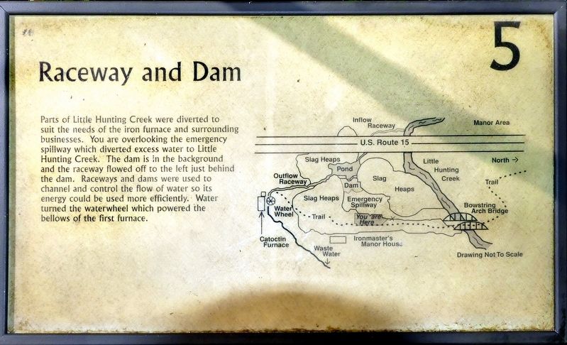
Raceways and dams were used to channel and control the flow of water so its energy could be used more efficiently. Water turned the waterwheel which powered the bellows of the first furnace. (Marker Number 5.)
Topics. This historical marker is listed in this topic list: Industry & Commerce.
Location. 39° 34.984′ N, 77° 26.06′ W. Marker is near Thurmont, Maryland, in Frederick County. Marker can be reached from Catoctin Furnace Road (Maryland Route 806) south of Red Bird Lane, on the right when traveling south. Touch for map. Marker is at or near this postal address: 12731 Catoctin Furnace Rd, Thurmont MD 21788, United States of America. Touch for directions.
Other nearby markers. At least 8 other markers are within walking distance of this marker. Bowstring Arch Bridge (within shouting distance of this marker); Slag Heaps (about 300 feet away, measured in a direct line); Ruins of the Ironmaster’s House (about 300 feet away); Ironmaster's Mansion (about 400 feet away); Catoctin Furnace (about 600 feet away); Catoctin Iron Furnace (about 700 feet away); a different marker also named Catoctin Iron Furnace (about 700 feet away); Dirty and Dangerous (about 700 feet away). Touch for a list and map of all markers in Thurmont.
Credits. This page was last revised on March 3, 2023. It was originally submitted on October 22, 2021, by Allen C. Browne of Silver Spring, Maryland. This page has been viewed 135 times since then and 12 times this year. Photos: 1, 2. submitted on October 22, 2021, by Allen C. Browne of Silver Spring, Maryland. • Mark Hilton was the editor who published this page.

