Hickman in Fulton County, Kentucky — The American South (East South Central)
Hickman Bluff Stabilization Project
1996 - 2000
Memphis District
U.S. Senator Mitch McConnell
Congressional Sponsor
Mayors of Hickman
Judy C. Powell
John P. Shuff
Richard H. White, M.D.
Project Design: D'Appolonia, Inc.
Prime Contractor: Schunbel Foundation Co.
Subcontractor: Coffey Construction Co.
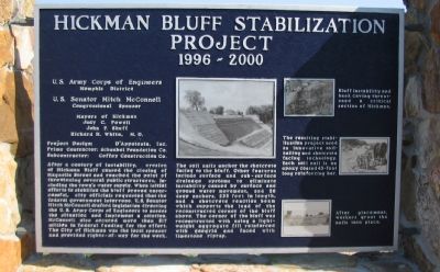
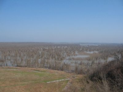
After a century of instability, erosion of Hickman Bluff caused the closing of Magnolia Street and reached the point of threatening several public structures, including the town's water supply. When initial efforts to stabilize the bluff proved unsuccessful, city officials requested that the federal government intervene. U.S. Senator Mich McConnell drafted legislation directing the U.S. Army Corps of Engineers to assess the situation and implement a solution. McConnell also secured more than $17 million in federal funding for the effort. The City of Hickman was the local sponsor and provided rights-of-way for the work.
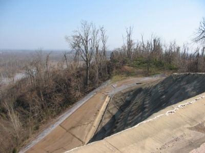
The soil nails anchor the shotcrete facing to the bluff. Other features include surface and sub-surface drainage systems to eliminate instability caused by surface and ground water movement, and 26 deep anchors, 233 feet in length, and a shotcrete reaction beam which supports the load of the reconstructed corner of the bluff above. The corner of the bluff was reconstructed with using a light-weight aggregate fill reinforced with geogrid and faced with limestone riprap.
Bluff instability and bank caving threatened a critical section of Hickman
The resulting stabilization project used an innovative soil-nailing and shotcrete facing technology. Each soil nail is an epoxy coated 45-foot long reinforcing bar.
After placement, workers grout the nails into place.
Topics. This historical marker is listed in this topic list: Charity & Public Work.
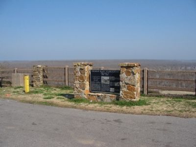
Location. 36° 34.313′ N, 89° 11.119′ W. Marker is in Hickman, Kentucky, in Fulton County. Marker is on Magnolia Street, on the right when traveling west. Located behind the Hickman Library. Touch for map. Marker is in this post office area: Hickman KY 42050, United States of America. Touch for directions.
Other nearby markers. At least 8 other markers are within 12 miles of this marker, measured as the crow flies. Elvis J. Stahr, Jr. (within shouting distance of this marker); Rufus B. Atwood (within shouting distance of this marker); Courthouse Steps (approx. half a mile away); Where Dixie Begins (approx. half a mile away); Fulton County (approx. half a mile away); Casey Jones (approx. 8.6 miles away); New Madrid Earthquake (approx. 9.3 miles away); Titan I (approx. 11.2 miles away in Tennessee). Touch for a list and map of all markers in Hickman.
More about this marker. On the marker are photos of the bluff erosion and stabilization measures employed.
Also see . . . Soil Nails. Details the use of this recently developed form of erosion control. (Submitted on April 29, 2009, by Craig Swain of Leesburg, Virginia.)
Credits. This page was last revised on September 19, 2020. It was originally submitted on April 29, 2009, by Craig Swain of Leesburg, Virginia. This page has been viewed 1,715 times since then and 31 times this year. Photos: 1, 2, 3, 4. submitted on April 29, 2009, by Craig Swain of Leesburg, Virginia.


