Rock Island in Warren County, Tennessee — The American South (East South Central)
“Minnow Box” Springhouse
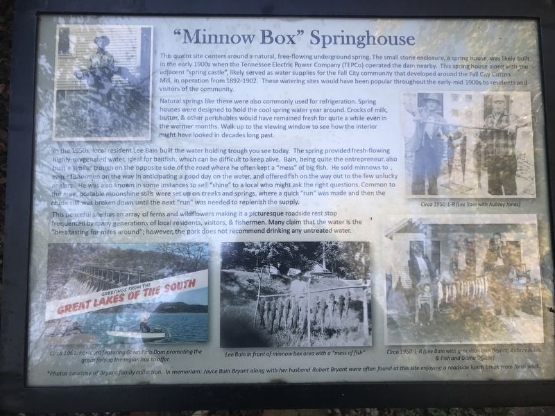
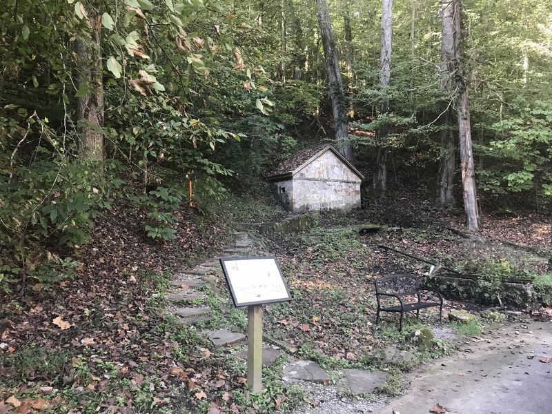
Natural springs like these were also commonly used for refrigeration. Spring houses were designed to hold the cool spring water year around. Crocks of milk, butter, & other perishables would have remained fresh for quite a while even in the warmer months. Walk up to the viewing window to see how the interior might have looked in decades long past.
In the 1950s, local resident Lee Bain built the water holding trough you see today. The spring provided fresh-flowing highly-oxygenated water, ideal for baitfish, which can be difficult to keep alive. Bain, being quite the entrepreneur, also built a similar trough on the opposite side of the road where he often kept a “mess” of big fish. He sold minnows to eager fishermen on the way in anticipating a good day on the water, and offered fish on the way out to the few unlucky anglers. He was also known in some instances to sell “shine” to a local who might ask the right questions. Common to the area, portable moonshine stills were set up on creeks and springs, where a quick “run” was made and then the crude still was broken down until the next “run” was needed to replenish the supply.
This peaceful site has an array of ferns and wildflowers making it a picturesque roadside rest stop frequented by many generations of local residents, visitors, & fishermen. Many claim that the water is the “best tasting for miles around”; however, the park does not recommend drinking any untreated water.
Captions (Clockwise from right)
• Circa 1950: L-R (Lee Bain with Aubrey Jones).
• Circa 1950:L-R (Lee Bain with grandson Dan Bryant, Aubrey Jones, & Fish and Game Officer)
• Lee Bain in front of minnow box area with a “mess of fish”
• Circa 1961: Postcard featuring Great Falls Dam promoting the great fishing the region has to offer.
* Photos courtesy of Bryant family collection. In memoriam: Joyce Buin Bryant along with her husband Robert Bryant were often found at this site enjoying a roadside lunch break from farm work.
Erected by Tennessee State Parks.
Topics. This historical marker is listed in these topic lists: Architecture • Industry & Commerce • Waterways & Vessels. A significant historical year for this entry is 1950.
Location. 35° 48.145′ N, 85° 37.55′ W. Marker is on Rock Island, Tennessee, in Warren County. Marker is on Great Falls Road (Tennessee Route 287) one mile east of Beach Road, on the right when traveling east. Marker is located east of the Great Falls Cotton Mill in Rock Island State Park. Touch for map. Marker is at or near this postal address: 1279 Great Falls Rd, Rock Island TN 38581, United States of America. Touch for directions.
Other nearby markers. At least 8 other markers are within 2 miles of this marker, measured as the crow flies. Spring Castle (about 600 feet away, measured in a direct line); Falls City (Great Falls) Cotton Mill (about 600 feet away); Great Falls HP-Spencer 46-kv Transmission Line (approx. half a mile away); Webb Hotel (approx. ¾ mile away); Rodgers' Tavern (approx. one mile away); Rock Island State Park (approx. one mile away); War on Tennessee’s Homefront (approx. 1½ miles away); The Old Kentucky Road (approx. 1.7 miles away). Touch for a list and map of all markers in Rock Island.
Credits. This page was last revised on October 24, 2021. It was originally submitted on October 24, 2021, by Duane and Tracy Marsteller of Murfreesboro, Tennessee. This page has been viewed 335 times since then and 82 times this year. Photos: 1, 2. submitted on October 24, 2021, by Duane and Tracy Marsteller of Murfreesboro, Tennessee.

