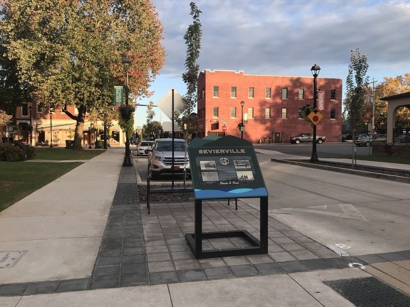
Sevierville in Sevier County, Tennessee — The American South (East South Central)
Sevierville
Floods & Fires
The oldest record of a major flood was recorded in 1867 at 16.5 stage feet. Since then, more than a dozen major floods have been recorded. The largest flood ever recorded in Sevierville was in 1875 at 18 feet.
In 1896, a flood measuring 16.8 feet damaged most businesses along with many dwellings. Another damaging flood occurred in 1920. This time the official recorded flood level was 16 feet. In 1928, a flood reached a height of 15.4 feet. Both prongs of the Little Pigeon River once again overflowed in 1957.
The last deluge occurred in 1965, two years after a series of floods over a two-week period left Sevierville a Federal Disaster Area. In March 1963, a flood measuring 14.7 feet caused extensive damage to downtown businesses and residences. But the worst was yet to come! While residents were still cleaning up from that flood. a second hit the following week with a crest a foot higher than the previous one. Water levels reached the tops of parking meters on Court Avenue. The event garnered coverage by national news sources.
The 1963 floods led to the Tennessee Valley Authority (TVA) implementing protective measures. By 1967 the West Prong had been rechanneled out of harm's way. There have been no serious floods since, and as a result, the town has grown extensively.
In 1856, a great fire destroyed the new courthouse, 41 houses, and several businesses in the downtown area. Most notably, the county lost valuable records documenting the lives of its early settlers. Another fire consumed much of downtown in 1900 causing businesses to move toward what became the commercial district encircling the new courthouse built in 1896.
Perhaps the most dramatic fire since the great fire of 1856 was the Temple Milling Company's blaze in 1980. A total of 105 men with twelve trucks fought the flames. By constantly spraying water on its roof, the heroic firemen managed to save the historic courthouse.
Captions
[Left, top] Flood at the forks of the river 1920
[Left, bottom] Corner of Bruce Street and Court Avenue in 1963
[Right, top] Court Avenue 1963
[Right, bottom] Temple Milling Company fire 1980
Erected by Sevierville Convention & Visitors Bureau.
Topics. This historical marker is listed in these topic lists: Disasters • Waterways & Vessels.
Location. 35° 52.047′ N, 83° 33.975′ W. Marker is in Sevierville, Tennessee, in Sevier County. Marker is on West Bruce Street west of Court Avenue, on the right when traveling west. Touch for map. Marker is at or near this postal address: 106 W Bruce St, Sevierville TN 37862, United States of America. Touch for directions.
Other nearby markers. At least 8 other markers are within walking distance of this marker. Sevier County Veterans (within shouting distance of this marker); Hon. Lieut. Spencer Clack (within shouting distance of this marker); Dolly Parton (within shouting distance of this marker); Isaac Dockery (within shouting distance of this marker); a different marker also named Sevierville (within shouting distance of this marker); a different marker also named Sevierville (within shouting distance of this marker); Dr. Massey's Bird Dog (within shouting distance of this marker); Sevierville's Infamous White Caps (about 300 feet away, measured in a direct line). Touch for a list and map of all markers in Sevierville.
Also see . . .
1. Floods on the Little Pigeon and west Fork Little Pigeon Rivers ... (PDF). 1958 Tennessee Valley Authority report about the city's flood history. (Submitted on October 24, 2021, by Duane and Tracy Marsteller of Murfreesboro, Tennessee.)
2. Historic Floods in Sevier County, Tennessee. Video by Sevier County Libraries about floods that hit the city prior to the rerouting of the Little Pigeon River's west fork. (Submitted on October 24, 2021, by Duane and Tracy Marsteller of Murfreesboro, Tennessee.)
Credits. This page was last revised on October 25, 2021. It was originally submitted on October 24, 2021, by Duane and Tracy Marsteller of Murfreesboro, Tennessee. This page has been viewed 401 times since then and 71 times this year. Photos: 1, 2. submitted on October 24, 2021, by Duane and Tracy Marsteller of Murfreesboro, Tennessee.

