West Sioux in Sioux Falls in Minnehaha County, South Dakota — The American Midwest (Upper Plains)
West Sioux Falls
October 23, 2021
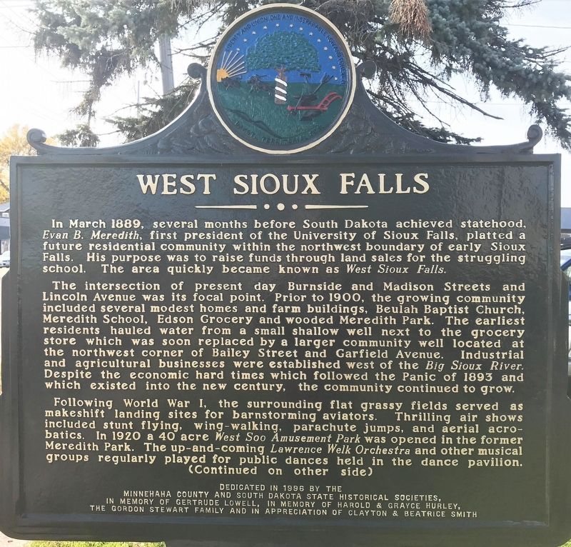
1. West Sioux Falls Marker
The intersection of present day Burnside and Madison Streets and Lincoln Avenue was its focal point. Prior to 1900, the growing community included several modest homes and farm buildings, Beulah Baptist Church, Meredith School, Edson Grocery and wooded Meredith Park. The earliest residents hauled water from a small shallow well next to the grocery store which was soon replaced by a larger community well located at the northwest corner of Bailey Street and Garfield Avenue. Industrial and agricultural businesses were established west of the Big Sioux River. Despite the economic hard times which followed the Panic of 1893 and which existed into the new century, the community continued to grow.
Following World War I, the surrounding flat grassy fields served as makeshift
this page online
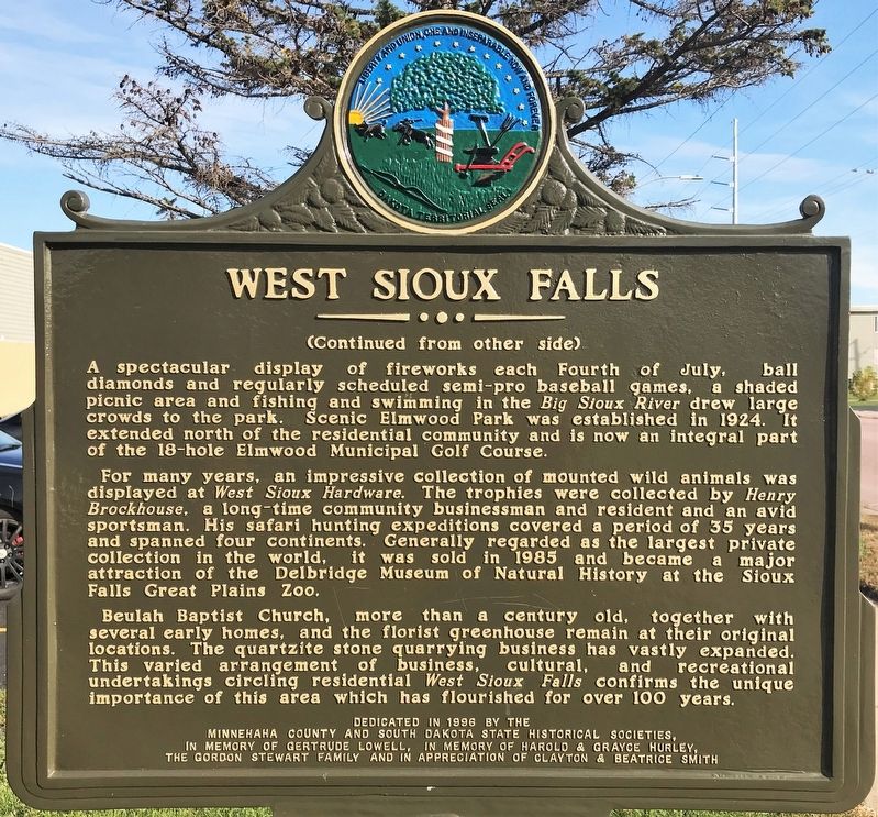
A spectacular display of fireworks each Fourth of July, ball diamonds and regularly scheduled semi-pro baseball games, a shaded picnic area and fishing and swimming in the Big Sioux River drew large crowds to the park. Scenic Elmwood Park was established in 1924. It extended north of the residential community and is now an integral part of the 18-hole Elmwood Municipal Golf Course.
For many years, an impressive collection of mounted wild animals was displayed at West Sioux Hardware. The trophies were collected by Henry Brockhouse, a long-time community businessman and resident and an avid sportsman. His safari hunting expeditions covered a period of 35 years and spanned four continents. Generally regarded as the largest private collection in the world, it was sold in 1985 and became
October 23, 2021
2. West Sioux Falls Marker
Beulah Baptist Church, more than a century old, together with several early homes, and the florist greenhouse remain at their original locations. The quartzite stone quarrying business has vastly expanded. This varied arrangement of business, cultural, and recreational undertakings circling residential West Sioux Falls confirms the unique importance of this area which has flourished for over 100 years.
Erected 1996 by Minnehaha County and South Dakota State Historical Societies, in memory of Gertrude Lowell, in memory of Harold & Grayce Hurley, the Gordon Stewart Family and in appreciation of Clayton & Beatrice Smith. (Marker Number 667.)
Topics and series. This historical marker is listed in this topic list: Political Subdivisions. In addition, it is included in the South Dakota State Historical Society Markers series list. A significant historical month for this entry is March 1889.
Location. 43° 33.511′ N, 96° 45.429′ W. Marker is in Sioux Falls, South Dakota, in Minnehaha County. It is in West Sioux. It is at the intersection of West
October 23, 2021
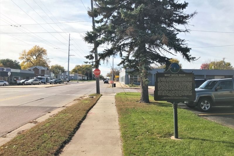
3. West Sioux Falls Marker, from the east

Regionally, this marker is in East River. It is also in the American Midwest, in the Lewis & Clark Corridor, in the Corn Belt, on the prairies, and on the Northern Plains. Globally, it is in North America, the Western Hemisphere, the Western World, and the Anglosphere. Historically, it finds itself in what was once Rupert’s Land and also the Louisiana Purchase.
Other nearby markers. At least 8 other markers are within walking distance of this marker: All City Elementary (approx. 0.2 miles away); The Town Pump (approx. 0.2 miles away); a different marker also named West Sioux Falls (approx. 0.3 miles away); J. F. Maddox (approx. ¾ mile away); Shoto-Teien Japanese Gardens (approx. ¾ mile away); In Memory of Makana Na Ota E 'En (approx. 0.8 miles away); Foss, Joseph Jacob (approx. 0.8 miles away); Leo K. Thorsness (approx. 0.8 miles away). Touch for a list and map of all markers

October 23, 2021
4. West Sioux Falls Marker, from the west
Credits. This page was last revised on February 16, 2023. It was originally submitted on October 26, 2021. This page has been viewed 391 times since then and 21 times this year. Photos: 1, 2, 3, 4. submitted on October 26, 2021. • J. Makali Bruton was the editor who published this page.
