Near Garretson in Minnehaha County, South Dakota — The American Midwest (Upper Plains)
1908 Palisades Bridge
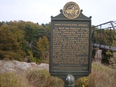
Photographed by Roger Dean Meyer, October 6, 2008
1. 1908 Palisades Bridge Marker, Side 1
A milldam bridge was built nearby in 1870 when C. W. Patten erected a flour mill on high ground northwest of the
In 1883 a bridge was built on this site. It made the uphill grade less abrupt for loaded wagons heading to Patten’s Mill and the village of Palisade. An ice jam destroyed this bridge in the spring of 1896 by lifting it from its moorings and floating it downstream.
The 1908 Palisades Bridge was listed on the National Register of Historic Place in 1999.
Erected 2000 by Minnehaha County and South
this page online
Topics and series. This historical marker is listed in this topic list: Bridges & Viaducts. In addition, it is included in the South Dakota State Historical Society Markers series list. A significant historical year for this entry is 1908.
Location. 43° 41.34′ N, 96° 31.118′ W. Marker is near Garretson, South Dakota, in Minnehaha County. It is on 255th Street ¼ mile west of 255th Street, on the right when traveling west. The bridge crosses Split Rock Creek within the Palisades State Park. The road dead ends after crossing the bridge and has no route number or name. It is off 255th Street which is a park road. The marker is on the west end of the bridge. Touch for map. Marker is in this post office area: Garretson SD 57030, United States of America. Touch for directions.

Regionally, this marker is in the Yankton Sioux Tribe, in East River, and in Greater Sioux Falls. It is also in the American Midwest, in the Lewis & Clark Corridor, in the Corn Belt, on the prairies, and on the Northern Plains. Globally, it is in North America, the Western Hemisphere, the Western World,
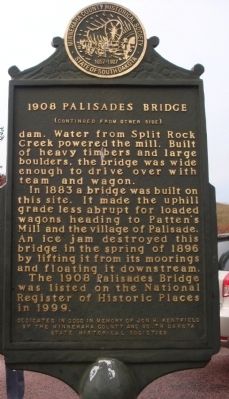
Photographed by Roger Dean Meyer, October 6, 2008
2. 1908 Palisades Bridge Marker, Side 2
Other nearby markers. At least 8 other markers are within 5 miles of this marker, measured as the crow flies: Village of Palisades (approx. 0.2 miles away); Palisades State Park (approx. 0.2 miles away); Garretson (approx. 2.2 miles away); Festival of Progress (approx. 2.4 miles away); The Legend of Jesse James (approx. 2.6 miles away); Norway Lutheran Church (approx. 4.6 miles away); Eleven Original Pioneer Families (approx. 4.6 miles away); a different marker also named Norway Lutheran Church (approx. 4.6 miles away). Touch for a list and map of all markers in Garretson.
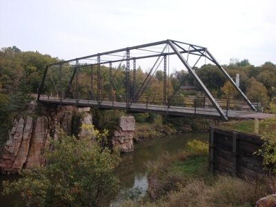
Photographed by Roger Dean Meyer, October 6, 2008
3. 1908 Palisades Bridge Side View
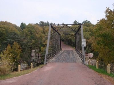
Photographed by Roger Dean Meyer, October 6, 2008
4. 1908 Palisades Bridge View From the Road
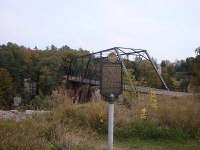
Photographed by Roger Dean Meyer, October 6, 2008
5. 1908 Palisades Bridge Marker with Bridge in Background
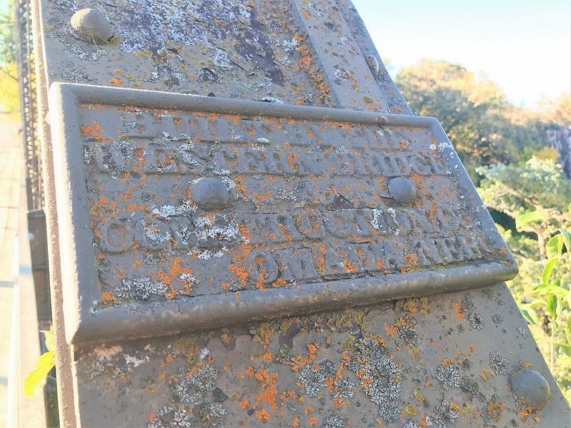
October 7, 2022
6. 1908 Palisades Bridge Plate
Omaha Neb"
Credits. This page was last revised on October 19, 2022. It was originally submitted on September 14, 2013, by Roger Dean Meyer of Yankton, South Dakota. This page has been viewed 1,553 times since then and 97 times this year. Last updated on October 27, 2021. Photos: 1, 2, 3, 4, 5. submitted on September 14, 2013, by Roger Dean Meyer of Yankton, South Dakota. 6. submitted on October 18, 2022. • J. Makali Bruton was the editor who published this page.
