North End East in Sioux Falls in Minnehaha County, South Dakota — The American Midwest (Upper Plains)
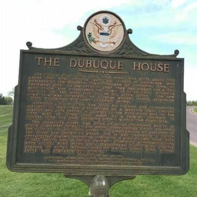
The Dubuque House
Although Dubuque House was built for visitors and prospective settlers, it may have also served as a meeting hall, freight station and post office. It appears in the field notes and on the first map of Sioux Falls made by a federal surveyor in August, 1859, the only building shown within the town-site.
The primitive hotel was built of rough undressed blocks of Sioux Quartzite, found in the stone outcroppings which surround the Falls of the Big Sioux River. No photographs or sketches of the hotel are known to exist, but it was probably a rough rectangular-shaped structure featuring a single open room with a loft above and a cellar below. Sleeping accommodations were crude, with cloth sack mattresses filled with prairie grasses on rough wooden cots or on the floor, with animal skins and blankets for covers.
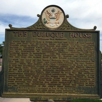
Since the settlers had a steam-driven saw mill, we can assume that the roof was probably made of rough boards and light wooden poles covered with thatch and dirt, much like settlers’ cabins. Windows were small and covered with cloth or skins. Oil lamps provided any interior lighting. There probably was not an inkeeper in residence; whether visitors paid for sleeping space is uncertain. But the existence of the Dubuque House enabled the town promoters to assure the world that the new city did indeed have a new hotel!
With the rest of the town, Dubuque House was abandoned in the Dakota War of 1862 and probably burned by the Santee Sioux. When fort Dakota, D.T., was established in 1865 at what is now the northeast corner of Phillips Avenue and Eight Street, the Sioux Falls town-site was included within the boundaries of the Fort. Not until Fort Dakota was closed in 1869 was the military reservation reopened for civilian settlement. The remains of the Dubuque House were razed and the stones were probably used to begin the construction of the Stevenson Hotel near the intersection of North Main Avenue and Falls Park Drive. Although the hotel’s walls were erected, the building was never completed. However, in 1874, stone from the unfinished Stevenson Hotel was used nearby for the construction of the city’s first brewery.
Erected 1997 by the Minnehaha County and South Dakota State Historical Societies, Minnehaha Century Fund and Blake Law Offices. (Marker Number 673.)
Topics and series. This historical marker is listed in this topic list: Settlements & Settlers. In addition, it is included in the South Dakota State Historical Society Markers series list. A significant historical month for this entry is September 1857.
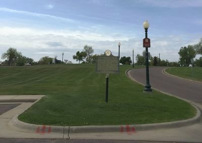
Location. 43° 33.549′ N, 96° 43.401′ W. Marker is in Sioux Falls, South Dakota, in Minnehaha County. It is in North End East. Marker is on North 2nd Avenue near East Falls Park Drive. It is at the entrance to the first parking lot for the Falls Park Visitor Information Center. Touch for map. Marker is at or near this postal address: 131 E Falls Park Dr, Sioux Falls SD 57104, United States of America. Touch for directions.
Other nearby markers. At least 8 other markers are within walking distance of this marker. Human Timeline (within shouting distance of this marker); Frederick Manfred’s “Siouxland” (about 500 feet away, measured in a direct line); Artisans at the Falls (about 600 feet away); In the Name of Progress (about 600 feet away); Monarch of the Plains (about 600 feet away); Prison Quarry (about 600 feet away); The Promise of Electricity (about 700 feet away); Falls Park Bridge (about 700 feet away). Touch for a list and map of all markers in Sioux Falls.
Credits. This page was last revised on March 16, 2023. It was originally submitted on December 14, 2015, by J. J. Prats of Powell, Ohio. This page has been viewed 588 times since then and 33 times this year. Last updated on October 27, 2021. Photos: 1, 2, 3. submitted on December 14, 2015, by J. J. Prats of Powell, Ohio. • J. Makali Bruton was the editor who published this page.


