Gilroy in Santa Clara County, California — The American West (Pacific Coastal)
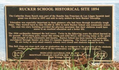
Rucker School Historical Site 1894
Photographed by Syd Whittle, April 25, 2009
1. Rucker School Historical Site 1894 Marker
Education was especially important to these pioneers who had been through dreadfully tough times. They worked hard to raise $5,000 in 1894 to build Rucker School and community center. The once two story building provided the physical assurance that their children would have access to an excellent education and better life.
The 1906 earthquake damaged the bell tower. Twice in the following years the school burned to the ground. Everything gone, except this strong and solid BELL still serving today as the spirit and strength of this community and faculty. Rucker School has been known for academic enrichment through theater arts since its humble beginning. The School was unified in 1966. We are lucky as most small country schools were closed and students bussed to town.
This bell rings out clear each year on graduation day as testament to the maturity of the students through the steadfast efforts of this community and Rucker’s excellent teachers.
this page online
Mountain Charlie Chapter 1850 E Clampus Vitus
Right Wrongs Nobody
Erected 2009 by Mountain Charlie Chapter 1850, E. Clampus Vitus.
Topics and series. This historical marker is listed in these topic lists: Education • Notable Buildings • Settlements & Settlers. In addition, it is included in the E Clampus Vitus series list. A significant historical date for this entry is February 20, 1914.
Location. 37° 3.224′ N, 121° 35.232′ W. Marker is in Gilroy, California, in Santa Clara County. It is at the intersection of 4th Street and Fourth Street, on the right when traveling west on 4th Street. Marker and bell are located on the grounds of the Rucker School. Touch for map. Marker is at or near this postal address: 325 Santa Clara Avenue, Gilroy CA 95020, United States of America. Touch for directions.

Regionally, this marker is in the San Francisco Bay Area and on the Coast Ranges. It is also on the American Pacific Coast. Globally, it is in North America, on the Ring of Fire, on the Pacific Rim, in the Western Hemisphere, in the Western World, and in the Anglosphere. Historically, it finds itself in what
Photographed by Syd Whittle, April 25, 2009
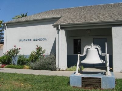
2. Rucker School Bell and Historical Site 1894 Marker
Other nearby markers. At least 8 other markers are within 4 miles of this marker, measured as the crow flies: Franklin Family Ranch (approx. 0.2 miles away); Community of San Martin (approx. 2½ miles away); Station Master, James A. Houck (approx. 3.2 miles away); Gilroy Historic Site No. 2 (approx. 3.2 miles away); Coyote Lake – Harvey Bear Ranch County Park (approx. 3.2 miles away); Pioneering Murphy Family (approx. 3.2 miles away); Robinson Hardware Co. (approx. 3.2 miles away); Thornton Building (approx. 3.3 miles away). Touch for a list and map of all markers in Gilroy.
Also see . . . Wikipedia Article on “Ruckers Township”, California. (Submitted on April 30, 2009, by Syd Whittle of Mesa, Arizona.)
Photographed by Syd Whittle, April 25, 2009
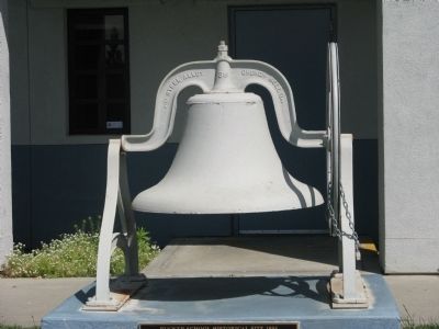
3. Rucker School Bell
Photographed by Syd Whittle, April 25, 2009
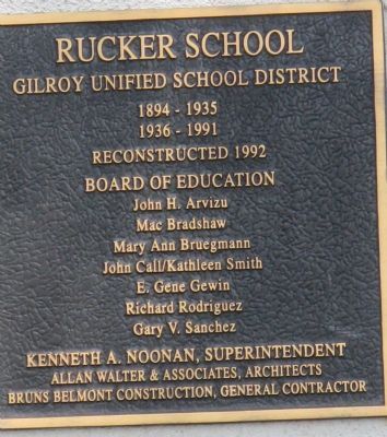
4. Second Marker at School
Gilroy Unified School District
1894-1935
1936-1991
Reconstructed 1992
Board of Education
John H. Arvizu
Mac Bradshaw
Mary Ann Bruegmann
John Call/Kathleen Smith
E. Gene Gewin
Richard Rodriguez
Gary V. Sanchez
Kenneth A. Noonan, Superintendent
Allan Walter & Associates, Architects
Bruns Belmont Construction, General Contractor
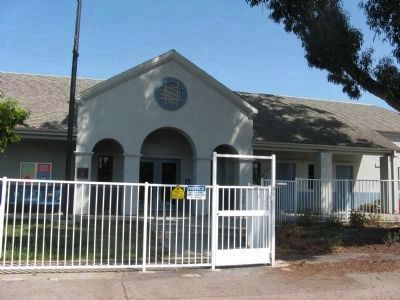
Photographed by Syd Whittle, April 25, 2009
5. Rucker School
Credits. This page was last revised on June 16, 2016. It was originally submitted on April 30, 2009, by Syd Whittle of Mesa, Arizona. This page has been viewed 2,077 times since then and 57 times this year. Photos: 1, 2, 3, 4, 5. submitted on April 30, 2009, by Syd Whittle of Mesa, Arizona.
