Castalian Springs in Sumner County, Tennessee — The American South (East South Central)
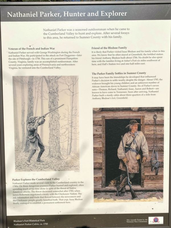
Nathaniel Parker, Hunter and Explorer
Bledsoe's Fort Historic Park
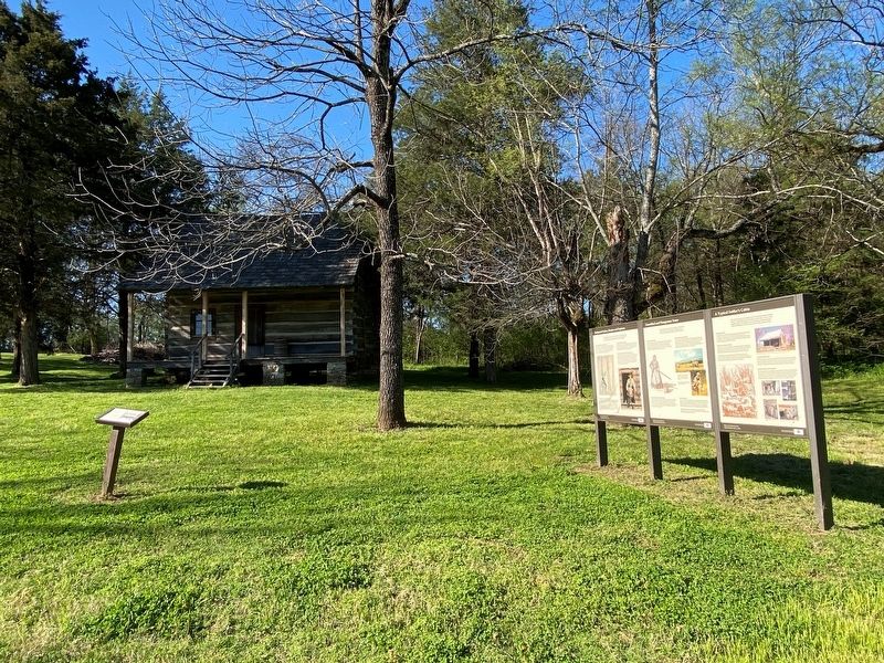
— Nathaniel Parker Cabin, ca. 1785 —
Inscription.
Nathaniel Parker was a seasoned outdoorsman when he came to the Cumberland Valley to hunt and explore. After several forays to this area, he returned to Sumner County with his family.
Veteran of the French and Indian War
Nathaniel Parker served with George Washington during the French and Indian War. He participated in the attack on Fort Duquesne-later the site of Pittsburgh-in 1758. This son of a prominent Hampshire County, Virginia, family was an accomplished outdoorsman. After several years exploring areas of Pennsylvania and northwestern Virginia, he ventured into the Cumberland Valley.
Parker Explores the Cumberland Valley
Nathaniel Parker made several visits to the Cumberland country in the 1780s. On these dangerous journeys Parker hunted and explored, often spending much of his time alone in spite of the threat of Native American attacks. The threat decreased somewhat after 1783, when James Robertson negotiated a treaty with the Chickasaw Nation. The aid, information and trade that flowed between the newcomers and the Chickasaw people greatly benefited both. That year, Isaaç Bledsoe finally managed to establish a permanent settlement here.
Friend of the Bledsoe Family
It is likely that Parker visited Isaac Bledsoe and his family when in this area. We know that he often stayed at Greenfield, the fortified station his friend Anthony Bledsoe built about 1784. No doubt he also spent time with the families living at Asher's Fort six miles southwest of here, and Hall's Station two and one-half miles east.
The Parker Family Settles in Sumner County
It may have been the friendships he developed that influenced Parker's decision to settle nearby despite the danger. About 1785, the widower brought his young children and an unknown number of African American slaves to Sumner County. Six of Parker's seven sons—Thomas, Richard, Nathaniel, Isaac, Aaron and Robert—are known to have come to Tennessee. Soon after arriving, Nathaniel Parker built a sturdy cabin about three-quarters of a mile from Anthony Bledsoe's fort, Greenfield.
Erected by Tennessee Wars Commission.
Topics. This historical marker is listed in these topic lists: Forts and Castles • Settlements & Settlers • War, French and Indian. A significant historical year for this entry is 1758.
Location. 36° 23.84′ N, 86° 19.184′ W. Marker is in Castalian Springs, Tennessee, in Sumner County. Marker can be reached from Hartsville Pike (Tennessee Route 25), on the right when traveling west. Touch for map. Marker is at or near this postal address: 2901 Hartsville Pike, Castalian Springs TN 37031, United States of America. Touch for directions.
Other nearby markers. At least 8 other markers
are within walking distance of this marker. Unsettled and Dangerous Years (here, next to this marker); A Typical Settler's Cabin (here, next to this marker); The Nathaniel Parker Log Cabin (here, next to this marker); Capt. Horace Lawson Hunley (a few steps from this marker); Bledsoe's Fort and Monument (about 300 feet away, measured in a direct line); Bledsoe's Lick (about 400 feet away); A Pioneer Cemetery (about 500 feet away); Rogana (about 500 feet away). Touch for a list and map of all markers in Castalian Springs.
Credits. This page was last revised on October 30, 2021. It was originally submitted on October 29, 2021, by Darren Jefferson Clay of Duluth, Georgia. This page has been viewed 259 times since then and 39 times this year. Photos: 1, 2. submitted on October 29, 2021, by Darren Jefferson Clay of Duluth, Georgia. • Mark Hilton was the editor who published this page.

