Castalian Springs in Sumner County, Tennessee — The American South (East South Central)
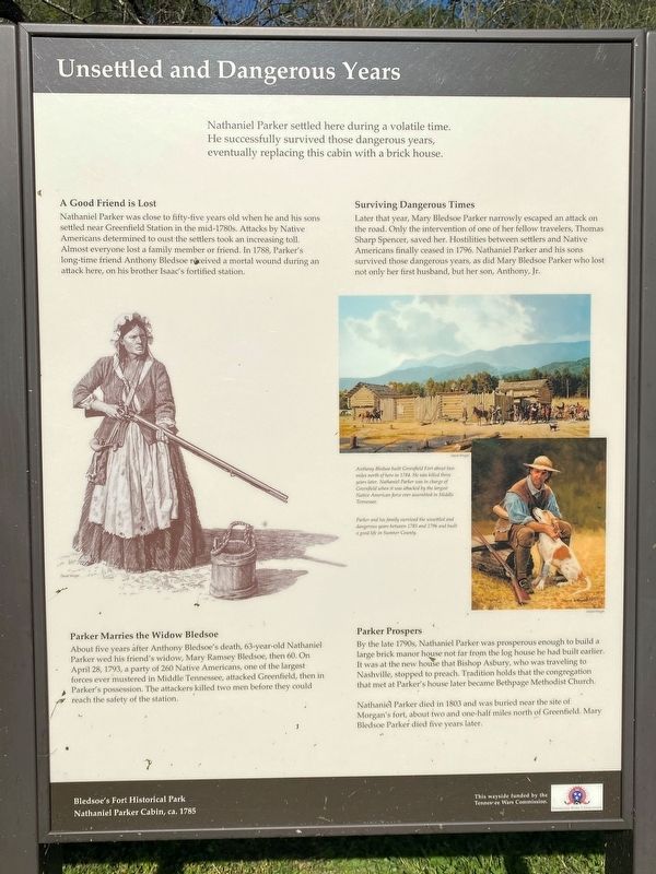
Unsettled and Dangerous Years
Bledsoe's Fort Historic Park
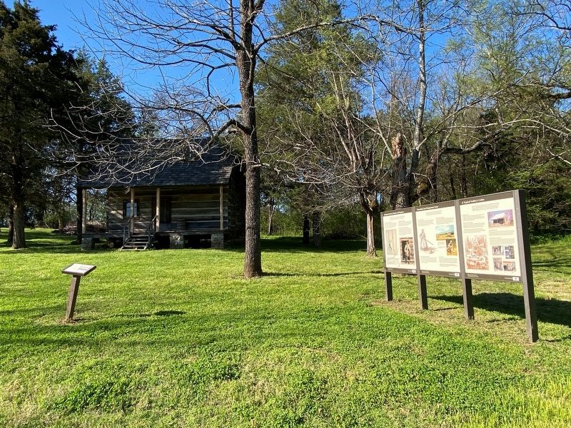
— Nathaniel Parker Cabin, ca. 1785 —
A Good Friend is Lost
Nathaniel Parker was close to fifty-five years old when he and his sons settled near Greenfield Station in the mid-1780s. Attacks by Native Americans determined to oust the settlers took an increasing toll. In 1788, Parker's long-time friend Anthony Bledsoe received a mortal wound during an attack here, on his brother Isaac's fortified station.
Parker Marries the Widow Bledsoe
About five years after Anthony Bledsoe's death, 63-year-old Nathaniel Parker wed his friend's widow, Mary Ramsey Bledsoe, then 60. On April 28, 1793, a party of 260 Native Americans, one of the largest forces ever mustered in Middle Tennessee, attacked Greenfield, then in Parker's possession. The attackers killed two men before they could reach the safety of the station.
Surviving Dangerous Times
Later that year, Mary Bledsoe Parker narrowly escaped an attack on the road. Only the intervention of one of her fellow travelers, Thomas Sharp Spencer, saved her. Hostilities between settlers and Native Americans finally ceased in 1796. Nathaniel Parker and his sons survived those dangerous years, as did Mary Bledsoe Parker who lost not only her first husband, but her son, Anthony, Jr. Almost everyone lost a family member or friend.
Parker Prospers
By the late 1790s, Nathaniel Parker was prosperous enough to build a large brick manor house not far from the log house he had built earlier. It was at the new house that Bishop Asbury, who was traveling to Nashville, stopped to preach. Tradition holds that the congregation that met at Parker's house later became Bethpage Methodist Church.
Nathaniel Parker died in 1803 and was buried near the site of Morgan's fort, about two and one-half miles north of Greenfield. Mary Bledsoe Parker died five years later.
Illustration 1 caption: Anthony Bledsoe built Greenfield Fort about two miles north of here in 1784. He was killed three years later. Nathaniel Parker was in charge of Greenfield when it was attacked by the largest Native American force ever assembled in Middle Tennessee.
Illustration 2 caption: Parker and his family survived the unsettled and dangerous years between 1785 and 1796 and built a good life in Sumner County.
Erected by Tennessee Wars Commission.
Topics. This historical marker is listed in these topic lists: Settlements & Settlers • War, French and Indian. A significant historical date for this entry is April 28, 1793.
Location. 36° 23.839′ N, 86° 19.184′ W. Marker is in Castalian Springs, Tennessee, in Sumner County. Marker can be reached from Hartsville Pike (Tennessee Route 25). Touch for map. Marker is at or near this postal address: 2901 Hartsville Pike, Castalian Springs TN 37031, United States of America. Touch for directions.
Other nearby markers. At least 8 other markers are within walking distance of this marker. A Typical Settler's Cabin (here, next to this marker); Nathaniel Parker, Hunter and Explorer (here, next to this marker); The Nathaniel Parker Log Cabin (here, next to this marker); Capt. Horace Lawson Hunley (a few steps from this marker); Bledsoe's Fort and Monument (about 300 feet away, measured in a direct line); Bledsoe's Lick (about 400 feet away); A Pioneer Cemetery (about 500 feet away); Rogana (about 500 feet away). Touch for a list and map of all markers in Castalian Springs.
Credits. This page was last revised on October 30, 2021. It was originally submitted on October 29, 2021, by Darren Jefferson Clay of Duluth, Georgia. This page has been viewed 212 times since then and 32 times this year. Photos: 1, 2. submitted on October 29, 2021, by Darren Jefferson Clay of Duluth, Georgia. • Mark Hilton was the editor who published this page.

