Wickliffe in Ballard County, Kentucky — The American South (East South Central)
Fort Jefferson
Before establishment of the two forts, Union troops were active in Ballard County. On June 5 and 6, 1861, a small force was observed checking on rebel activity, and again on August 21, 1861.
By late September 1861, there were 3,595 federal troops at Fort Holt and more than 2,000 at Fort Jefferson. Refugees, mostly former slaves, flooded Union lines soon after the forts were established. They were put to work by General Grant on the fortifications at Fort Holt and worked felling trees and digging earthworks.
Troops from Fort Jefferson and Fort Holt were sent to Elliott's Mill and involved in skirmishes and reconnaissance in late September 1861. Fort Holt troops later went on a September 26 raid on Blandville and arrested secessionists on September 26. All the troops from Fort Holt went with General Grant and fought in the Battle of Belmont.
Most of the troops from Forts Holt and Jefferson accompanied General Grant to Forts Henry and Donelson as the western theatre moved east and south. On January 10, 1862 Federal troops were sent to Fort Jefferson as a diversion to distract Confederates at Forts Henry and Donelson.
Much of the action seen by both forts involved river boats. A naval skirmish occurred near Fort Jefferson at Lucus Bend on the Mississippi River, September 9 and 10, 1861. The USS Conestoga defeated the CSS Yankee, but returned to Cairo under heavy sniper fire from both sides of the river. The largest skirmish occurred on January 11, 1862 at Lucas Bend. Confederate gunboats attacked the USS Essex and the USS St. Louis. After twenty minutes of artillery exchanges and an hour-long running battle there was no clear winner. This encounter was the last time the Confederate Navy approached this far north.
By April 1862, both of these forts were deserted, Fort Holt having been flooded out in the spring. Federal forces in far western Kentucky concentrated at Columbus and Paducah.
Erected by Kentucky Transportation Cabinet. (Marker Number 27.)
Topics and series. This historical marker is listed in these topic lists: War, US Civil • War, US Revolutionary. In addition, it is included in the Former U.S. Presidents: #18 Ulysses S. Grant series list. A significant historical month for this entry is January 1874.
Location. 36° 57.342′ N, 89° 5.469′ W. Marker is in Wickliffe, Kentucky, in Ballard County. Marker is on Westvaco Road (U.S. 51/62), on the right when traveling south. Located at the entrance to Fort Jefferson Memorial Cross Park. Touch for map. Marker is in this post office area: Wickliffe KY 42087, United States of America. Touch for directions.
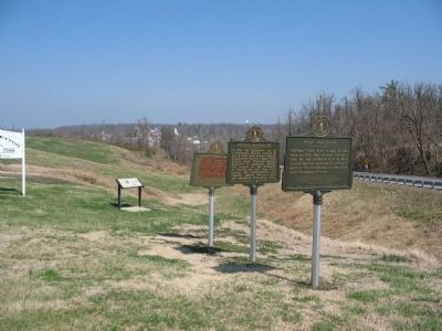
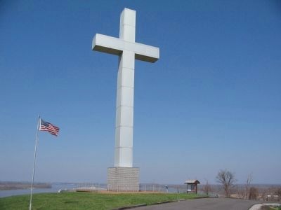
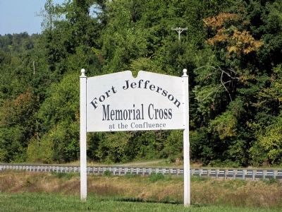
Other nearby markers. At least 8 other markers are within one mile of this marker, measured as the crow flies. Union Supply Base (a few steps from this marker); Fort Jefferson Site / Indian Massacre (a few steps from this marker); Lewis and Clark in Kentucky Fort Jefferson (a few steps from this marker); Fort Jefferson Memorial Cross at the Confluence (about 700 feet away, measured in a direct line); Lewis & Clark at Old Fort Jefferson (approx. 0.2 miles away); County Named, 1842 (approx. 0.7 miles away);
Private First Class Robert Monroe Hammonds (approx. 0.7 miles away); The Prince of the French Explorers (approx. one mile away). Touch for a list and map of all markers in Wickliffe.
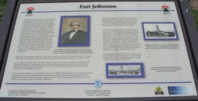
More about this marker. On the left center of the marker is a portrait of Joseph Holt. Fort Holt was named for Joseph Holt, Secretary of War at the end of the Buchannan Administration. He was a native of Breckinridge County, Kentucky. In the upper right is a photo of the USS Conestoga which defeated the CSS Yankee in a skirmish that occurred near Fort Jefferson on the Mississippi River. On the lower right is an engraving of Fort Holt which was on the Kentucky side of the Ohio River opposite of Cairo, Illinois. The marker is Site 27 of the Kentucky Ohio River Civil War Heritage Trail.
Photographed By Craig Swain
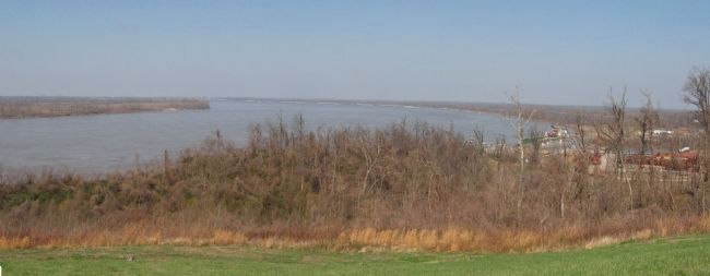
4. Mississippi River at Wickliffe
Looking north from the site of Fort Jefferson. To the left is Bird Point on the Missouri shore. Beyond Bird Point, behind the bend of the river is Cairo and the confluence of the Mississippi and Ohio Rivers. On the right is the river port at Wickliffe with many river barges docked. Fort Holt stood on the low ground north of the river port.
Credits. This page was last revised on October 5, 2020. It was originally submitted on May 1, 2009, by Craig Swain of Leesburg, Virginia. This page has been viewed 3,322 times since then and 73 times this year. Photos: 1, 2, 3. submitted on May 1, 2009, by Craig Swain of Leesburg, Virginia. 4. submitted on May 2, 2009, by Craig Swain of Leesburg, Virginia. 5. submitted on October 3, 2010, by Monty L. Robertson of Loami, Illinois.
