Perry Point in Cecil County, Maryland — The American Northeast (Mid-Atlantic)
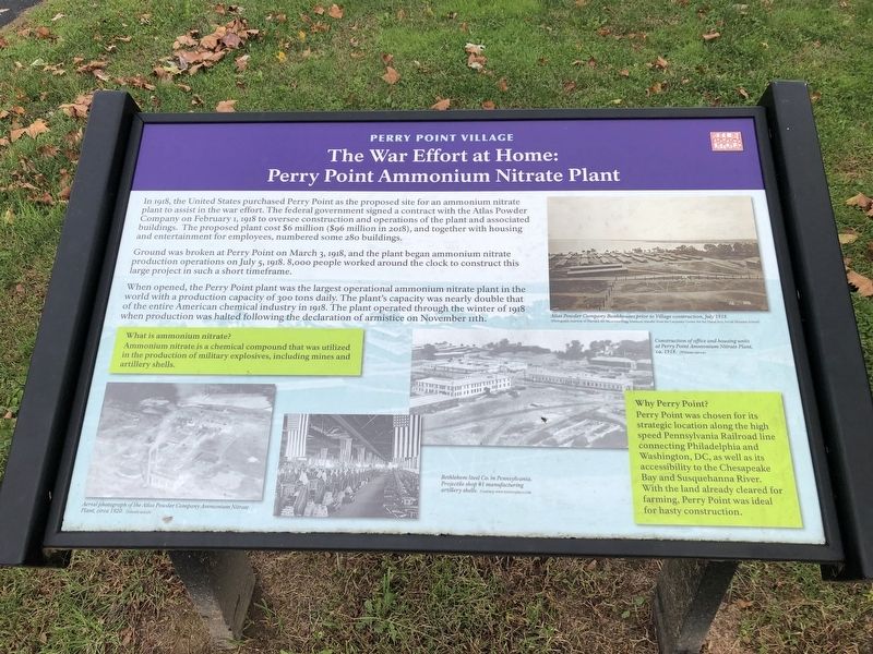
The War Effort at Home: Perry Point Ammonium Nitrate Plant
Perry Point Village
Photographed by Devry Becker Jones (CC0), October 30, 2021
1. The War Effort at Home: Perry Point Ammonium Nitrate Plant Marker
In 1918, the United States purchased Perry Point as the proposed site for an ammonium nitrate plant to assist in the war effort. The federal government signed a contract with the Atlas Powder Company on February 1, 1918 to oversee construction and operations of the plant and associated buildings. The proposed plant cost $6 million ($96 million in 2018), and together with housing and entertainment for employees, numbered some 280 buildings.
Ground was broken at Perry Point on March 3, 1918, and the plant began ammonium nitrate production operations on July 5, 1918. 8,000 people worked around the clock to construct this large project in such a short timeframe.
When opened, the Perry Point plant was the largest operational ammonium nitrate plant in the world with a production capacity of 300 tons daily. The plant's capacity was nearly double that of the entire American chemical industry in 1918. The plant operated through the winter of 1918 when production was halted following the declaration of armistice on November 11th.
What is ammonium nitrate?
Ammonium nitrate is a chemical compound that was utilized in the production of military explosives, including mines and artillery shells.
Why Perry Point?
Perry Point was chosen for its strategic location along the high speed Pennsylvania Railroad line connecting Philadelphia and Washington, DC, as well as its accessibility to the Chesapeake Bay and Susquehanna River. With the land already cleared for farming, Perry Point was ideal for hasty construction.
Topics and series.
this page online
Location. 39° 33.216′ N, 76° 4.446′ W. Marker is in Perry Point, Maryland, in Cecil County. It is at the intersection of 3rd Street and Avenue A, on the left when traveling east on 3rd Street. Touch for map. Marker is at or near this postal address: 1085 3rd St, Perry Point MD 21902, United States of America. Touch for directions.

Regionally, this marker is in Greater Wilmington, on the Eastern Shore, and in Greater Philadelphia. It is also in the American Mid-Atlantic, on the Delmarva Peninsula, in the Tidewater, in the Chesapeake Bay Region, and on the Eastern Seaboard. Globally, it is in the North Atlantic Region, North America, the Western Hemisphere, the Western World, and the Anglosphere. Historically, it finds itself in what was once one of the original Thirteen Colonies and also the Antebellum South.
Other nearby markers. At least 8 other markers are within walking
Photographed by Devry Becker Jones (CC0), October 30, 2021
2. The War Effort at Home: Perry Point Ammonium Nitrate Plant Marker
Another marker is no longer nearby. Perryville (was approx. 0.3 miles away but has been replaced with another marker now near it).
Credits. This page was last revised on October 31, 2021. It was originally submitted on October 31, 2021, by Devry Becker Jones of Washington, District of Columbia. This page has been viewed 686 times since then and 58 times this year. Photos: 1, 2. submitted on October 31, 2021, by Devry Becker Jones of Washington, District of Columbia.
