Kittery in York County, Maine — The American Northeast (New England)
Fort Foster
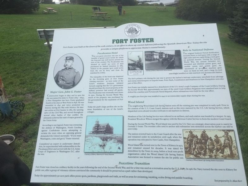
Fort Foster was built at the dawn of the 20th century, in an effort to shore up coastal defenses following the Spanish-American War. Today the site provides a unique platform to appreciate Maine’s coastal beauty.
Major Gen. John G. Foster
Construction began in 1897, and in 1900 the site was named for John G. Foster (1823-1874), a New Hampshire war hero. Foster graduated fourth in his class at West Point in 1846. He was wounded in 1847 and twice promoted for bravery during the War with Mexico. He later saw action at Fort Sumter in 1861, the opening action of the Civil War, and served throughout several other battles of that conflict. He ultimately achieved the rank of major general in the Union Army.
According to one legend, Foster was overseeing the defense of Washington, North Carolina against Confederate forces attempting to reclaim the town when an opposing general demanded the Union's surrender. "If you want Washington, come and get it," Foster retorted.
Considered an expert in underwater demolition, he experimented with submersibles in the Piscataqua River, and served with U.S. Army Corps of Engineers in Washington D.C. after the war.
Pocahontas Hotel
This 200-guest structure was one of the handful of grand resort hotels for which the Seacoast was well known around the turn of the century. The Pocahontas was situated on nearly 190 acres of land purchased by Samuel Jennison in 1885. Visitors to the popular spot could arrive from the sea by ferry and from the land mainland by trolley.
The tranquility of the hotel was shattered by the booming guns of Fort Foster training exercises — as were some of the hotel's windows. Jennison initiated lawsuits arguing that the U.S. government should purchase resort property as the military presence had scared off guests. The Pocahontas was eventually torn down in 1920. During the Second World War, much of the property was purchased by the government for the expansion of Fort Foster.
Today the park's large pavilion sits on the stone foundations of one of the hotel's cottages.
[Photo] Courtesy of Kittery Historical & Naval Museum
Role in National Defense
The original Edicott Period fortification included three 10-inch guns with a range of eight miles and two rapid firing 3-inch guns on pedestal mounts. During the Second World War, the arsenal included two mounted and shielded 90mm guns and mobile 37mm and 40mm guns. An assortment of 50-caliber machine guns were on hand as well, and a large 60-inch searchlight installed on rails watched over Portsmouth Harbor.
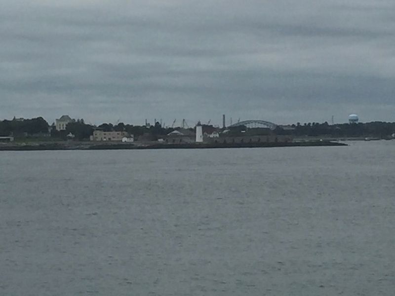
The fort's primary mission during the war was to protect the harbor's intricate underwater minefield from sabotage and enemy minesweepers or torpedo boats. Fort Starks, Constitution, and Dearborn in New Hampshire were also part of this effort.
Fort Foster was initially manned by a detachment of U.S. Army's 124th Company of the Coast Artillery. During the Second World War, approximately 100 men of the 22nd Coast Artillery Regiment were attached here to help defend the coastline and Portsmouth Naval Shipyard, where submarines were built for the war effort.
A roughly 500-foot pier was installed in 1942 to accommodate supply ships during the war.
[Photos] Courtesy of Kittery Historical & Naval Museum
Wood Island
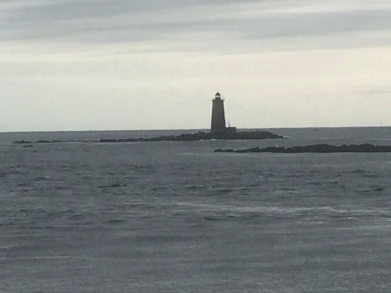
The neighboring Wood Island Life Saving Station seen off the existing pier was completed in early 1908. Prior to the creation of the U.S. Coast Guard, stations such as this were manned by the U.S. Life Saving Service. which dispatched crews aboard wooden rowboats to aid mariners in distress.
Members of the Life Saving Service were referred to as surfmen, and each station was headed by a keeper. In 1915. President Woodrow Wilson merged this agency with the Revenue Cutter Service to form the modern Coast Guard.
During the Second World War, Wood Island was used by the U.S. Navy as a strategic observation post to watch for German U-boats. The wooden cribs used to anchor anti-submarine nets stretched across the harbor can still be seen today.
The station reverted back to the Coast Guard after the war and remained under its jurisdiction until 1948, when the operation was relocated to New Castle, New Hampshire.
Wood Island was turned over to the Town of Kittery in 1973 and remained unused for decades. It was slated for demolition by the Town in 2009, before a local non-profit organization called the Wood Island Life Saving Station Association was formed to restore the site for public use.
[Photo] Courtesy of Wood Island Life Saving Station Association.
Peacetime Transition
Fort Poster was closed as a military facility in the years following the end of the Second World War, and for a time was used as a recreation area by the U.S. Navy. In 1961 the Navy turned the site over to Kittery for public use, after a group[ of visionary citizens convinced the community it should be preserved as a park rather than be developed.
Today the approximately 90-acre park offers picnic spots, pavilions, playgrounds and trails, as well as areas for swimming, kayaking, scuba diving and paddle boarding.
Text prepared by D. Allen Kerr
Erected by Town of Kittery.
Topics. This historical marker is listed in these topic lists: Forts and Castles • Parks & Recreational Areas • War, World II. A significant historical year for this entry is 1897.
Location. 43° 4.084′ N, 70° 41.522′ W. Marker is in Kittery, Maine, in York County. Marker can be reached from Pocahontas Road. Touch for map. Marker is in this post office area: Kittery ME 03904, United States of America. Touch for directions.
Other nearby markers. At least 8 other markers are within 2 miles of this marker, measured as the crow flies. Mines Building (approx. 0.9 miles away in New Hampshire); Fort William and Mary Commemoration Marker (approx. 0.9 miles away in New Hampshire); Portcullis (approx. 0.9 miles away in New Hampshire); Walbach Tower (approx. one mile away in New Hampshire); a different marker also named Walbach Tower (approx. one mile away in New Hampshire); William and Mary Raids (approx. 1.1 miles away in New Hampshire); Frost Cemetery (approx. 1.2 miles away in New Hampshire); New Castle Congregational Church (approx. 1.3 miles away in New Hampshire).
Also see . . .
1. John G. Foster. (Submitted on November 2, 2021, by Steve Stoessel of Niskayuna, New York.)
2. Battle of Washington. (Submitted on November 2, 2021, by Steve Stoessel of Niskayuna, New York.)
3. Historian's Office of United States Coast Guard. (Submitted on November 2, 2021, by Steve Stoessel of Niskayuna, New York.)
Credits. This page was last revised on November 7, 2021. It was originally submitted on November 1, 2021, by Steve Stoessel of Niskayuna, New York. This page has been viewed 242 times since then and 21 times this year. Photos: 1, 2, 3, 4. submitted on November 1, 2021, by Steve Stoessel of Niskayuna, New York. • J. J. Prats was the editor who published this page.


