Osgood in Ripley County, Indiana — The American Midwest (Great Lakes)
The Bilby Tower
United States Coast & Geodetic Survey (USC&GS)
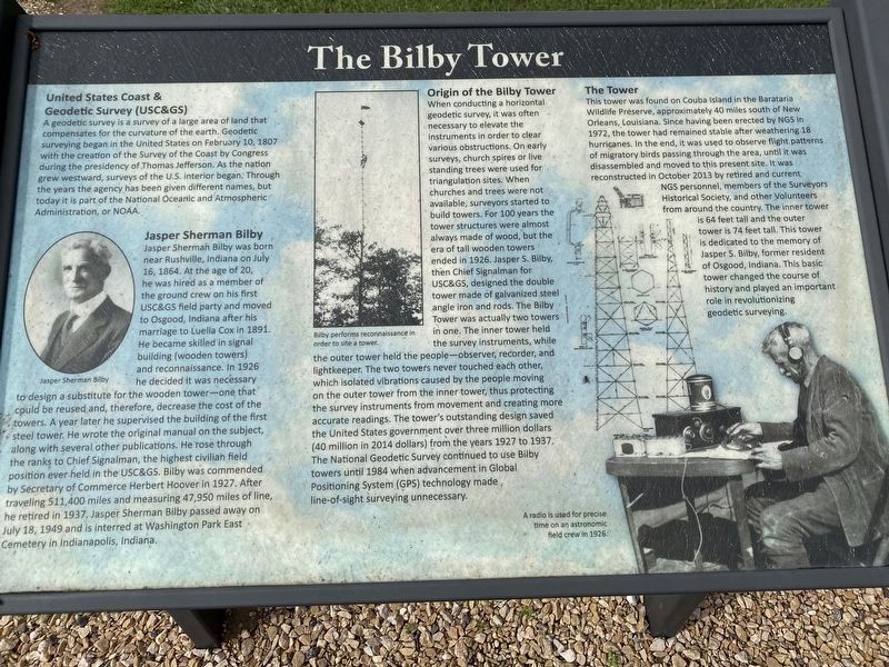
A geodetic survey is a survey of a large area of land that compensates for the curvature of the earth. Geodetic surveying began in the United States on February 10, 1807 with the creation of the Survey of the Coast by Congress during the presidency of Thomas Jefferson. As the nation grew westward, surveys of the U.S. interior began. Through the years the agency has been given different names, but today it is part of the National Ocean and Atmospheric Administration, or NOAA.
Jasper Sherman Bilby
Jasper Sherman Bilby was born near Rushville, Indiana on July 16, 1864. At the age of 20, he was hired as a member of the ground crew on his first USC&GS field party and moved to Osgood, Indiana after his marriage to Luella Cox in 1891. He became skilled in signal building (wooden towers) and reconnaissance. In 1926 he decided it was necessary to design a substitute for the wooden tower—one that could be reused and, therefore, decrease the cost of the towers. A year later he supervised the building of the first steel tower. He wrote the original manual on the subject, along with several other publications. He rose through the ranks to Chief Signalman, the highest civilian field position ever held in the USC&GS. Bilby was commended by Secretary of Commerce Herbert Hoover in 1927. After traveling 511,400 miles and measuring 47,950 miles of line, he retired in 1937. Jasper Sherman Bilby passed away on July 18, 1949 and is interred at Washington Park East Cemetery in Indianapolis, Indiana.
Origin of Bilby Tower
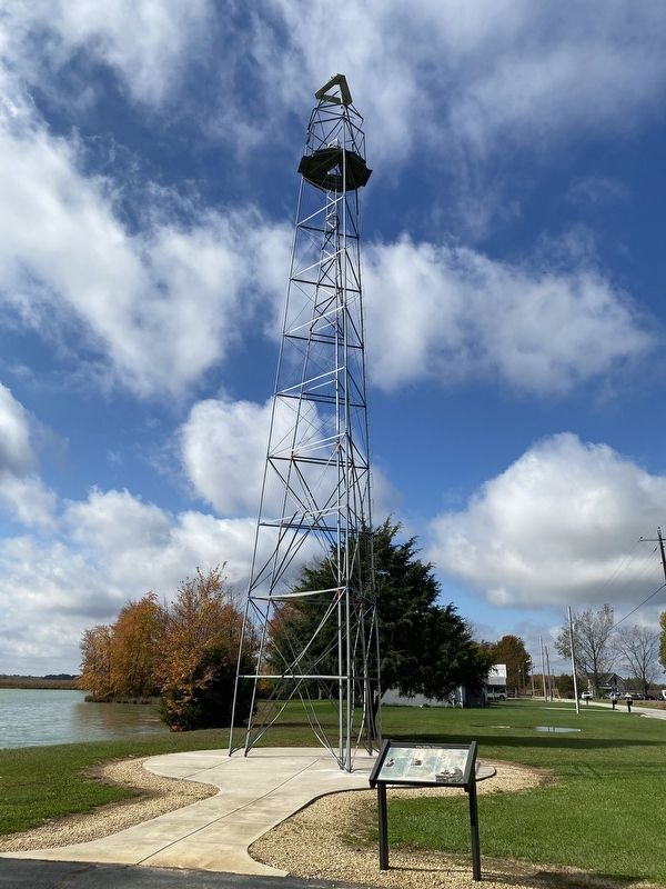
When conducting a horizontal geodetic survey, it was often necessary to elevate the instruments in order to clear various obstructions. On early surveys, church spires or live standing trees were used for triangulation sites. When churches and trees were not available, surveyors started to build towers. For 100 years the tower structures were almost always made of wood, but the era of tall wooden towers ended in 1926. Jasper S. Bilby, then Chief Signalman for USC&GS, designed the double tower made of galvanized steel angle iron and rods. The Bilby Tower was actually two towers in one. The inner tower held the survey instruments, while the outer tower held the people—observer, recorder and lightkeeper. The two towers never touched each other, which isolated vibrations caused by the people moving on the outer tower from the inner tower, thus protecting the survey instruments from movement and creating more accurate readings. The tower's outstanding design saved the United States government over three million dollars (40 million in 2014 dollars) from the years 1927 to 1937. the National Geodetic Survey continued to use Bilby towers until 1984 when advancement in Global Positioning System (GPS) technology made line-of-sight surveying unnecessary.
The Tower
This tower was found on Couba Island in the Barataria Wildlife Preserve, approximately 40 miles south of New Orleans, Louisiana. Since having been erected by NGS in 19972, the tower had remained stable after weathering 18 hurricanes. In the end, it was used to observe flight patterns of migratory birds passing through the area, until it was disassembled and moved to this present site. It was reconstructed in October 2013 by retired and current NGS personnel, members of the Surveyors Historical Society, and other Volunteers from around the country. The inner tower is 64 feet tall and the outer tower is 74 feet tall. This tower is dedicated to the memory of Jasper S. Bilby, former resident of Osgood, Indiana. This basic tower changed the course of history and played an important role in revolutionizing geodetic surveying.
Erected 2014.
Topics. This historical marker is listed in these topic lists: Animals • Exploration • Industry & Commerce • Science & Medicine. A significant historical date for this entry is February 10, 1807.
Location. 39° 7.109′ N, 85° 17.519′ W. Marker is in Osgood, Indiana, in Ripley County. Marker is on County Road W300N, 0.2 miles west of South Shook Street, on the right when traveling west. Touch for map. Marker is at or near this postal address: 1930 W County Rd 300 N, Osgood IN 47037, United States of America. Touch for directions.
Other nearby markers. At least 8 other markers are within one mile of this marker, measured as the crow flies. Crusher Lane (a few steps from this marker); Bilby Loop (within shouting distance of this marker); Bilby Steel Tower (approx. half a mile away); Willson House (approx. 0.6 miles away); Ohio and Mississippi Railroad (approx. ¾ mile away); William Forsyth, Artist (approx. 0.8 miles away); The Fugitive Trail (approx. one mile away); Abolitionists (approx. one mile away). Touch for a list and map of all markers in Osgood.
Credits. This page was last revised on November 2, 2021. It was originally submitted on November 2, 2021, by Amy Buskey of Cincinnati, Ohio. This page has been viewed 341 times since then and 42 times this year. Photos: 1, 2. submitted on October 31, 2021, by Amy Buskey of Cincinnati, Ohio. • Devry Becker Jones was the editor who published this page.

