Dillon in Dillon County, South Carolina — The American South (South Atlantic)
Main Street Methodist Church
Photographed by J. J. Prats, February 26, 2009
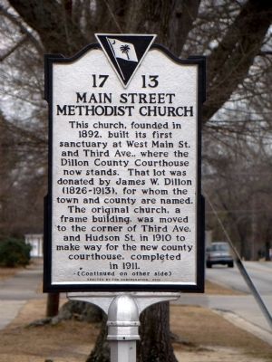
1. Main Street Methodist Church Marker (front)
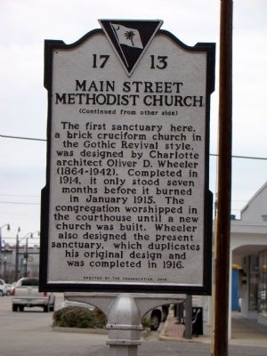
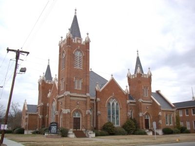
The first sanctuary here, a brick cruciform church in the Gothic Revival style, was designed by Charlotte architect Oliver D. Wheeler (1864–1942). Completed in 1914, it only stood seven months before it burned in January 1915. The congregation worshipped in the courthouse until a new church was built. Wheeler also designed the present sanctuary, which duplicates his original design and was completed in 1916.
Erected 2003 by the congregation. (Marker Number 17-13.)
Topics. This historical marker is listed in this topic list: Religion & Religious Structures. A significant historical month for this entry is January 1915.
Location. 34° 24.93′ N, 79° 22.122′ W. Marker is in Dillon, South Carolina, in Dillon
this page online

Regionally, this marker is in South Carolina’s Pee Dee. It is also in the American South and specifically in the Deep South. Globally, it is in North America, the Western Hemisphere, the Western World, and the Anglosphere. Historically, it finds itself in what was once the territory of the Mississippian Culture, one of the original Thirteen Colonies, one of the Confederate States of America, and the Antebellum South.
Other nearby markers. At least 8 other markers are within walking distance of this marker: Dillon Theatre (approx. ¼ mile away); Anderson Brothers Bank (approx. ¼ mile away); 106 North MacArthur Avenue (approx. ¼ mile away); 112 North MacArthur Avenue (approx. ¼ mile away); Mayors of Dillon (approx. ¼ mile away); Town of Dillon / Florence Railroad Company (approx. ¼ mile away); Duncan McLaurin (approx. ¼ mile away); Dillon County / Dillon County Courthouse
Photographed by J. J. Prats, February 26, 2009
2. Main Street Methodist Church Marker (back)
Photographed by J. J. Prats, February 26, 2009
3. Main Street Methodist Church and Marker
Credits. This page was last revised on June 16, 2016. It was originally submitted on May 1, 2009, by J. J. Prats of Powell, Ohio. This page has been viewed 1,226 times since then and 18 times this year. Photos: 1, 2, 3. submitted on May 1, 2009, by J. J. Prats of Powell, Ohio.
