Del Rio in Val Verde County, Texas — The American South (West South Central)
San Felipe High School
Photographed by Brian Anderson, September 5, 2021
1. San Felipe High School Marker
Inscription.
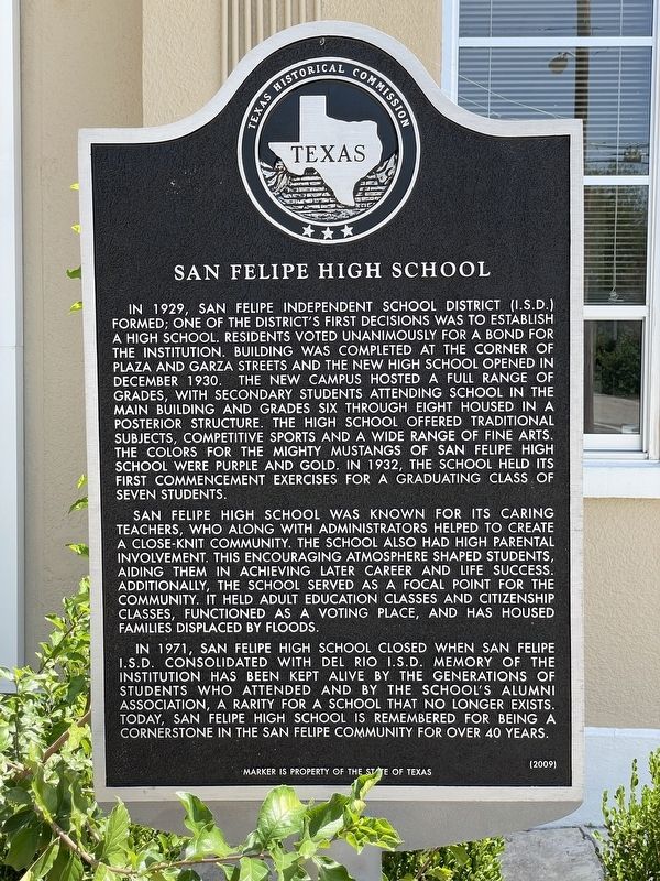
San Felipe High School. . In 1929, San Felipe Independent School District (I.S.D.) formed; one of the District’s first decisions was to establish a high school. Residents voted unanimously for a bond for the institution. Building was completed at the corner of Plaza and Garza Streets and the new high school opened in December 1930. The new campus hosted a full range of grades, with secondary students attending school in the main building and grades six through eight housed in a posterior structure. The high school offered traditional subjects, competitive sports and a wide range of fine arts. The colors for the Mighty Mustangs of San Felipe High School were purple and gold. In 1932, the School held its first commencement exercises for a graduating class of seven students., San Felipe High School was known for its caring teachers, who along with administrators helped to create a close-knit community. The School also had high parental involvement. This encouraging atmosphere shaped students, aiding them in achieving later career and life success. Additionally, the School served as a focal point for the community. It held adult education classes and citizenship classes, functioned as a voting place, and has housed families displaced by floods., In 1971, San Felipe High School closed when San Felipe I.S.D. consolidated with Del Rio I.S.D. Memory of the institution has been kept alive by the generations of students who attended and by the School’s alumni association, a rarity for a school that no longer exists. Today, San Felipe High School is remembered for being a cornerstone in the San Felipe community for over 40 years.
In 1929, San Felipe Independent School District (I.S.D.) formed; one of the District’s first decisions was to establish a high school. Residents voted unanimously for a bond for the institution. Building was completed at the corner of Plaza and Garza Streets and the new high school opened in December 1930. The new campus hosted a full range of grades, with secondary students attending school in the main building and grades six through eight housed in a posterior structure. The high school offered traditional subjects, competitive sports and a wide range of fine arts. The colors for the Mighty Mustangs of San Felipe High School were purple and gold. In 1932, the School held its first commencement exercises for a graduating class of seven students.
San Felipe High School was known for its caring teachers, who along with administrators helped to create a close-knit community. The School also had high parental involvement. This encouraging atmosphere shaped students, aiding them in achieving later career and life success. Additionally, the School served as a focal point for the community. It held adult education classes
Click or scan to see this page online
and citizenship classes, functioned as a voting place, and has housed families displaced by floods.
In 1971, San Felipe High School closed when San Felipe I.S.D. consolidated with Del Rio I.S.D. Memory of the institution has been kept alive by the generations of students who attended and by the School’s alumni association, a rarity for a school that no longer exists. Today, San Felipe High School is remembered for being a cornerstone in the San Felipe community for over 40 years.
Erected 2009 by Texas Historical Commission. (Marker Number 16268.)
Topics. This historical marker is listed in this topic list: Education. A significant historical month for this entry is December 1930.
Location. 29° 21.485′ N, 100° 52.911′ W. Marker is in Del Rio, Texas, in Val Verde County. It is on West Garza Street, on the right when traveling east. Touch for map. Marker is at or near this postal address: 1207 West Garza Street, Del Rio TX 78840, United States of America. Touch for directions.
Regionally, this marker is in the Hill Country. Globally, it is in North America, a Gulf of Mexico state, the Western Hemisphere, the Western World, and the
Photographed by Brian Anderson, September 5, 2021
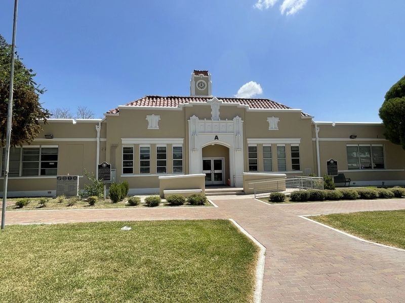
2. San Felipe High School
Anglosphere. Historically, it finds itself in what was once New Spain, the Republic of Texas, and one of the Confederate States of America.
Credits. This page was last revised on November 4, 2021. It was originally submitted on November 4, 2021, by Brian Anderson of New Albany, Ohio. This page has been viewed 11,777 times since then and 315 times this year. Photos:1, 2. submitted on November 4, 2021, by Brian Anderson of New Albany, Ohio.