
South Point in Lawrence County, Ohio — The American Midwest (Great Lakes)
Catalpa Tree
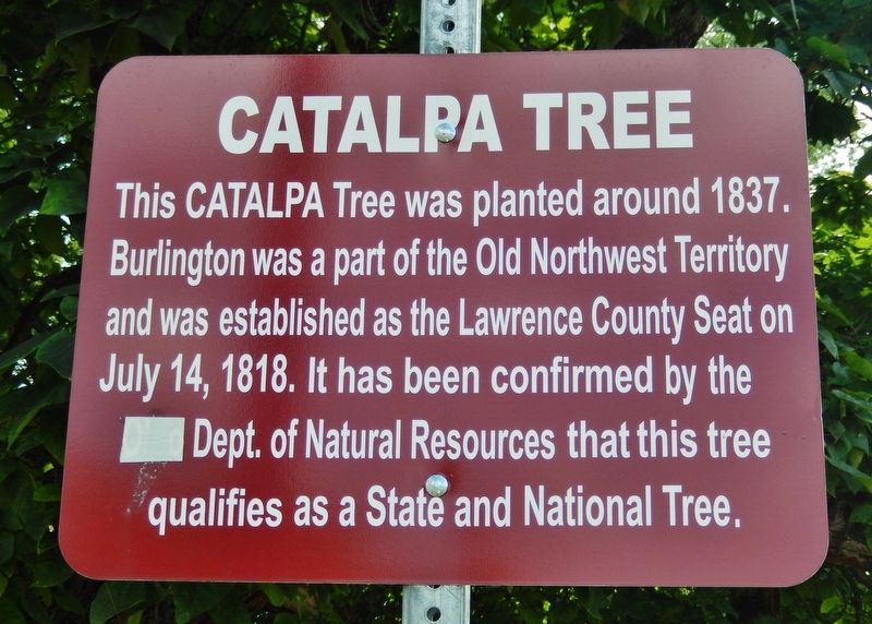
Photographed by Cosmos Mariner, August 29, 2021
1. Catalpa Tree Marker
This CATALPA Tree was planted around 1837. Burlington was a part of the Old Northwest Territory and was established as the Lawrence County Seat on July 14, 1818. It has been confirmed by the Dept. of Natural Resources that this tree qualifies as a State and National Tree.
Topics and series. This historical marker is listed in this topic list: Settlements & Settlers. In addition, it is included in the Historic Trees series list. A significant historical year for this entry is 1837.
Location. 38° 24.433′ N, 82° 31.831′ W. Marker is in South Point, Ohio, in Lawrence County. It is on Jefferson Street (County Road 1) just east of Davidson Street, on the left when traveling east. Marker and giant Catalpa tree are located on the north side of the street. Touch for map. Marker is in this post office area: South Point OH 45680, United States of America. Touch for directions.

Regionally, this marker is in Ohio’s Kyova Tri-State Region. It is also in the American Midwest, in the Ohio River Valley, in Appalachia, and specifically in Northern Appalachia. Globally, it is in North America, the Western Hemisphere, the Western
this page online
Other nearby markers. At least 8 other markers are within 2 miles of this marker, measured as the crow flies: Burlington Veteran's Memorial (about 400 feet away, measured in a direct line); Burlington Commons (about 500 feet away); The Promised Land (approx. 0.6 miles away); Indian Mound (approx. 0.7 miles away in West Virginia); Veterans Administration Hospital (approx. 0.8 miles away in West Virginia); Ceredo Settlers (approx. 1½ miles away in West Virginia); Z. D. Ramsdell House (approx. 1½ miles away in West Virginia); Wayne County / Cabell County (approx. 1.6 miles away in West Virginia).
Also see . . . Catalpa. Wikipedia entry (Submitted on February 14, 2022, by Larry Gertner of New York, New York.)
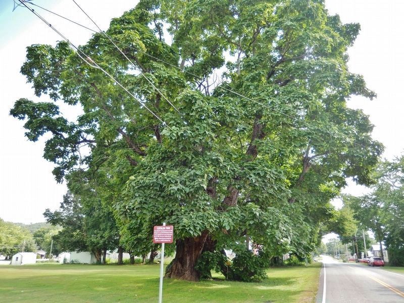
Photographed by Cosmos Mariner, August 29, 2021
2. Catalpa Tree Marker
Credits. This page was last revised on April 27, 2022. It was originally submitted on November 8, 2021, by Cosmos Mariner of Cape Canaveral, Florida. This page has been viewed 684 times since then and 49 times this year. Photos: 1, 2. submitted on November 8, 2021, by Cosmos Mariner of Cape Canaveral, Florida.
