Near Butte in Silver Bow County, Montana — The American West (Mountains)
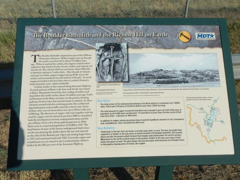
The Boulder Batholith and the Richest Hill on Earth

Photographed By Barry Swackhamer, July 14, 2021
1. The Boulder Batholith and the Richest Hill on Earth Marker
Captions: (upper center) "I Have Struck It."; (upper right) Copper Mines, ACM (Anaconda Copper Mining Co. Butte, Montana, Meaderville side of the Butte Hill. Butte Mines looking West.; (bottom right, map) The Boulder Batholith. Darker-colored granite rock are in the darker areas.
Granite similar to that exposed along Interstate Highway 15 and east of Butte is the host rock for the ores mined at Butte. This granite formed by slow cooling of molten rock deep below the earth's surface about 76 million years ago. Faults and fractures in the Butte area later cut the granite, forming pathways for hot water that carried metals in solution. As these solutions reacted with the enclosing granite they cooled and deposited quarts and metallic minerals to form veins. Some of these veins were of tremendous size: up to 50 feet wide and 4,500 long. The discovery of copper-rich veins together with the need for copper wire for electrical use from 1880 on stimulated both the development of many underground mines and city of Butte. From a few dozen gold prospectors in 1864, Butte went to a reported population of 91,000 in 1917. The head frames of some of the former underground shaft mines can be seen piercing the skyline above the tan rock exposed on the sides of the Berkeley pit. Open-pit mining began there in 1955 and continued until mid-1982 Currently copper and molybdenum ore are mined in the Continental pit, which is hidden by the hills just west of the Interstate Highway.
Geo-Facts:
• The total extent of the underground workings in the Butte district is estimated to be 10,000 miles. There were 74 mines in the Butte district more than 1,000 feet deep.
• The total amount of copper recovered from Butte ore is enough to put a 4-inch-thick layer of payment on all traffic lanes on Interstate 15 from Butte to more than 30 miles south of Salt Lake City, Utah - a distance of 450 miles.
• In addition to copper, mining operations have recovered significant amounts of zinc, manganese, lead, molybdenum, silver and gold from Butte ore.
Geo-Activity:
• Think back to the last time you broke a ceramic mug, bowl, or vase. The way you might have repaired it is similar to the way veins of metal formed in the Boulder batholith. The ceramic pieces are like the granite which formed from magma and cooled under the earth's surface. Movement
in the earth created cracks in the granite, similar to the way your mug or bold broke into pieces as well. The glue mimics the way hot water with minerals ran through cracks in the granite, leaving veins of metal, like copper.
Erected by Montana Department of Transportation.
Topics. This historical marker is listed in this topic list: Natural Features.
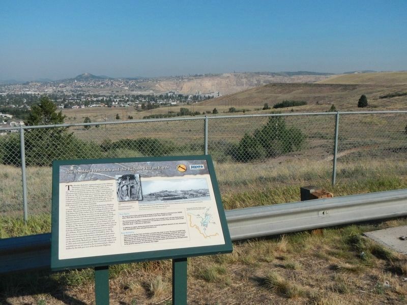
Location. 45° 59.47′ N, 112° 28.509′ W. Marker is near Butte, Montana, in Silver Bow County. Marker is on Interstate 15 near Interstate 90, on the right when traveling south. The marker is located at a pullout/overview on southbound Interstate 15. Touch for map. Marker is in this post office area: Butte MT 59701, United States of America. Touch for directions.
Other nearby markers. At least 8 other markers are within 3 miles of this marker, measured as the crow flies. Butte (here, next to this marker); Meaderville (a few steps from this marker); Mining The Berkeley Pit 1955-1982 (approx. 2˝ miles away); The Berkeley Pit: The Water Returns (approx. 2˝ miles away); The Berkeley Pit Threatens the Water (approx. 2˝ miles away); Butte Mining Through the Years (approx. 2˝ miles away); St. Joseph's Catholic Church (approx. 2.7 miles away); James Naughten Residence (approx. 3.1 miles away). Touch for a list and map of all markers in Butte.
Credits. This page was last revised on November 18, 2021. It was originally submitted on November 18, 2021, by Barry Swackhamer of Brentwood, California. This page has been viewed 160 times since then and 15 times this year. Photos: 1, 2. submitted on November 18, 2021, by Barry Swackhamer of Brentwood, California.
