Mount Carmel in Wabash County, Illinois — The American Midwest (Great Lakes)
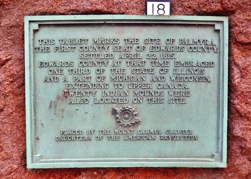
Site of Palmyra
the first county seat of Edwards County,
settled April 22, 1815.
Edwards County at that time embraced
one third of the State of Illinois
and a part of Michigan and Wisconsin,
extending to Upper Canada.
Twenty Indian mounds were
also located on this site.
Erected by Mount Carmel Chapter, Daughters of the American Revolution.
Topics and series. This historical marker is listed in these topic lists: Native Americans • Settlements & Settlers. In addition, it is included in the Daughters of the American Revolution series list. A significant historical date for this entry is April 22, 1815.
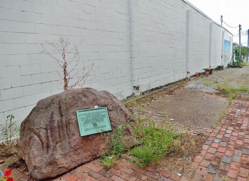
Location. 38° 24.54′ N, 87° 45.654′ W. Marker is in Mount Carmel, Illinois, in Wabash County. Marker can be reached from North Market Street south of West 4th Street, on the right when traveling south. Marker is located along the walkway on the north side of the Wabash County Museum. Touch for map. Marker is at or near this postal address: 320 North Market Street, Mount Carmel IL 62863, United States of America. Touch for directions.
Other nearby markers. At least 8 other markers are within 11 miles of this marker, measured as the crow flies. USS Wabash (within shouting distance of this marker); Gettysburg Address (within shouting distance of this marker); Wabash County Soldiers Monument (within shouting distance of this marker); Capt. Bellenden S. Hutcheson, M.D. (about 300 feet away, measured in a direct line); Lyles Station, Indiana (approx. 6.1 miles away in Indiana); a different marker also named Lyles Station (approx. 6.1 miles away in Indiana); War Memorial (approx. 8.8 miles away); Brownlee Addition Historic District (approx. 10.9 miles away in Indiana). Touch for a list and map of all markers in Mount Carmel.
More about this marker. This marker was originally placed about 3˝ miles north of Mount Carmel along Illinois Highway 1, near the old Palmyra town site. It was moved here, outside the Wabash County Museum, for preservation and exhibit.
Also see . . .
1. Palmyra, Edwards County, Illinois.
Palmyra (1814–1821) was a town in the English Settlement, 2 miles north of the town of Mount Carmel, Illinois, in what is today Wabash County. First settled in 1814, Palmyra was originally the site of a ferry across the Wabash River. It was named the first county seat of Edwards County, and meetings were held at the home of a resident.
(Submitted on November 22, 2021, by Cosmos Mariner of Cape Canaveral, Florida.)
2. Albion, Illinois.
In 1821, the county seat of Edwards County was moved from Palmyra to Albion. However, residents of Mount Carmel felt their town should be the county seat. Four companies of militia marched from Mount Carmel towards Albion to seize the county documents stored in the courthouse. The situation was eventually resolved in 1824 by separating Wabash County from Edwards County at Bonpas Creek. The resulting counties remain two of the smallest in Illinois.(Submitted on November 22, 2021, by Cosmos Mariner of Cape Canaveral, Florida.)
3. Wabash County, Illinois.
Wabash County was formed in 1824 out of Edwards County, to avert an armed confrontation between the militias of Albion and Mt. Carmel after the county seat was moved from Palmyra (near the current city of Mount Carmel) to Albion.(Submitted on November 22, 2021, by Cosmos Mariner of Cape Canaveral, Florida.)
Credits. This page was last revised on November 22, 2021. It was originally submitted on November 22, 2021, by Cosmos Mariner of Cape Canaveral, Florida. This page has been viewed 392 times since then and 56 times this year. Photos: 1, 2. submitted on November 22, 2021, by Cosmos Mariner of Cape Canaveral, Florida.

