Caldwell in Greenbrier County, West Virginia — The American South (Appalachia)
Caldwell: Heritage
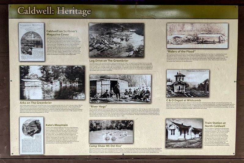
Caldwell on Scribner's Magazine Cover
Caldwell, located two and a half miles east of Lewisburg, gets its name from James R. Caldwell, whose family owned and occupied the stately brick house, "Elmhurst," on the bank of the Greenbrier River. Prior to its construction in 1824, a wooden covered toll bridge was built across the river and the house was used as a stagecoach stop for many years. The bridge was burned in 1862 following the Battle of Lewisburg. At the turn of the century, Caldwell was selected by thé West Virginia Pulp and Paper Co. as the site for a new paper mill. After much objection from the local people concerned with polluting runoff into the river, the decision was made to build the mill in Covington, Virginia. Caldwell became a major stop on the Greenbrier line of the C&O Railway as trains began to move lumber, goods and passengers up and down the Greenbrier Valley.
Arks on The Greenbrier
Farm families eagerly waited for the spring thaw when the ice would break and go down the river. In the years before 1908 that meant a log drive on the Greenbrier. It was an exciting event for people in the river communities. "Arks," or house rafts, were built of spruce and were seventy to one hundred feet long. A low log house was erected on each raft. The bunkhouse ark contained double-decked bunks and a large wood stove. A second ark carried the cook shack and dining room, and sometimes there was a third ark to carry teams of horses and equipment. One notable log drive to Ronceverte in 1899 consisted of six arks that carried twenty horses and living quarters for 107 men.
Kate's Mountain
Located a short distance to the east of the river is Kate's Mountain, pictured here in "Scribner's Magazine." The legend of how it got its name is as beautiful as the mountain itself. The first settler to claim land on the Greenbrier tributary of Howard's Creek was Nicholas Carpenter in about 1750. He was later killed by Indians at a fort on the Jackson River. His wife Kate and their infant daughter had stayed behind at the Howard's Creek home site and they too were attacked. Kate escaped with the baby in her arms to the top of a mountain overlooking the creek. Legend has it that mother and child escaped harm by hiding in a hollowed-out log and that to commemorate her courage, the mountain standing across from The Greenbrier Resort's main entrance still bears her name.
Log Drive on The Greenbrier
The timber boom in the mountains of West Virginia lasted well into the 1920's. The rapid removal of timber from the vast virgin forests was hastened by the arrival of the Chesapeake and Ohio Railway in 1900. But, long before that, there were sawmills scattered throughout the mountains on either side of the Greenbrier River. As the lumber industry began to grow, the need arose for a way to get the logs to the often-distant mills. Thus, the practice of using rafts to carry the logs downstream was employed and log drives commenced on the river to supply the hungry teeth of the big mill owned by the St. Lawrence Boom and Manufacturing Company south of Caldwell, in Ronceverte.
"River Hogs"
The men driving logs were known as "river hogs" and their job was both demanding and dangerous. After the logs were rolled into the swollen stream, the men and horse teams followed on the shore to refloat logs that became stranded on the banks. Much of the work was performed in icy water. Log jams occurred frequently as the swift current would pile the logs into tangled stacks. Only the most skilled drivers could walk the face of the jam to break loose the key logs. This would cause the jam to break suddenly sending the men jumping and scrambling for safety on the churning mass of logs. Accounts vary on the date of the last log drive on the Greenbrier. The Editor of The Pocahontas Times, Calvin W. Price, claimed to have seen the last drive on St. Patrick's Day — March 17, 1907.
Camp Shaw-Mi-Del-Eca"
They came to hike and camp, to play tennis and go horseback riding, They learned the ways and legends of local tribes - the Shawnee, the Mingo, the Delaware and the Seneca. And they looked forward to the canoe trips on the Greenbrier River. They were the boys of Shaw-Mi-Del-Eca. Greenbrier Military School's Camp for Boys was located along the river in Caldwell and operated for 8 weeks every summer until the closing of the school in 1973. Water sports, such as surfboard riding and fishing, were enjoyed in a private, artificial lake formed by a concrete dam across a section of the river.
"Riders of the Flood"
The St. Lawrence Boom and Manufacturing Company was the first company to drive logs down the Greenbrier River, which was wide and free of obstacles making it ideally suited for a log drive. Trees were cut during the summer and fall then "skidded" to a slide by teamsters with horses. Once cold weather arrived the slide was watered down to produce a thick coat of ice so that the logs would easily slide down the mountain to the landing below. There they were stacked to await the runoff from spring rains that filled the "splash" dams with enough water for the logs to float. When the gates were opened the rushing water would carry the logs downstream.
C&O Depot at Whitcomb
The Whitcomb train depot was located at milepost 0 at the junction of the Greenbrier Division with the C&O main line pictured here. The Greenbrier Line switched off to the left and the main tracks curved before crossing the Greenbrier River. The depot was the standard style with a switch tower built on its roof. The distance markings on mileposts along the route were measured from the junction at Whitcomb. From there to Winterburn, in northernmost Pocahontas County, the railroad followed the river to its head, so, of course, the line was ascending. The railroad curved as the river curved. It was anything but straight. 64% of the line was in curves.
Train Station at North Caldwell
The C&O station at Caldwell was originally listed on the schedule as Little Sulphur. Once the depot building was completed in 1901 ihe name changed to Hunter, and finally in 1902 was listed as North Caldwell. The station had numerous facilities including a section foreman's house, bunkhouse, section tool house, and stock pens. The railroad also operated a farm and nursery here for a few years. The North Caldwell station was closed in 1967. On December 28, 1978, the last train made its run from Durbin heading for Hinton. The Greenbrier line of the Chesapeake and Ohio faded into history, passing through Ronceverte unnoticed.
Topics. This historical marker is listed in these topic lists: Industry & Commerce • Railroads & Streetcars • Settlements & Settlers. A significant historical year for this entry is 1750.
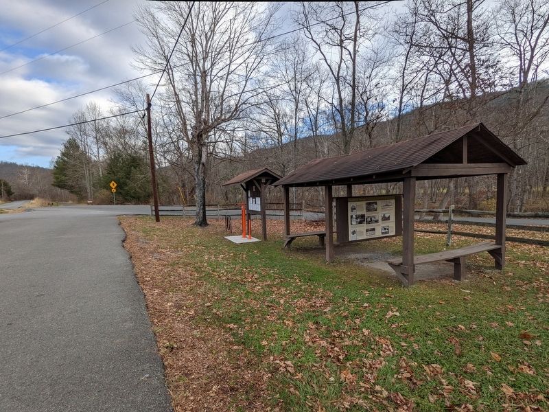
Location. 37° 47.617′ N, 80° 22.823′ W. Marker is in Caldwell, West Virginia, in Greenbrier County. Marker is on Stone House Road (County Route 38) 0.1 miles south of Oak Branch Lane, on the right when traveling south. Located at the Greenbrier River Trail trailhead. Touch for map. Marker is at or near this postal address: 173 MVF Dr, Caldwell WV 24925, United States of America. Touch for directions.
Other nearby markers. At least 8 other markers are within 4 miles of this marker, measured as the crow flies. Berea Sand (approx. 1.4 miles away); Robert C. Byrd Clinic (approx. 3.2 miles away); Col. John Stuart / Mathew Arbuckle (approx. 3.2 miles away); Greenbrier Military School (approx. 3.3 miles away); a different marker also named Greenbrier Military School (approx. 3.4 miles away); Lewisburg Battle (approx. 3.4 miles away); Colonial Army Rendezvous (approx. 3.6 miles away); Samuel Price (approx. 3.6 miles away).
Also see . . .
1. Greenbrier River Trail. West Virignia State Parks (Submitted on November 28, 2021.)
2. Greenbrier River Trail. Greenbrier River Trail Association (GRTA) & Greenbrier River Trail Foundation (GRTF) (Submitted on November 28, 2021.)
Credits. This page was last revised on December 26, 2023. It was originally submitted on November 28, 2021, by Bernard Fisher of Richmond, Virginia. This page has been viewed 454 times since then and 103 times this year. Last updated on December 25, 2023, by Carl Gordon Moore Jr. of North East, Maryland. Photos: 1, 2, 3, 4. submitted on November 28, 2021, by Bernard Fisher of Richmond, Virginia. • Devry Becker Jones was the editor who published this page.


