Plymouth in Wayne County, Michigan — The American Midwest (Great Lakes)
Plymouth Township
⎯⎯⎯
Charter Township Of Plymouth

Photographed by J.T. Lambrou, November 29, 2021
1. Plymouth Township/Charter Township Of Plymouth Marker
Plymouth Township
Pioneers from New England began settling and farming in this area around 1825. Abram B. Markham, an early leader, built the first gristmill in the area. Settlers held “raising bees” to help new arrivals build their log homes. In April 1827, soon after the common council voted to name their community “Plymouth,” the township officially incorporated under a law signed by Territorial Governor Lewis Cass. The first township meeting was held at the homestead of John Tibbits. He and many other early settlers are buried in Shearer Cemetery. Canton Township split off from Plymouth Township in 1834. In 1862 numerous residents of Plymouth enlisted in the 24th Michigan Infantry, a regiment that fought at Gettysburg as part of the Iron Brigade. The regiment later served as honor guard for President Abraham Lincoln’s funeral in 1865.
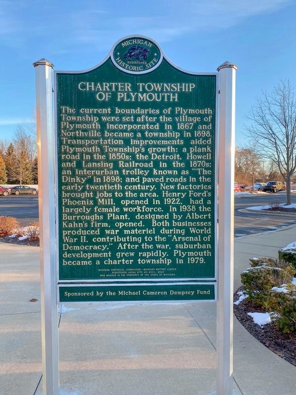
Charter Township Of Plymouth
The current boundaries of Plymouth Township were set after the village of Plymouth incorporated in 1867 and Northville became a township in 1898. Transportation improvements aided Plymouth Township’s growth: a plank road in the 1850s; the Detroit, Howell
this page online
Erected 2020 by Michigan Historical Commission - Michigan History Center. (Marker Number L2331.)
Topics. This historical marker is listed in this topic list: Settlements & Settlers. A significant historical year for this entry is 1825.
Location. 42° 21.688′ N, 83° 26.824′ W. Marker is in Plymouth, Michigan, in Wayne County. It can be reached from North Haggerty Road near Orangelawn Avenue. The marker is in front of the Plymouth Township police station. Touch for map. Marker is at or near this postal address: 9955 North Haggerty Road, Plymouth MI 48170, United States of America. Touch for directions.

Regionally, this marker
Photographed by J.T. Lambrou, November 29, 2021
2. Plymouth Township/Charter Township Of Plymouth Marker
Other nearby markers. At least 8 other markers are within 2 miles of this marker, measured as the crow flies: Roadside Development (approx. 0.6 miles away); Sutherland House (approx. 1.2 miles away); Charles G. Curtiss House (approx. 1.2 miles away); The Wilcox House (approx. 1.2 miles away); Plymouth Railroads (approx. 1.2 miles away); Gunsolly Carding Mill (approx. 1.2 miles away); Chessie Caboose 904151 (approx. 1.2 miles away); The Plymouth Plank Road (approx. 1.3 miles away). Touch for a list and map of all markers in Plymouth.

Photographed by J.T. Lambrou, November 29, 2021
3. Plymouth Township/Charter Township Of Plymouth Marker
The marker is in front of the police station.
Credits. This page was last revised on December 19, 2021. It was originally submitted on November 29, 2021, by J.T. Lambrou of New Boston, Michigan. This page has been viewed 732 times since then and 94 times this year. Photos: 1, 2, 3. submitted on November 29, 2021, by J.T. Lambrou of New Boston, Michigan. • J. Makali Bruton was the editor who published this page.
