Lockport in Niagara County, New York — The American Northeast (Mid-Atlantic)
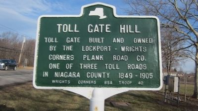
Toll Gate Hill
Erected by Wrights Corners BSA Troop 40.
Topics. This historical marker is listed in this topic list: Roads & Vehicles. A significant historical year for this entry is 1849.
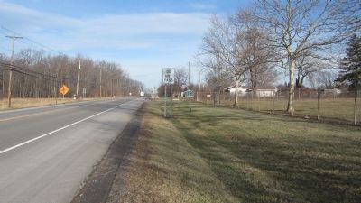
Location. 43° 11.648′ N, 78° 40.593′ W. Marker is in Lockport, New York, in Niagara County. Marker is on Lake Avenue (New York State Route 78) 1.9 miles south of Ridge Road (New York State Route 104), on the right when traveling north. Touch for map. Marker is in this post office area: Lockport NY 14094, United States of America. Touch for directions.
Other nearby markers. At least 8 other markers are within 2 miles of this marker, measured as the crow flies. The Niagara Grape (approx. 0.2 miles away); Gertrude Warren (approx. 0.2 miles away); Wyndham Lawn (approx. 0.4 miles away); City of Lockport Medal of Honor Recipients (approx. 0.4 miles away); Original Niagara Grape Vine (approx. 0.6 miles away); Lockport (approx. ¾ mile away); The Lowertown Historic District (approx. 1.1 miles away); Residence of Washington Hunt (approx. 1.1 miles away). Touch for a list and map of all markers in Lockport.
Regarding Toll Gate Hill. Toll Gate Hill is part of the Niagara Escarpment; see link.
Also see . . . Niagara Escarpment - Wikipedia. (Submitted on January 13, 2014, by Anton Schwarzmueller of Wilson, New York.)
Additional keywords. Niagara Escarpment
Credits. This page was last revised on December 1, 2021. It was originally submitted on January 13, 2014, by Anton Schwarzmueller of Wilson, New York. This page has been viewed 726 times since then and 50 times this year. Last updated on November 30, 2021, by Carl Gordon Moore Jr. of North East, Maryland. Photos: 1, 2. submitted on January 13, 2014, by Anton Schwarzmueller of Wilson, New York. • Bill Pfingsten was the editor who published this page.

