Piney Point in St. Mary's County, Maryland — The American Northeast (Mid-Atlantic)
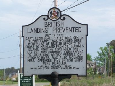
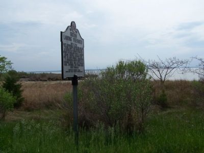
British Landing Prevented
July 17, 1776
Erected by Maryland Historical Trust & Maryland State Highway Administration.
Topics. This historical marker is listed in these topic lists: War, US Revolutionary • Waterways & Vessels. A significant historical date for this entry is July 29, 1722.
Location. 38° 8.122′ N, 76° 29.878′ W. Marker is in Piney Point, Maryland, in St. Mary's County. Marker is on Piney Point Road, on the right when traveling south. Marker is just beyond bridge at St. George's Island. Touch for map. Marker is in this post office area: Piney Point MD 20674, United States of America. Touch for directions.
Other nearby markers. At least 8 other markers are within 2 miles of this marker, measured as the crow flies. The Dory Boat (approx. 1.7 miles away); Military Influence (approx. 1.7 miles away); Natural Highways (approx. 1.7 miles away); Piney Point Lighthouse (approx. 1.7 miles away); a different marker also named Piney Point Lighthouse (approx. 1.7 miles away); Potomac River Military Testing (approx. 1.7 miles away); Bay Lights (approx. 1.7 miles away); Osprey (approx. 1.7 miles away). Touch for a list and map of all markers in Piney Point.
Credits. This page was last revised on November 22, 2019. It was originally submitted on May 7, 2009, by Bill Pfingsten of Bel Air, Maryland. This page has been viewed 1,195 times since then and 49 times this year. Photos: 1, 2, 3. submitted on May 7, 2009, by Bill Pfingsten of Bel Air, Maryland.


