Carthage in Cincinnati in Hamilton County, Ohio — The American Midwest (Great Lakes)
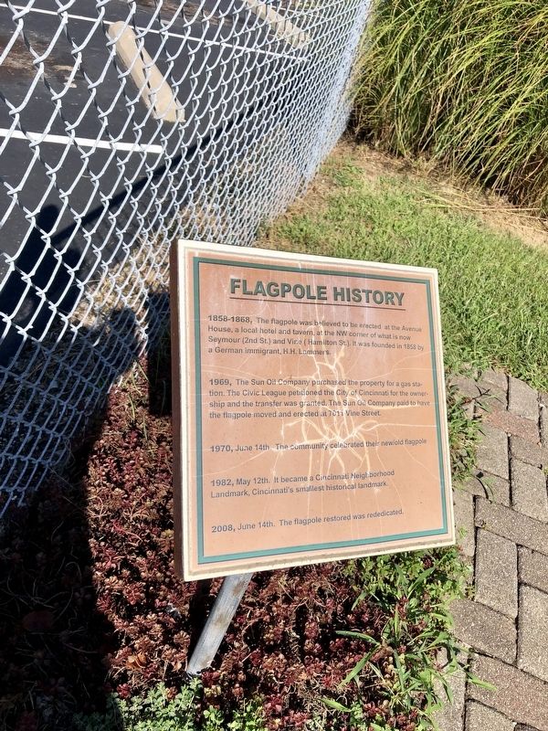
Flagpole History
Warren LeMay via Flickr/Public domain, August 28, 2019
1. Flagpole History Marker
1969, The Sun Oil Company purchased the property for a gas station. The Civic League petitioned the City of Cincinnati for the ownership and the transfer was granted. The Sun Oil Company paid to have the flagpole moved and erected at 7011 Vine Street.
1970, June 14th. The community celebrated their new/old flagpole.
1982, May 12th. It became a Cincinnati Neighborhood Landmark, Cincinnati's smallest historical landmark.
2008, June 14th. The flagpole restored was rededicated.
Topics. This historical marker is listed in this topic list: Landmarks. A significant historical year for this entry is 1858.
Location. 39° 11.614′ N, 84° 28.868′ W. Marker is in Cincinnati, Ohio, in Hamilton County. It is in Carthage. It is on Vine Street north of 70th Street, on the left when traveling north. Touch for map. Marker is at or near this postal address: 7011 Vine St, Cincinnati OH 45216, United States of
this page online

Regionally, this marker is in the American Midwest and in the Ohio River Valley. Globally, it is in North America, the Western Hemisphere, the Western World, and the Anglosphere. Historically, it finds itself in what was once the Haudenosaunee (Iroquois) Confederacy, the territory of the Mississippian Culture, and the Northwest Territory.
Other nearby markers. At least 8 other markers are within 3 miles of this marker, measured as the crow flies: Walter Scott, Christian Pioneer (approx. ¼ mile away); St. Aloysius Orphanage (approx. 1.7 miles away); Doughboy (approx. 2.2 miles away); Stearns and Foster Company (approx. 2.3 miles away); Linden Drive (approx. 2.3 miles away); Milestone (approx. 2.3 miles away); Spreen’s Corner (approx. 2.4 miles away); Robert Reily (approx. 2.4 miles away). Touch for a list and map of all markers in Cincinnati.
Another marker is no longer nearby. White's Station (was approx. ¾ mile away but has been confirmed missing).
Warren LeMay via Flickr/Public domain, August 28, 2019
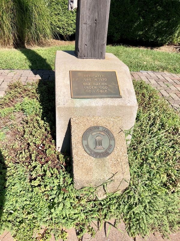
2. Carthage Flagpole Secondary Markers
The top plaque notes the flagpole was dedicated on June 14, 1970. The bottom plaque notes that it is a Cincinnati Neighborhood Landmark.

Warren LeMay via Flickr/Public domain, August 28, 2019
3. Flagpole History Marker
Credits. This page was last revised on February 4, 2023. It was originally submitted on December 3, 2021, by Duane and Tracy Marsteller of Murfreesboro, Tennessee. This page has been viewed 535 times since then and 46 times this year. Photos: 1, 2, 3. submitted on December 3, 2021, by Duane and Tracy Marsteller of Murfreesboro, Tennessee.
