Near Sylva in Jackson County, North Carolina — The American South (South Atlantic)
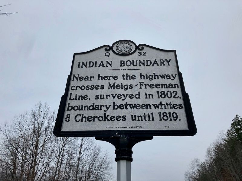
Indian Boundary
crosses Meigs-Freeman
Line, surveyed in 1802,
boundary between whites
& Cherokees until 1819.
Erected 1998 by North Carolina Division of Archives and History. (Marker Number Q-32.)
Topics and series. This historical marker is listed in these topic lists: Native Americans • Settlements & Settlers. In addition, it is included in the North Carolina Division of Archives and History series list. A significant historical year for this entry is 1802.
Location. 35° 23.299′ N, 83° 11.956′ W. Marker is near Sylva, North Carolina, in Jackson County. Marker is on Asheville Highway (Business U.S. 23) south of Cope Creek Road, on the right when traveling south. Touch for map. Marker is at or near this postal address: 1259 Asheville Hwy, Sylva NC 28779, United States of America. Touch for directions.
Other nearby markers. At least 8 other markers are within 6 miles of this marker, measured as the crow flies. Site of First Jackson County North Carolina Courts (approx. 0.8 miles away); Sylva Collegiate Institute (approx. 1˝ miles away); Gertrude Dills McKee (approx. 1.8 miles away); To our Valiant Fathers (approx. 1.9 miles away); Jackson County War Monument (approx. 1.9 miles away); Dan K. Moore (approx. 2 miles away); Rutherford Trace (approx. 5.2 miles away); Lewis J. Smith (approx. 5˝ miles away). Touch for a list and map of all markers in Sylva.
Also see . . . Meigs-Freeman Line retains significance. Feature article on "probably the most influential land survey ever completed in Jackson County." (The Sylva Herald, posted Nov. 26, 2009; updated Feb. 4, 2013) (Submitted on December 5, 2021, by Duane and Tracy Marsteller of Murfreesboro, Tennessee.)
Credits. This page was last revised on January 30, 2022. It was originally submitted on December 5, 2021, by Duane and Tracy Marsteller of Murfreesboro, Tennessee. This page has been viewed 199 times since then and 39 times this year. Photos: 1, 2. submitted on December 5, 2021, by Duane and Tracy Marsteller of Murfreesboro, Tennessee.

