Near Pickstown in Charles Mix County, South Dakota — The American Midwest (Upper Plains)
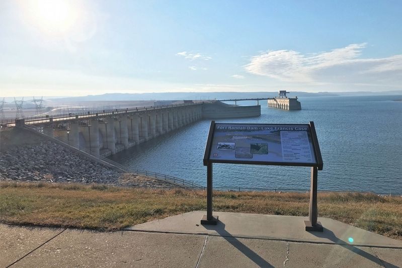
Fort Randall Dam - Lake Francis Case
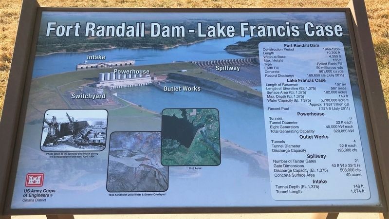
Fort Randall Dam
Construction Period: 1946-1956
Length: 10,700 ft
Width at Base: 4,300 ft
Max. Height: 165 ft
Type: Rolled Earth Fill
Earth Fill: 50 million cu yds
Concrete: 961,000 cu yds.
Record Discharge: 169,800 cfs (July 2011)
Lake Francis Case
Length of Reservoir: 107 mi
Length of Shoreline (El. 1,375): 567 miles
Surface Area (El. 1,375): 102,000 acres
Max. Depth (El. 1,375): 140 ft
Water Capacity (El. 1,375): 5,700,000 acre ft, Approx. 1.857 trillion gal
Record Pool: 1,374 ft (July 2011)
Powerhouse
Tunnels: 8
Tunnel Diameter: 22 ft each
Eight Generators: 40,000 kW each
Total Generating Capacity: 320,000 kW
Outlet Works
Tunnels: 4
Tunnel Diameter: 22 ft each
Discharge Capacity: 128,000 cfs
Spillway
Number of Tainter Gates: 21
Gate Dimensions: 40 ft W x 29 ft H
Discharge Capacity (El. 1,375): 508,000 cfs
Concrete Surface Area: 40 acres
Intake
Tunnel Depth (El. 1,375): 146 ft
Tunnel Length: 1,074 ft
Captions:
Photo taken of the spillway and intake during the construction of the dam. April 1954
1945 Aerial with 2010 Water & Streets Overlayed
2010 Aerial
Erected by US Army Corps of Engineers, Omaha District.
Topics. This historical marker is listed in this topic list: Waterways & Vessels. A significant historical month for this entry is April 1945.
Location. 43° 4.165′ N, 98° 32.746′ W. Marker is near Pickstown, South Dakota, in Charles Mix County. Marker is on U.S. 18, 0.7 miles west of Lewis Avenue, on the right when traveling west. The marker is located at the Fort Randall Dam Visitor Center. Touch for map. Marker is in this post office area: Lake Andes SD 57356, United States of America. Touch for directions.
Other nearby markers. At least 8 other markers are within walking distance of this marker. Star Power (a few steps from this marker); Women's Work: Making & Raising Tipis (a few steps from this marker); Circle of Life (a few steps from this marker); Buffalo Tipi Covers (a few steps from this marker); Tipi: "They Dwell" (a few steps from this marker); Gifts of the Buffalo (a few steps from this marker); Pickstown / Lewis and Clark (approx. 0.7 miles away); Pickstown Centennial Garden Memorial (approx. 0.7 miles away). Touch for a list and map of all markers in Pickstown.
Credits. This page was last revised on December 6, 2021. It was originally submitted on December 6, 2021. This page has been viewed 254 times since then and 16 times this year. Photos: 1, 2, 3, 4. submitted on December 6, 2021. • J. Makali Bruton was the editor who published this page.


