Hubble Acres in South Valley in Bernalillo County, New Mexico — The American Mountains (Southwest)
El Camino Real
The Royal Road
(English:)
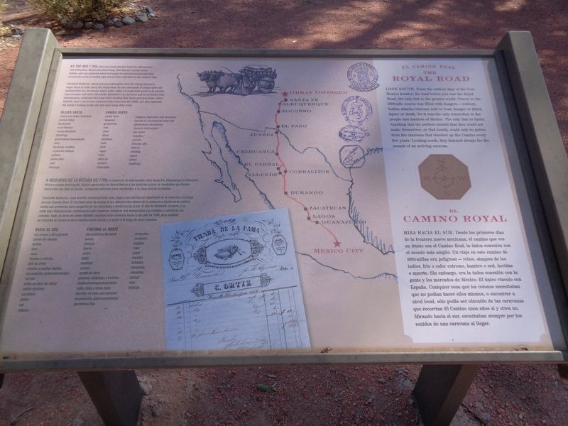
Look south. From the earliest days of the New Mexico frontier, the road before you was the Royal Road, the only link to the greater world. Travel on the 1600-mile course was filled with dangers - robbery, Indian attacks, extreme cold or heat, hunger or thirst, injury or death. Yet it was the only connection to the people and markets of Mexico. The only link to Spain. Anything that the settlers needed that they could not make themselves, or find locally, could only be gotten from the caravans that traveled up the Camino every few years. Looking south, they listened always for the sounds of an arriving caravan.
By the mid 1700s, two-way trade between Santa Fe, Albuquerque and Chihuahua, Mexico was flourishing. New Mexico's prized woven textiles and raw materials were exchanged for manufactured goods from around the world, including high-priced items intended for the colony's elite.
Clemente Gutierrez, whose great granddaughter built this house, became a major force in trade along this Royal Road. He sent thousands of sheep south and profited from his storehouse where other settlers brought their goods to be packed into caravans and sold in the south. Clemente's son, Lorenzo, and his grandson Juan Nepomuceno, continued this trade while building their herds and farm fields. James Hubbell, Juan's son-in-law, maintained this trade into the 1880s, but also expanded the family's trading to the east and west along other trails.
Headed South
sheep and other livestock • animal hides • buckskins • wool fleeces • woven blankets • stockings • government documents • mail • beeswax candles • captured Indians • pottery • pinon nuts • salt • tobacco
Coming North
metal tools • weapons • gunpowder • iron • steel • silver • furniture • mail • food • sugar • wine • olive oil • oysters • chocolate • religious depictions and devotions • barrels of sacramental wine fine • government documents • musical instruments • porcelain • majolica • mirrors • Chinese silk • fabrics • clothing • paper • shoes • medicine
(Spanish:)
Mira hacia el sur. Desde los primeros días de la frontera de Nuevo México, el camino que tenía ante usted era el Camino Real, el único vínculo con el mundo más amplio. Viajar en el recorrido de 1600 millas estuvo lleno de peligros: robo, ataques de indios, frío o calor extremos, hambre o sed, lesiones o muerte. Sin embargo, era la única conexión con la gente y los mercados de México. El único enlace a España. Cualquier cosa que los colonos necesitaran que no pudieran hacer ellos mismos, o encontrar localmente, solo se podía obtener de las caravanas que recorrían el Camino cada pocos años. Mirando hacia el sur, siempre escucharon los sonidos de una caravana que llegaba.
A mediados de la década de 1700, el comercio de ida y vuelta entre Santa Fe, Albuquerque y Chihuahua, México, estaba floreciendo. Los preciados tejidos y materias primas de Nuevo México se intercambiaron por productos manufacturados de todo el mundo, incluidos artículos de alto precio destinados a la clasa alta de la colonia.
Clemente Gutiérrez, cuya bisnieta construyó esta casa, se convirtió en una fuerza importante en el comercio a lo largo de este Camino Real. Envió miles de ovejas al sur y se benefició de su almacén donde otros colonos traían sus mercancías para empaquetarlas en caravanas y venderlas en el sur. El hijo de Clemente, Lorenzo, y su nieto Juan Nepomuceno, continuaron este oficio mientras construían sus rebaños y campos de cultivo. James Hubbell, el yerno de Juan, mantuvo este comercio en la década de 1880, pero también expandió el comercio de la familia hacia el este y el oeste a lo largo de otros senderos.
Hacia al Sur
las ovejas y otro ganado • pieles de venado • bufalo • alce • vaca • venado y nutrias • piel de ovea • mantas y medias tejidas • documentos gubernamentales • correo • velas de cera de abea • indios cautivos • ceramica • pinon • sal • tabaco
Viniendo al norte
Herramientas de metal • armas • polvora • hierro • acero • plata • muebles • correo • aceite de oliva • pinturas religiosas y exvotos • medicamentosintrumentos • seda china y otras telas • barriles de vino sacramental • documentos gubernamentales • porcelana fina • musicales • ceramica • espejos • ropa • papel • zapatos • ostiones • chocolate • alimentos • azucar • vino • delicias
Topics. This historical marker is listed in these topic lists: Industry & Commerce • Roads & Vehicles • Settlements & Settlers. A significant historical year for this entry is 1600.
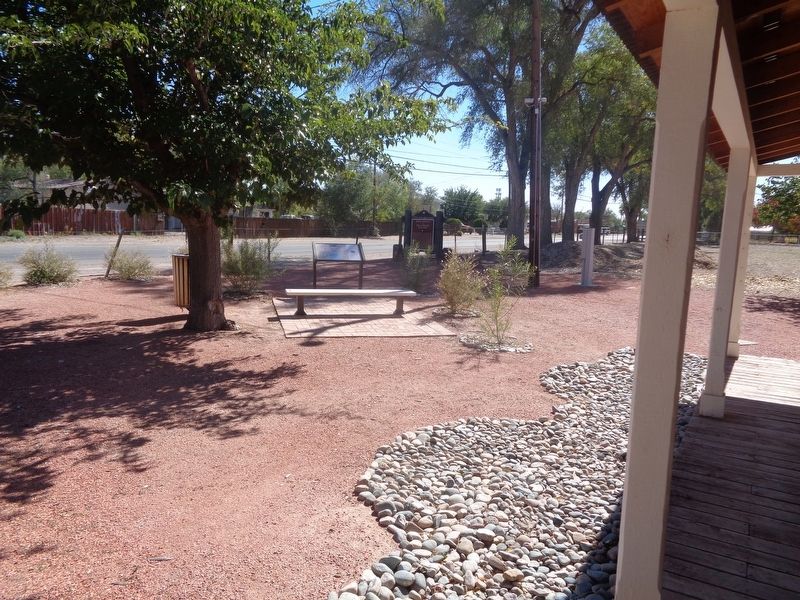
Location. 34° 59.33′ N, 106° 41.767′ W. Marker is in South Valley, New Mexico, in Bernalillo County. It is in Hubble Acres. Marker can be reached from Isleta Boulevard Southwest south of Appleton Road SW. Marker is on the grounds of Gutierrez-Hubbell House. Touch for map. Marker is at or near this postal address: 6029 Isleta Blvd SW, Albuquerque NM 87105, United States of America. Touch for directions.
Other nearby markers. At least 8 other markers are within 5 miles of this marker, measured as the crow flies. Juliana Gutierrez y Chaves Hubbell / Gutierrez-Hubbell House (here, next to this marker); La Plazita (within shouting distance of this marker); Gutierrez-Hubbell House (within shouting distance of this marker); Why are there sheep in the Bernalillo County Seal? (about 300 feet away, measured in a direct line); Josefa Baca / Pajarito Land Grant (about 500 feet away); Pajarito (about 600 feet away); Los Padillas (approx. 2.2 miles away); Old Armijo School (approx. 4.9 miles away). Touch for a list and map of all markers in South Valley.
Credits. This page was last revised on February 2, 2023. It was originally submitted on December 9, 2021, by Jason Voigt of Glen Carbon, Illinois. This page has been viewed 194 times since then and 11 times this year. Photos: 1, 2. submitted on December 9, 2021, by Jason Voigt of Glen Carbon, Illinois.

