Marshall in Madison County, North Carolina — The American South (South Atlantic)
Marshall High School

Warren LeMay via Flickr/Public domain, January 6, 2019
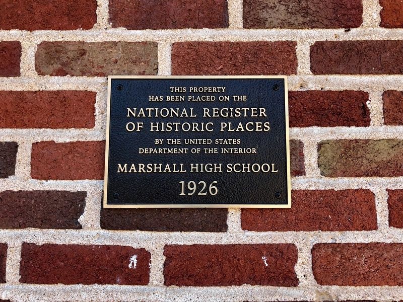
1. Marshall High School Marker
National register of Historic Places Registration Form
Click for more information.
Click for more information.
has been placed on the
National Register
of Historic Places
by the United States
Department of the Interior
Marshall High School
1926
Topics. This historical marker is listed in these topic lists: Architecture • Education. A significant historical year for this entry is 1926.
Location. 35° 47.756′ N, 82° 41.187′ W. Marker is in Marshall, North Carolina, in Madison County. Marker can be reached from Blannahassett Island Road north of Baileys Branch Road (County Road 1001), on the left when traveling north. Marker is at the building's main entrance. Touch for map. Marker is at or near this postal address: 116 Blannahassett Island Rd, Marshall NC 28753, United States of America. Touch for directions.
Other nearby markers. At least 8 other markers are within 8 miles of this marker, measured as the crow flies. Buncombe Turnpike (approx. 0.2 miles away); David Vance (approx. 0.2 miles away); Colonel Edward F. Rector, USAF (approx. 0.2 miles away); Marshall (approx. 0.2 miles away); Jewell Hill (approx. 4.7 miles away); Wellness Center (approx. 7.9 miles away); Mars Hill College (approx. 7.9 miles away); McConnell Hall (approx. 7.9 miles away). Touch for a list and map of all markers in Marshall.
Regarding Marshall High School. Excerpt from the National Register nomination:
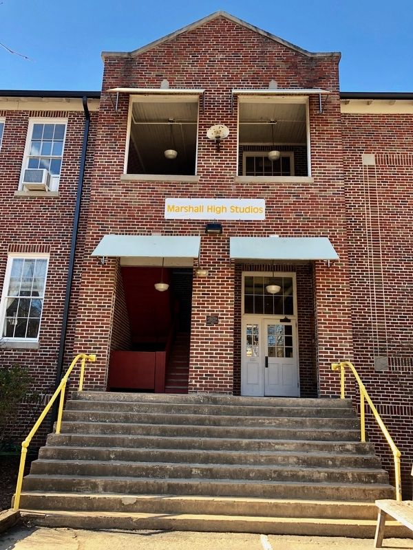
… The unique topography of the town of Marshall, with the river to the south and steep hillsides to the north, made large portions of available land hard to come by at the time the school was constructed in 1926. The school building, athletic field, and ca. 1956 gymnasium, all located on the island, occupy one of the few level pieces of land in the town aside from Main Street. Tree-lined river banks are located to the north and south of the school building, with the gymnasium and part of the athletic field located across the courtyard from the main building, to the west. East of the school building is the bridge and approach road, with parking located in front of the building, in the former location of a ca. 1952 elementary school building which was demolished after the flood of 2004. The athletic field wraps around the building on the north and east. The building is a good example of an early twentieth century school building in the Colonial Revival style.
The school, located on an island in the French Broad River, closed in 1973 when a new high school was built. It was subsequently renovated and now houses a working arts studio.
Credits. This page was last revised on December 27, 2021. It was originally submitted on December 9, 2021, by Duane and Tracy Marsteller of Murfreesboro, Tennessee. This page has been viewed 176 times since then and 15 times this year. Photos: 1, 2. submitted on December 9, 2021, by Duane and Tracy Marsteller of Murfreesboro, Tennessee.
