Near Canoe River in Fraser-Fort George, British Columbia — Canada’s West Coast (North America)
Canoe River Tragedy
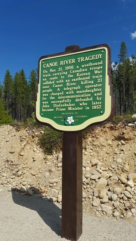
B.C. Ministry of Transportation and Infrastructure via Flickr (CC BY-NC-ND 2.0), July 5, 2018
1. Canoe River Tragedy Marker
Erected 2017 by Province of British Columbia.
Topics. This historical marker is listed in these topic lists: Disasters • Railroads & Streetcars • War, Korean. A significant historical date for this entry is November 21, 1950.
Location. 52° 44.525′ N, 119° 15.965′ W. Marker is near Canoe River, British Columbia, in Fraser-Fort George. It is on Southern Yellowhead Highway (Provincial Highway 5) 2.4 kilometers south of Bear Road, on the left when traveling south. Marker is in the Camp Creek pullout on the northbound side. Touch for map. Marker is in this post office area: Canoe River BC V0E 2Z0, Canada. Touch for directions.

Regionally, this marker is in the BC Interior and in Cariboo Chilcotin Coast. Globally, it is in North America, on the Ring of Fire, on the Pacific Rim, in the Western Hemisphere, in the Western World, and in the Anglosphere. Historically, it finds itself in what was once a British colony.
Also see . . .
1. Canoe River Train Crash (YouTube). "Disasters of the Century" documentary on the collision. (Uploaded by Bad Day HQ) (Submitted on February 17, 2022, by Duane and Tracy Marsteller of Murfreesboro, Tennessee.)
2. Canoe River train crash. Wikipedia entry on the tragedy. (Submitted on February 17, 2022, by Duane and Tracy Marsteller of Murfreesboro, Tennessee.)
Credits. This page was last revised on June 14, 2022. It was originally submitted on December 10, 2021, by Duane and Tracy Marsteller of Murfreesboro, Tennessee. This page has been viewed 341 times since then and 18 times this year. Photo 1. submitted on December 10, 2021, by Duane and Tracy Marsteller of Murfreesboro, Tennessee.
Editor’s want-list for this marker. Wide shot of marker and surrounding area in context • Can you help?
