Lillooet in Squamish-Lillooet, British Columbia — Canada’s West Coast (North America)
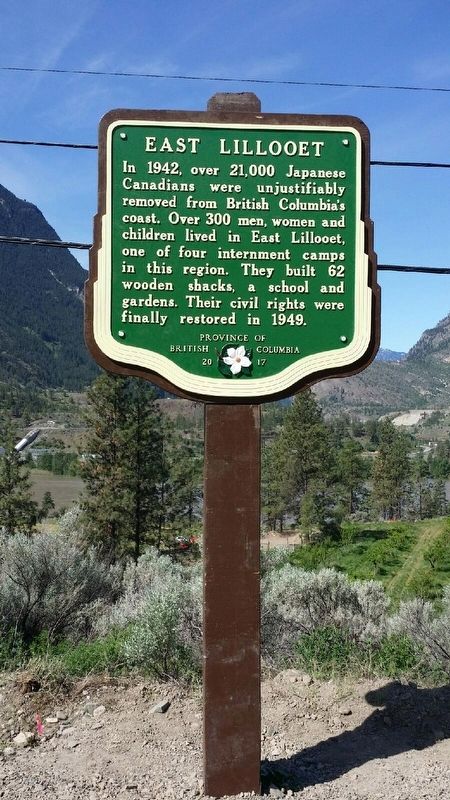
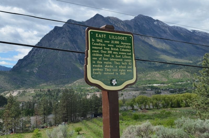
East Lillooet

By B.C. Ministry of Transportation and Infrastructure (CC BY-NC-ND 2.0), May 2018
1. East Lillooet Marker
Erected 2018 by Province of British Columbia.
Topics. This historical marker is listed in this topic list: War, World II. A significant historical year for this entry is 1942.
Location. 50° 40.638′ N, 121° 54.861′ W. Marker is in Lillooet, British Columbia, in Squamish-Lillooet. Marker is at the intersection of Lytton-Lillooet Highway (Provincial Highway 12) and Summner Road, on the left when traveling north on Lytton-Lillooet Highway. Touch for map. Marker is in this post office area: Lillooet BC V0K 1V0, Canada. Touch for directions.
Other nearby markers. At least 2 other markers are within 5 kilometers of this marker, measured as the crow flies. Lillooet (approx. 2.7 kilometers away); The Old Bridge (approx. 3.8 kilometers away).
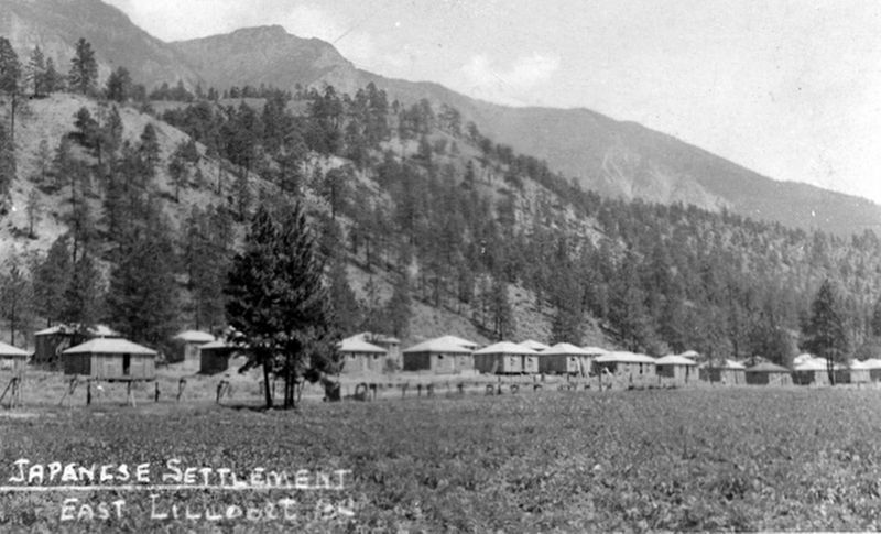
Also see . . . The East Lillooet Japanese Canadian World War II Interment Camp Site. Despite inflammatory editorials in the local newspaper opposing their presence, in April of 1942, the first arrivals in East Lillooet constructed sixty-two tarpaper shacks that came to house over three hundred people while their former comfortable homes, possessions and properties were auctioned off. (District of Lillooet) (Submitted on December 12, 2021, by Duane and Tracy Marsteller of Murfreesboro, Tennessee.)

B.C. Ministry of Transportation and Infrastructure via Flickr (CC BY-NC-ND 2.0), May 11, 2018
2. East Lillooet Marker
Credits. This page was last revised on February 11, 2022. It was originally submitted on December 10, 2021, by Duane and Tracy Marsteller of Murfreesboro, Tennessee. This page has been viewed 137 times since then and 27 times this year. Photos: 1. submitted on December 12, 2021, by Duane and Tracy Marsteller of Murfreesboro, Tennessee. 2. submitted on December 10, 2021, by Duane and Tracy Marsteller of Murfreesboro, Tennessee. 3. submitted on December 12, 2021, by Duane and Tracy Marsteller of Murfreesboro, Tennessee.
