
Victoria in Capital Region, British Columbia — Canada’s West Coast (North America)
The First Flight
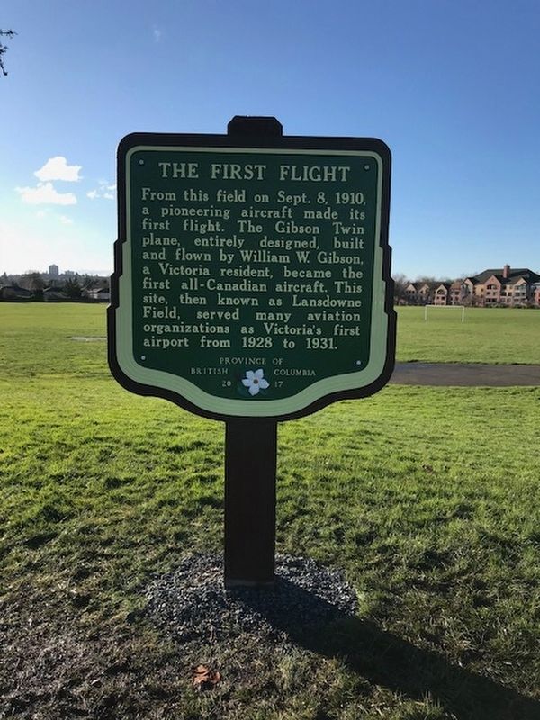
B.C. Ministry of Transportation and Infrastructure via Flickr (CC BY-NC-ND 2.0), December 20, 2017
1. The First Flight Marker
Erected 2017 by Province of British Columbia.
Topics. This historical marker is listed in this topic list: Air & Space. A significant historical date for this entry is September 8, 1910.
Location. 48° 26.758′ N, 123° 19.779′ W. Marker is in Victoria, British Columbia, in Capital Region. It is at the intersection of Lansdowne Road and Carman Street, on the right when traveling east on Lansdowne Road. Marker is in the Lansdowne Middle School athletic field. Touch for map. Marker is at or near this postal address: 1765 Lansdowne Rd, Victoria BC V8P 1A7, Canada. Touch for directions.

Regionally, it is in North America, on the Ring of Fire, in the Pacific Rim, in the Western Hemisphere, in the Western World, and in the Anglosphere. Historically, it finds itself in what was once a British
this page online
Other nearby markers. At least 8 other markers are within 3 kilometers of this marker, measured as the crow flies: "Summerdyne" (approx. 2.4 kilometers away); Oak Bay Grocery (approx. 2.4 kilometers away); Robert Dunsmuir (approx. 2.8 kilometers away); Craigdarroch (approx. 2.8 kilometers away); The People and the Lieutenant Governor (approx. 3.1 kilometers away); Rockland Cairn (approx. 3.1 kilometers away); The Role of the Lieutenant Governor (approx. 3.1 kilometers away); Congregation Emanu-El (approx. 3.1 kilometers away). Touch for a list and map of all markers in Victoria.
Also see . . .
1. W.W.(William Wallace) Gibson. Short biography of the pioneering Canadian aviator. (British Columbia Aviation Hall of Fame) (Submitted on February 18, 2022, by Duane and Tracy Marsteller of Murfreesboro, Tennessee.)
2. The Balgonie Birdman (YouTube). Animated 1991 short depicts Gibson's quest for human flight. (Directed by Brian Duchscherer; uploaded by National Film Board) (Submitted on February 18, 2022, by Duane and Tracy Marsteller of Murfreesboro, Tennessee.)
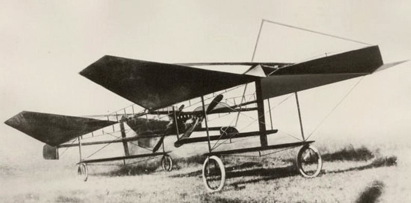
William Wallace Gibson via Saanich Archives 1985-010-002 (Public domain), 1908
2. The Gibson Twin Plane
Credits. This page was last revised on February 18, 2022. It was originally submitted on December 10, 2021, by Duane and Tracy Marsteller of Murfreesboro, Tennessee. This page has been viewed 1,182 times since then and 124 times this year. Photos: 1. submitted on December 10, 2021, by Duane and Tracy Marsteller of Murfreesboro, Tennessee. 2. submitted on February 18, 2022, by Duane and Tracy Marsteller of Murfreesboro, Tennessee.
Editor’s want-list for this marker. Wide shot of marker and surrounding area in context. • Can you help?
