Sparwood in East Kootenay, British Columbia — Canada’s West Coast (North America)
Natal, Michel and Middletown (1898-1976)

B.C. Ministry of Transportation and Infrastructure via Flickr (CC BY-NC-ND 2.0), April 13, 2016
1. Natal, Michel and Middletown (1898-1976) Marker
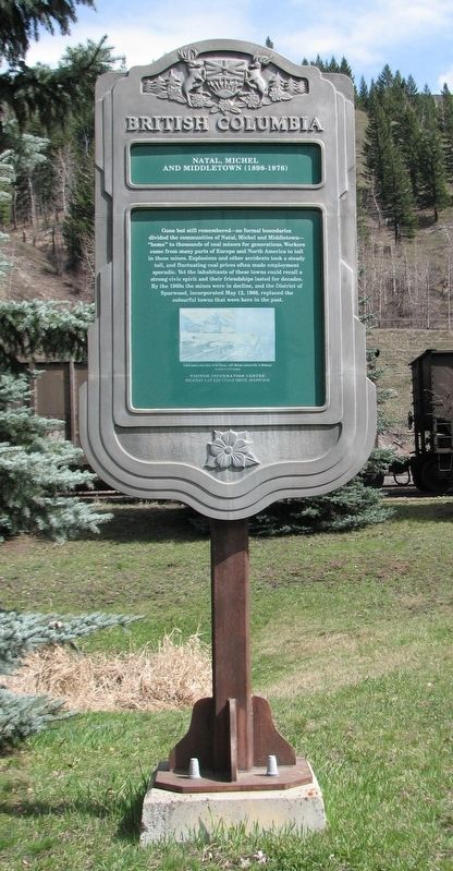
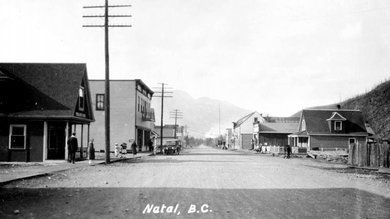
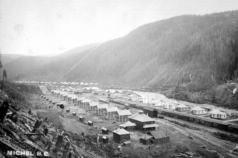
Gone but still remembered — no formal boundaries divided the communities of Natal, Michel and Middletown — “home” to thousands of coal miners for generations. Workers came from many parts of Europe and North America to toil in these mines. Explosions and other accidents took a steady toll, and fluctuating coal prices often made employment sporadic. Yet the inhabitants of these towns could recall a strong civic spirit and their friendships lasted for decades. By the 1960s the mines were in decline, and the District of Sparwood, incorporated May 12, 1966, replaced the colourful towns that were here in the past.
Caption: Coke ovens and mine installations, with Michel community in distance. BCARS Photo
Erected by Province of British Columbia.
Topics. This historical marker is listed in these topic lists: Industry & Commerce • Settlements & Settlers. A significant historical date for this entry is May 12, 1966.
Location. 49° 43.092′ N, 114° 50.454′ W. Marker is in Sparwood, British Columbia, in East Kootenay. Marker is on Crowsnest Highway (Provincial Highway 3) 0.4 kilometers west of Elk Valley Coal Road, on the right when traveling west. Marker is in a small pullout on the westbound side. Touch for map. Marker is in this post office area: Sparwood BC V0B 2G0, Canada. Touch for directions.
Other nearby markers. At least 2 other markers are within 14 kilometers of this marker, measured as the crow flies. George Mercer Dawson (1849-1901) (approx. 5.6 kilometers away); Crowsnest Pass (approx. 13.7 kilometers away).
Also see . . . Boom & Bust: Ghost Towns of the Elk Valley. Tourism Fergie website entry (Submitted on October 24, 2023, by Larry Gertner of New York, New York.)
Credits. This page was last revised on October 24, 2023. It was originally submitted on December 10, 2021, by Duane and Tracy Marsteller of Murfreesboro, Tennessee. This page has been viewed 363 times since then and 97 times this year. Photos: 1. submitted on December 10, 2021, by Duane and Tracy Marsteller of Murfreesboro, Tennessee. 2, 3. submitted on February 17, 2022, by Duane and Tracy Marsteller of Murfreesboro, Tennessee.
Editor’s want-list for this marker. Wide shot of marker and surrounding area in context • Confirm coordinates • Can you help?

