Midway in Kootenay Boundary, British Columbia — Canada’s West Coast (North America)
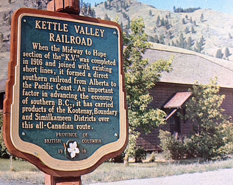
Kettle Valley Railroad

B.C. Ministry of Transportation and Infrastructure via Flickr (CC BY-NC-ND 2.0), July 6, 2016
1. Kettle Valley Railroad Marker
Erected 1966 by Province of British Columbia.
Topics. This historical marker is listed in this topic list: Railroads & Streetcars. A significant historical year for this entry is 1916.
Location. 49° 0.674′ N, 118° 47.135′ W. Marker is in Midway, British Columbia, in Kootenay Boundary. Marker is on Crowsnest Highway (Provincial Highway 3) just west of Beamish Street, on the right when traveling west. Marker is in front of the Kettle River Museum. Touch for map. Marker is at or near this postal address: 907 Crowsnest Hwy, Midway BC V0H 1M0, Canada. Touch for directions.
Other nearby markers. At least 4 other markers are within 11 kilometers of this marker, measured as the crow flies. Midway (approx. 0.9 kilometers away); Boundary Falls Smelter (approx. 6.7 kilometers away); Copper Street (approx. 10.5 kilometers away); Greenwood Smelter (approx. 10.6 kilometers away).
Also see . . . The Kettle Valley Railway. History and significance of the 310-mile (500km) railroad. (Canadian Society for Civil Engineering) (Submitted on February 24, 2022, by Duane and Tracy Marsteller of Murfreesboro, Tennessee.)
Credits. This page was last revised on June 14, 2022. It was originally submitted on December 10, 2021, by Duane and Tracy Marsteller of Murfreesboro, Tennessee. This page has been viewed 88 times since then and 8 times this year. Photo 1. submitted on December 10, 2021, by Duane and Tracy Marsteller of Murfreesboro, Tennessee.
Editor’s want-list for this marker. Wide shot of marker and surrounding area, • Can you help?