
Near Telkwa in Bulkley-Nechako, British Columbia — Canada’s West Coast (North America)
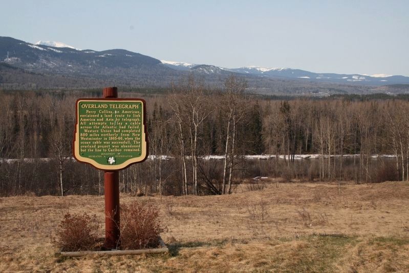
Overland Telegraph

B.C. Ministry of Transportation and Infrastructure via Flickr (CC BY-NC-ND 2.0)
1. Overland Telegraph Marker
Western Union had completed 800 miles northerly from New Westminster in 1865-66, when the ocean cable was successfull. The overland project was abandoned but the line to Cariboo remained.
Erected by British Columbia Department of Recreation and Conservation.
Topics. This historical marker is listed in this topic list: Communications. A significant historical year for this entry is 1865.
Location. 54° 40.032′ N, 126° 59.739′ W. Marker is near Telkwa, British Columbia, in Bulkley-Nechako. It is on Yellowhead Highway (Provincial Highway 16) half a kilometer west of George Frontage Road, on the left when traveling west. Marker is at the south-east-bound pull-out named Bulkley View Rest Area, at the picnic tables. Touch for map. Marker is in this post office area: Telkwa BC V0J 2X3, Canada. Touch for directions.

Regionally, this marker is in Northern BC. Globally, it is in North America, on the Ring of Fire, in the Pacific Rim, in the Western Hemisphere, in the
this page online
Also see . . .
1. Perry Collins' Overland Telegraph. Collins' dream of a telegraph line between San Francisco and Moscow via the Bering Strait was dashed by another entrepreneur's success. (Barry Evans, North Coast Journal of Politics, People and Art, posted Jan. 29, 2009) (Submitted on February 17, 2022, by Duane and Tracy Marsteller of Murfreesboro, Tennessee.)
2. Russian–American Telegraph. Wikipedia entry on the planned telegraph line, which was abandoned when a competing line across the Atlantic Ocean was completed first. (Submitted on February 17, 2022, by Duane and Tracy Marsteller of Murfreesboro, Tennessee.)
© Murray Lundberg (used by permission), April 22, 2008
2. Overland Telegraph Marker

Perry McDonough Collins and J.H. Colton via Boston Public Library Norman B. Leventhal Map Center, 1864
3. Portion of map of Perry Collins' proposed American-Russian telegraph line

Unknown via British Columbia Archives (Public domain), circa 1865
4. Edmund Conway with the Collins Overland Telegraph party
Conway was in charge of the route's American and British Columbia sections. His men had installed more than 650 kilometers of telegraph line between New Westminster and Quesnel when the project was abandoned.
Credits. This page was last revised on July 29, 2026. It was originally submitted on December 10, 2021, by Duane and Tracy Marsteller of Murfreesboro, Tennessee. This page has been viewed 586 times since then and 85 times this year. Photos: 1. submitted on December 10, 2021, by Duane and Tracy Marsteller of Murfreesboro, Tennessee. 2. submitted on February 24, 2022, by Duane and Tracy Marsteller of Murfreesboro, Tennessee. 3, 4. submitted on February 17, 2022, by Duane and Tracy Marsteller of Murfreesboro, Tennessee.
