Peachland in Central Okanagan, British Columbia — Canada’s West Coast (North America)
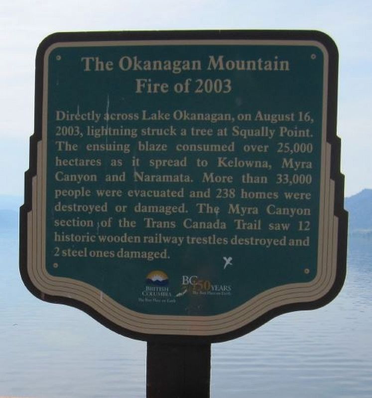
The Okanagan Mountain Fire of 2003
B.C. Ministry of Transportation and Infrastructure via Flickr (CC BY-NC-ND 2.0), June 15, 2016
1. The Okanagan Mountain Fire of 2003 Marker
Erected by Province of British Columbia.
Topics. This historical marker is listed in this topic list: Disasters. A significant historical date for this entry is August 16, 2003.
Location. 49° 44.38′ N, 119° 45.867′ W. Marker is in Peachland, British Columbia, in Central Okanagan. It is on Okanagan Highway (Provincial Highway 97) 0.2 kilometers south of Hardy Street, on the left when traveling south. Marker is in Antler's Beach Regional Park. Touch for map. Marker is in this post office area: Peachland BC V0H 1X9, Canada. Touch for directions.

Regionally, this marker is in the BC Interior and in Thompson-Okanagan. Globally, it is in North America, on the Ring of Fire, on the Pacific Rim, in the Western Hemisphere, in the Western
this page online
Other nearby markers. At least one other marker is within 14 kilometers of this marker, measured as the crow flies: J.M. Robinson (approx. 13.3 kilometers away).
Also see . . .
1. A brief history of the Okanagan Mountain Park fire (YouTube). In 2003, the city of Kelowna was attacked by a ravaging forest fire, the likes of which the province hadn’t seen before. This is a brief history of that event and the brave people involved. (Global News, posted June 11, 2019) (Submitted on February 19, 2022, by Duane and Tracy Marsteller of Murfreesboro, Tennessee.)
2. The Okanagan Mountain Park forest fire. Slideshow of the most significant interface wildfire event in B.C. history, which caused $200 million in damage, evacuated 33,000 people and destroyed over 230 homes. (Canadian Broadcasting Corp., posted Sept. 11, 2013) (Submitted on February 19, 2022, by Duane and Tracy Marsteller of Murfreesboro, Tennessee.)
3. 2003 Okanagan Mountain Park fire. Wikipedia entry on the firestorm, which was battled by 60 fire
Shawn via Flickr (CC BY-SA 2.0), August 16, 2003
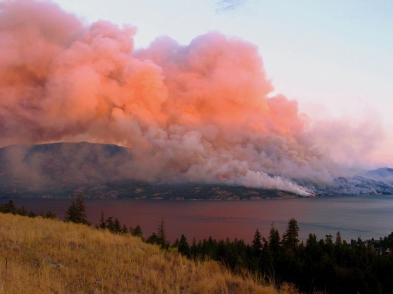
2. Okanagan Fire
The first evening of the big Okanagan Mountain fire that led to 30,000 evacuations and over 200 destroyed homes.
Credits. This page was last revised on February 19, 2022. It was originally submitted on December 10, 2021, by Duane and Tracy Marsteller of Murfreesboro, Tennessee. This page has been viewed 341 times since then and 38 times this year. Photos: 1. submitted on December 10, 2021, by Duane and Tracy Marsteller of Murfreesboro, Tennessee. 2. submitted on February 19, 2022, by Duane and Tracy Marsteller of Murfreesboro, Tennessee.
Editor’s want-list for this marker. Wide shot of marker and surrounding area in context • Can you help?
