Yale in Fraser Valley, British Columbia — Canada’s West Coast (North America)
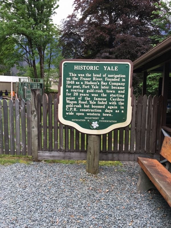
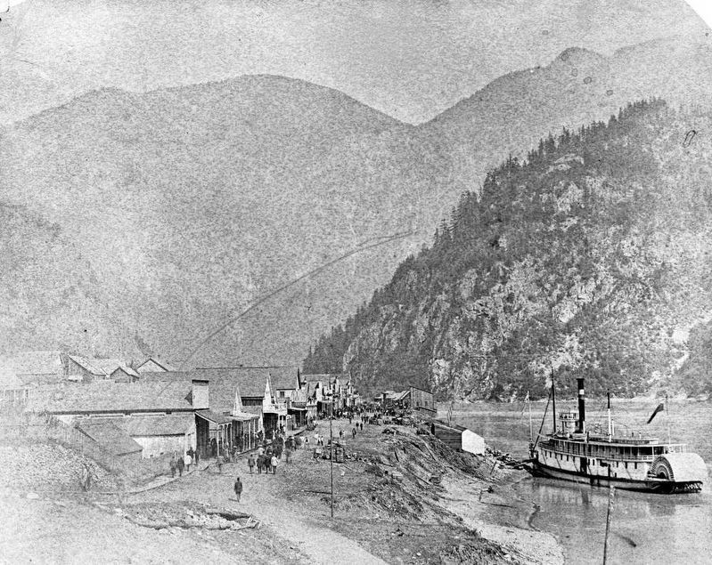
Historic Yale

B.C. Ministry of Transportation and Infrastructure via Flickr (CC BY-NC-ND 2.0)
1. Historic Yale Marker
Erected by British Columbia Department of Recreation and Conservation.
Topics. This historical marker is listed in this topic list: Settlements & Settlers. A significant historical year for this entry is 1848.
Location. 49° 33.763′ N, 121° 25.938′ W. Marker is in Yale, British Columbia, in Fraser Valley. Marker can be reached from Douglas Street east of Victoria Street, on the left when traveling east. Marker is in Yale Historic Site. Touch for map. Marker is at or near this postal address: 31187 Douglas St, Yale BC V0K 2S0, Canada. Touch for directions.
Other nearby markers. At least 3 other markers are within 16 kilometers of this marker, measured as the crow flies. The Yale Convention (within shouting distance of this marker); Early Chinese (approx. 5.7 kilometers away); J.W. Trutch (approx. 16.2 kilometers away).
Also see . . .
1. Yale Historic Site. Website for "the wickedest little settlement in British Columbia." (Submitted on February 12, 2022, by Duane and Tracy Marsteller of Murfreesboro, Tennessee.)
2. Yale, British Columbia. Wikipedia entry on the community that, in its gold rush heyday, was reputedly the largest city west of Chicago and north of San Francisco. (Submitted on February 12, 2022, by Duane and Tracy Marsteller of Murfreesboro, Tennessee.)
Credits. This page was last revised on February 12, 2022. It was originally submitted on December 10, 2021, by Duane and Tracy Marsteller of Murfreesboro, Tennessee. This page has been viewed 382 times since then and 75 times this year. Photos: 1. submitted on December 10, 2021, by Duane and Tracy Marsteller of Murfreesboro, Tennessee. 2. submitted on February 12, 2022, by Duane and Tracy Marsteller of Murfreesboro, Tennessee.
Editor’s want-list for this marker. Closeup photo of marker. Confirm coordinates. • Can you help?
