Near Ashcroft in Thompson-Nicola, British Columbia — Canada’s West Coast (North America)
Ghost of Walhachin

B.C. Ministry of Transportation and Infrastructure via Flickr (CC BY-NC-ND 2.0)
1. Ghost of Walhachin Marker
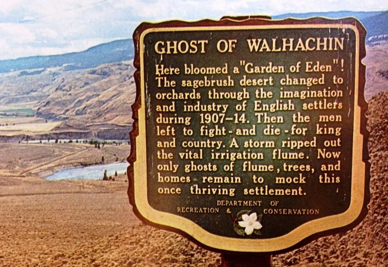
Here bloomed a “Garden of Eden”! The sagebrush desert changed to orchards through the imagination and industry of English settlers during 1907-14. Then the men left to fight - and die - for king and country. A storm ripped out the vital irrigation flume. Now only ghosts of flumes, trees, and homes remain to mock this once thriving settlement.
Erected by British Columbia Department of Recreation and Conservation.
Topics. This historical marker is listed in these topic lists: Horticulture & Forestry • Settlements & Settlers. A significant historical year for this entry is 1907.
Location. 50° 47.842′ N, 121° 6.556′ W. Marker is near Ashcroft, British Columbia, in Thompson-Nicola. Marker is on Trans-Canada Highway (Provincial Highway 1) half a kilometer east of Battle Creek Forest Service Road, on the right when traveling east. Marker is at an overlook approximately 16.1 kilometers east of Cache Creek. Touch for map. Marker is at or near this postal address: 220 BC-1, Ashcroft BC V0K 1A0, Canada. Touch for directions.
Other nearby markers. At least 1 other marker is within 3 kilometers of this marker, measured as the crow flies. McAbee Fossil Beds (approx. 2.2 kilometers away).
Also see . . .
1. Ghost of Walhachin (PDF). The remnants of the flume that once nourished Walhachin's verdant crops now lay scattered in the hills above the highway and in Deadman Valley below. (Amy Thacker, Gold Country Communities Society) (Submitted on December 11, 2021, by Duane and Tracy Marsteller of Murfreesboro, Tennessee.)
2. Walachin. Wikipedia entry on the ghost town once called "Canada's Camelot." (Submitted on December 11, 2021, by Duane and Tracy Marsteller of Murfreesboro, Tennessee.)
3. The Short Season Of High Society. It was to be an overseas Utopia for the upper classes of England — lush gardens and orchards, a heavenly climate and all the familiar trappings of aristocracy. It lasted about a decade. What went wrong? (Graham Chandler, Legion magazine, posted June 4, 2009) (Submitted on December 11, 2021, by Duane and Tracy Marsteller of Murfreesboro, Tennessee.)
4. Golden Country: Past, Present, and Beyond: Walhachin. First in an eight-part series of articles on the community's genesis, growth and decline. (Barbara Roden, The Ashford-Cache Creek Journal, posted Dec. 27, 2016) (Submitted on December 12, 2021, by Duane and Tracy Marsteller of Murfreesboro, Tennessee.)
Additional keywords. Ghost town

Unknown via British Columbia Archives; d-03191_141 (Public domain), 1910
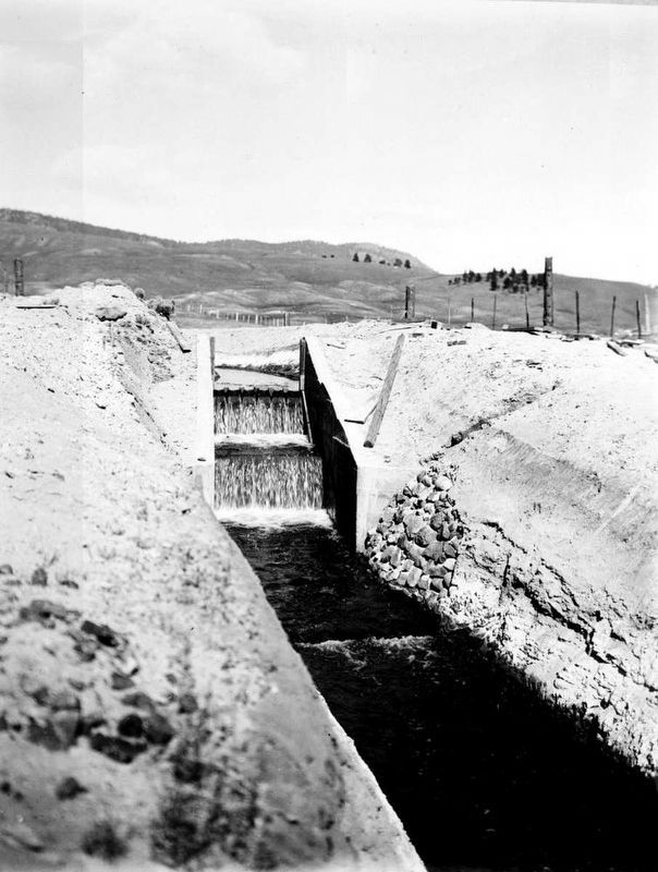
3. Walhachin flume
The hastily built flume carried water from Deadman's Creek 12 miles to irrigate Walachin's orchards. It was intended to be a temporary measure until a suitable water source could be found, so the wooden flume deteriorated quickly. It wasn't until decades later that it was discovered the site's soil was unsuitable for orchard crops.
Credits. This page was last revised on October 8, 2023. It was originally submitted on December 10, 2021, by Duane and Tracy Marsteller of Murfreesboro, Tennessee. This page has been viewed 460 times since then and 87 times this year. Photos: 1. submitted on December 10, 2021, by Duane and Tracy Marsteller of Murfreesboro, Tennessee. 2, 3, 4. submitted on December 12, 2021, by Duane and Tracy Marsteller of Murfreesboro, Tennessee.
Editor’s want-list for this marker. Wide shot of marker and surrounding area in context. • Can you help?

