West End in Kamloops in Thompson-Nicola, British Columbia — Canada’s West Coast (North America)
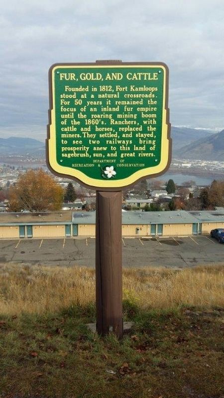
Fur, Gold and Cattle

B.C. Ministry of Transportation and Infrastructure via Flickr (CC BY-NC-ND 2.0)
1. Fur, Gold and Cattle Marker
Erected by British Columbia Department of Recreation and Conservation.
Topics. This historical marker is listed in these topic lists: Agriculture • Forts and Castles • Industry & Commerce • Railroads & Streetcars. A significant historical year for this entry is 1812.
Location. 50° 40.413′ N, 120° 21.197′ W. Marker is in Kamloops, British Columbia, in Thompson-Nicola. It is in West End. Marker can be reached from Columbia Street West, 0.3 kilometers west of Grandview Terrace, on the right when traveling west. Marker is in the Columbia Street viewpoint. Touch for map. Marker is at or near this postal address: 610 Columbia St W, Kamloops BC V2C 1L1, Canada. Touch for directions.
Other nearby markers. At least 1 other marker is within 5 kilometers of this marker, measured as the crow flies. Kamloops Indian Residential School (approx. 4.2 kilometers away).
Also see . . . Fort Kamloops. It wasn't just one fort — and it didn't always stay in the same place. (FortWiki) (Submitted on December 13, 2021, by Duane and Tracy Marsteller of Murfreesboro, Tennessee.)
Credits. This page was last revised on February 16, 2023. It was originally submitted on December 10, 2021, by Duane and Tracy Marsteller of Murfreesboro, Tennessee. This page has been viewed 77 times since then and 10 times this year. Photo 1. submitted on December 10, 2021, by Duane and Tracy Marsteller of Murfreesboro, Tennessee.
Editor’s want-list for this marker. Wide shot of marker and surrounding area in context. • Can you help?