Tonopah in Nye County, Nevada — The American Mountains (Southwest)
The Railroads
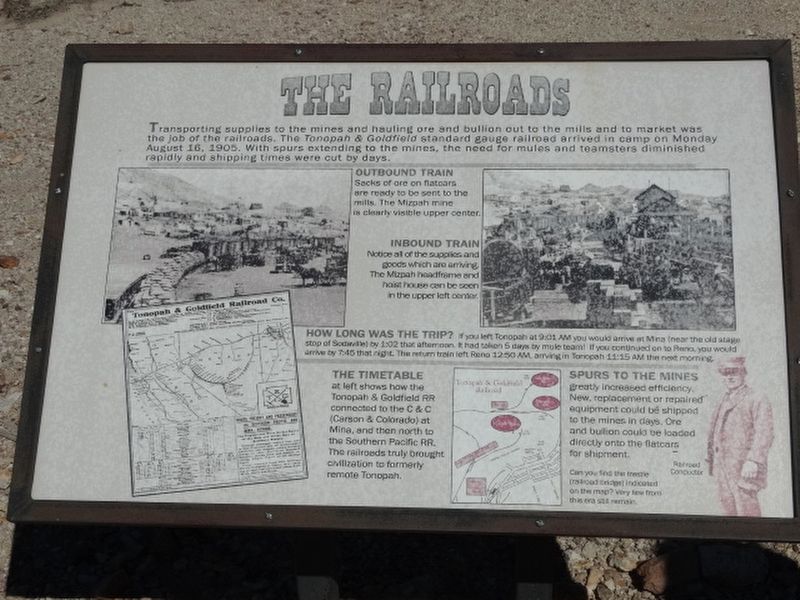
OUTBOUND TRAIN
Sacks of ore on flatcars ae ready to be sent to the mills. The Mizpah mine is clearly visible upper center.
INBOUND TRAIN
Notice all of the supplies and goods which are arriving. The Mizpah headframe and hoist house can be seen in the upper left center.
HOW LONG WAS THE TRIP? If you left Tonopah at 9:01 AM you would arrive at Mina (near the old stage stop of Sodaville by 1:02 that afternoon. It has taken 5 days by mule team! If you continued on to Reno, you would arrive 7:45 that night. This return train left Reno 12:50 AM arriving in Tonopah 11:15 AM the next morning.
THE TIMETABLE
at left shows how the Tonopah & Goldfield RR connected to the C & C (Carson & Colorado) at Mine, and then north to the Southern Pacific RR. The railroads truly brought cicilization to formerly remote Tonopah.
SPURS TO THE MINES
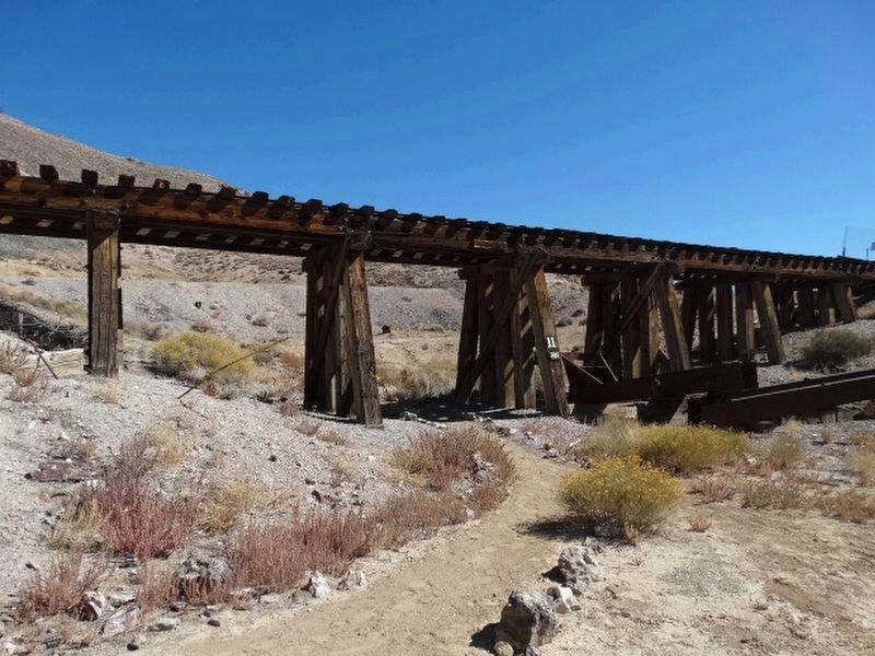
greatly increased efficiency. New replacement or repaired equipment could be shipped to the mines in days Ore and bullion could be loaded directly onto the flatcars for shipment. Can you find the trestle (railroad bridge) indicated on the map? Very low front this ear still remain.
Erected by Tonopah Historic Mining Park.
Topics. This historical marker is listed in these topic lists: Architecture • Industry & Commerce • Railroads & Streetcars. A significant historical date for this entry is August 16, 1905.
Location. 38° 4.254′ N, 117° 13.638′ W. Marker is in Tonopah, Nevada, in Nye County. Marker is on Burro Avenue, on the right when traveling east. Located in the Tonopah Historic Mining Park. Touch for map. Marker is at or near this postal address: 110 Burro Avenue, Tonopah NV 89049, United States of America. Touch for directions.
Other nearby markers. At least 8 other markers are within walking distance of this marker. Up From The Depths (within shouting distance of this marker); Belle's Mine (within shouting distance of this marker); Haul Out The Riches (about 400 feet away, measured in a direct line); Glory Hole (about 400 feet away); The Hoistmen (about 400 feet away); Silver Vein (about 400 feet away); Mine To Market (about 500 feet away); The Tonopah Mining Boom (about 600 feet away). Touch for a list and map of all markers in Tonopah.
Credits. This page was last revised on December 31, 2021. It was originally submitted on December 12, 2021, by Denise Boose of Tehachapi, California. This page has been viewed 110 times since then and 7 times this year. Photos: 1, 2, 3, 4. submitted on December 12, 2021, by Denise Boose of Tehachapi, California. • Andrew Ruppenstein was the editor who published this page.


