
Near Pickstown in Gregory County, South Dakota — The American Midwest (Upper Plains)
Fort Without a Stockade
December 3, 2021
1. Fort Without a Stockade Marker
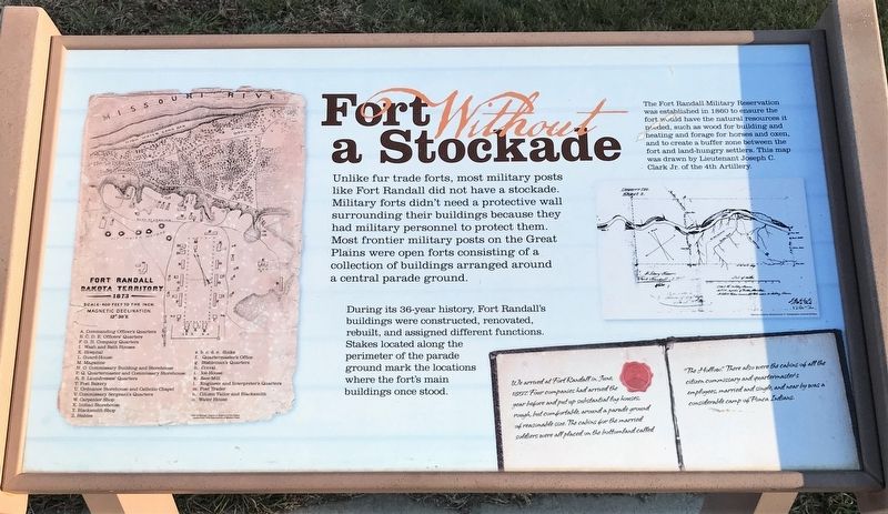
During its 36-year history, Fort Randall's buildings were constructed, renovated, rebuilt, and assigned different functions. Stakes located along the perimeter of the parade ground mark the locations where the fort's main buildings once stood.
The Fort Randall Military Reservation was established in 1860 to ensure the fort would have the natural resources it needed, such as wood for building and heating and forage for horses and oxen, and to create a buffer zone between the fort and land-hungry settlers. This map was drawn by Lieutenant Joseph C. Clark Jr. of the 4th Artillery.
Book pages:
We arrived at Fort Randall in June, 1857. Four companies had arrived the year before and put up substantial log houses, rough, but comfortable, around a parade ground of reasonable size. The cabins for the married soldiers were all placed on the bottomland called "The Hollow." There also were the cabins of all the citizen commissary and quartermaster's employees, married and single, and near by was a considerable camp of Ponca Indians.
Map:
1873
Scale-400
this page online
Magnetic Declination, 12° 30'E
A. Commanding Officer's Quarters
B. C. D. E. Officers' Quarters
F. G. H. Company Quarters
I. Wash and Bath Houses
K. Hospital
L. Guard-House
M. Magazine
N. O. Commissary Building and Storehouse
P. Q. Quartermaster and Commissary Storehouse
R. S. Laundresses' Quarters
T. Post Bakery
U. Ordnance Storehouse and Catholic Chapel
V. Commissary Sergeant's Quarters
W. Carpenter Shop
X. Indian Storehouse
Y. Blacksmith Shop
Z. Stables
a. b. c. d. e. Sinks
f. Quartermaster's Office
g. Stableman's Quarters
h. Corral
i. Ice-House
k. Saw-Mill
l. Engineer and Interpreter's Quarters
m. Post Trader
n. Citizen Tailor and Blacksmith
o. Water House
Topics. This historical marker is listed in this topic list: Forts and Castles. A significant historical year for this entry is 1860.
Location. 43° 2.947′ N, 98° 33.733′ W. Marker is near Pickstown, South Dakota, in Gregory County. It is on Stone Church Drive east of Toe Road West, on the right when traveling east. Located at Historic Fort Randall. Touch for map. Marker is in this post office area: Lake Andes SD 57356, United States
December 3, 2021
2. Fort Without a Stockade Marker (right)
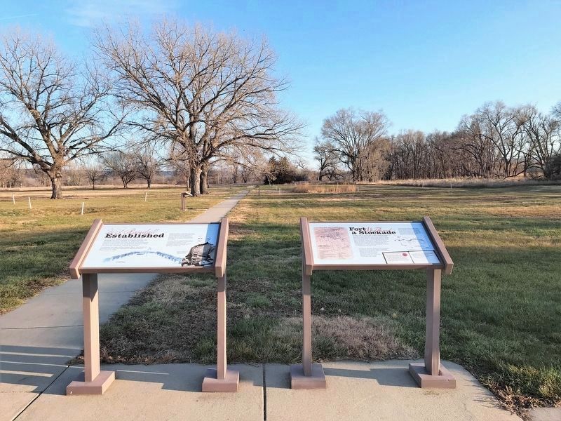
In the background (and throughout the trail) can be seen white stakes that outline where Fort Randall buildings once stood.

Regionally, this marker is in East River. It is also in the American Lewis & Clark Corridor, on the prairies, and on the Northern Plains. Globally, it is in North America, the Western Hemisphere, the Western World, and the Anglosphere. Historically, it finds itself in what was once Rupert’s Land and also the Louisiana Purchase.
Other nearby markers. At least 8 other markers are within walking distance of this marker: Fort Randall Established (here, next to this marker); The Advancing Frontier (here, next to this marker); Explore Fort Randall (here, next to this marker); Soldiers at Fort Randall (a few steps from this marker); Spiritual & Social Sustenance (within shouting distance of this marker); Fort Randall (within shouting distance of this marker); Plat of Fort Randall (within shouting distance of this marker); Echo Lodge, No. 2. (within shouting distance of this marker). Touch for a list and map of all markers in Pickstown.
Related markers. Click here for a list of markers that are related to this marker. This is a list of markers along the Historic Fort Randall parade ground trail.
Credits. This page was last revised on March 8, 2025. It was originally submitted on December 10, 2021. This page has been viewed 305 times since then and 26 times this year. Last updated on December 15, 2021. Photos: 1, 2. submitted on December 10, 2021. • J. Makali Bruton was the editor who published this page.
