Winston in Broadwater County, Montana — The American West (Mountains)
Winston

Photographed By Barry Swackhamer, July 17, 2021
1. Winston - A Town with Dreams of Striking it Rich (Panel 1)
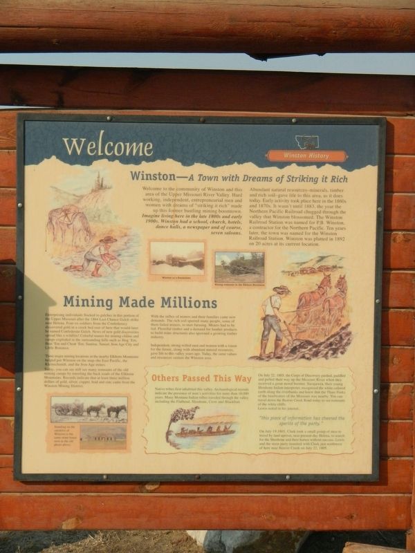
Captions: (upper center) Winston as a Boomtown, Mining remnants in the Elkhorn Mountains; (bottom left) Standing on the outskirts of Winston is the same stone house seen in the old photo above.
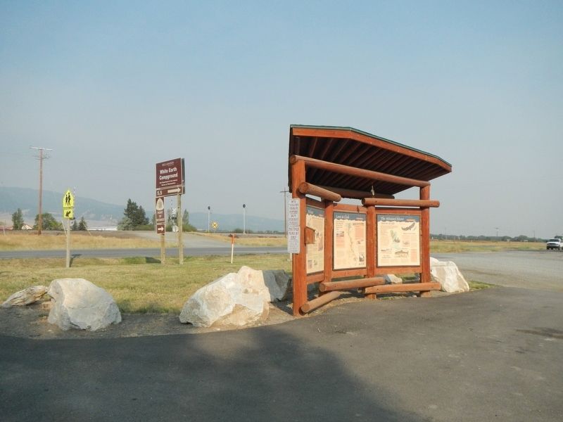
(Three historical panels are located at this informational kiosk:)
(Panel 1:)
Winston History
Welcome to the community of Winston and this area of the Upper Missouri River Valley. Hard working, independent, entrepreneurial men and women with dreams of "striking it rich" made up this former bustling mining boomtown.
Imagine living here in the late 1800s and early 1900s. Winston had a school, church, hotels, dance halls, a newspaper and of course, seven saloon.
Abundant natural resources-minerals, timber and rich soil-gave life to this area, as it does today. Early activity took place here in the 1860s and 1870s. It wasn't until 1883, the year the Northern Pacific Railroad chugged through the valley that Winston blossomed. The Winston Railroad Station was named for P.B. Winston, a contractor for the Northern Pacific. Ten years later, the town was named for the Winston Railroad Station. Winston was platted in 1892 on 20 acres at it current location.
Mining Made Millions
Enterprising individuals flocked to gulches in this portion of the Upper Missouri after the 1864 Last Chance Gulch strike near Helena. Four ex-soldiers from the Confederacy discovered gold in a creek bed east of here that would later be named Confederate Gulch. News of new gold discoveries spread like wildfire! Colorful names for mining claims and camps exploded in the surrounding hills such as Hog 'Em, Beat 'Em and Cheat 'Em; Sunrise, Sunset, Iron Age City and Little Bonanza.
Three major mining locations in the nearby Elkhorn Mountains helped put Winston on the map-the East Pacific, the Kleinschmidt, and the Iron Age mines.
Today, you can see still see (sic) many remnants of the old mining camps by traveling the back roads of the Elkhorn Mountains. Records indicate that a least three million dollars of gold, silver, copper, lead and zinc came from the Winston Mining District.
With the influx of miners and their families came new demands. The rich soil spurred many people, some of them failed miners, to start farming. Miners had to be fed. Plentiful timber and a demand for lumber products to build mine structures also spawned a growing timber industry.
Independent, strong-willed men and women with a vision for the future, along with abundant natural resources, gave life to this valley years ago. Today, the same values and resources sustain the Winston area.
(Side-bar on the bottom right)
Others Passed This Way
Native tribes first inhabited this valley. Archaeological records indicate the presence of man's activities

Photographed By Barry Swackhamer, July 17, 2021
2. Lewis & Clark (Panel2:)
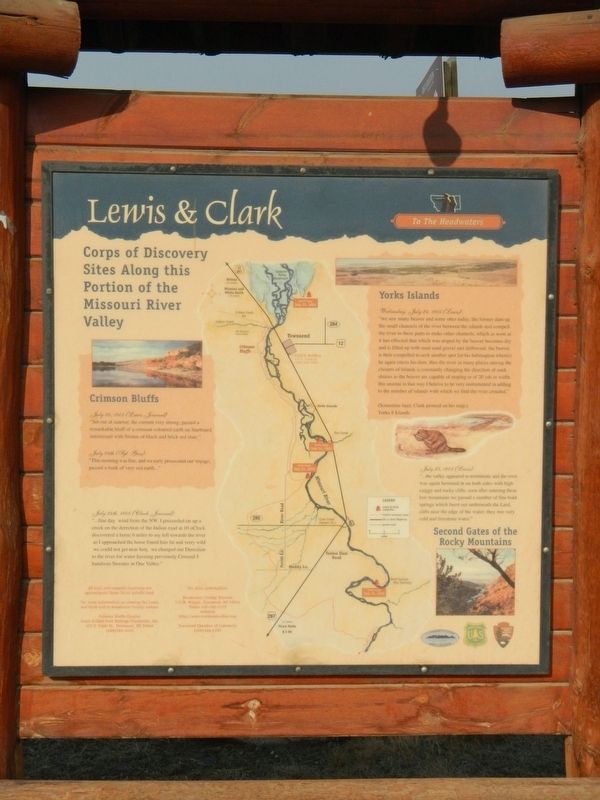
Captions for the map at the center:
All train and campsite locations are approximate. Some lie on private land.
For more information on viewing the Lewis and Clark trail in Broadwater County contact:
Crimson Bluffs Chapter, Lewis & Clark Trail Heritage Foundation Inc. 414S. Front Street, Townsend, MT 59644, (406)266-3425
For more information:
Broadwater County Museum, 133 N. Walnut, Townsend, MT 59644, Phone (406)266-5252, website http://www.townsendvalley.com
Townsend Chamber of Commerce, (406)266-4101
On July 22, 1805, the Corp of Discovery pushed, paddled and pulled their way up the Missouri River when they received a great moral booster. Sacajawea, their young Shoshone Indian interpreter, recognized the white-colored earth along the riverbanks and knew that the Three Forks of the headwaters of the Missouri was nearby. You can travel down the Beaver Creek Road today to see remnants of the white cliffs.
Lewis noted in his journal,
On July 19, 1805, Clark took a small group of men to travel by land upriver, near present-day Helena, to search for the Shoshone and their horses without success. Lewis and the main party reunited with Clark just northwest of here near Beaver Creek on July 22, 1805.
(Panel 2:)
To the Headwaters
Corps of Discovery Sites Along this Portion of the Missouri River Valley
Crimson Bluffs
July 24, 1805 (Lewis Journal)
"Set out at sunrise; the current very strong; passed a remarkable bluff of a crimson coloured earth on Starboard intermixed with Stratas of black and brick red slate."
July 24th (Sgt. Gass)
"This morning was fine, and we early prosecuted our voyage; passed a bank of very red earth..."
July 24th, 1805 (Clark Journal)
"...fine day wind from the NW. I proceeded on up a creek on the derection of Indian road at 10 oClock discovered a horse 6 miles to my left towards the river as I approached the horse found him fat and verry wild we could not get near him, we changed our Derection to the river for water haveing previously Crossed 5 handsom Streams in One Valley."
York Islands
Wednesday, July 24, 1805 (Lewis)
"we saw many beaver and some otter today; the former dam up the small channels of the river between the islands and compell the river in these parts to make other channels; which as soon as it has effected that which was stoped by the beaver becomes dry and is filled up with mud sand gravel and driftwood. the beaver is then compelled to seek another spot for his habitaqtion wher(e) he again erects his dam thus the river in many places among the clusters of islands is constantly changing in direction of such sluices as the breaker are capable of stoping or of 20 yds in width. this anamal in that way I believe to be very instrumental in adding to the number of islands with which we find the river crouded."
(Sometime later, Clark penned on his map:)
Yorks 8 Islands
July 25, 1805 (Lewis)
"....the valley appeared to termineate and the river again hemmed in on both sides with high caiggy and rocky clifts, soon after entering these low mountains we passed a number of fine bold springs which burst out underneath the Lard, clifts near the edge of the water; they wer very cold and freestone water."
Second Gates of the Rocky Mountains
(Panel 3:)
-Source of Life
Rich River Resources
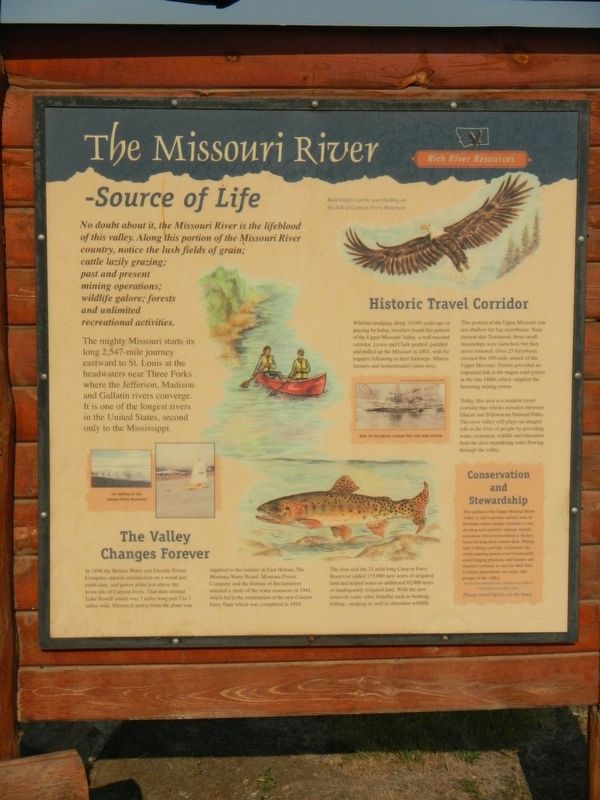
No doubt about it, the Missouri River is the life blood of this valley. Along this portion of the Missouri River country, notice the lush fields of grain; cattle lazily grazing; past and present mining operations; wildlife galore' forests and unlimited recreational activities.
The mighty Missouri starts its long 2,547-mile journey at the headwaters near Three Forks where the Jefferson, Madison and Gallatin rivers converge. It is one of the longest rivers in the United States, second only to the Mississippi.
The Valley Changes Forever
In 1896 the Helena Water and Electric Power Company started construction on a wood and earth dam, and power plant just above the town site of Canyon Ferry. The dam created Lake Sewell which was 7 miles long and 2 to 3 miles wide. Electrical power from the plant was supplied to the smelter in East Helena. The Montana Water Board, Montana Power Company and the Bureau of Reclamation initiated a study of the water resources in 1941, which led to the construction of the new Canyon Ferry Dam which was completed in 1954. The dam and the 25-mile long Canyon Ferry Reservoir added 155,000 new acres of irrigated land and helped water an additional 82,000 acres of inadequately irrigated land. With the new reservoir came other benefits such as boating, fishing, camping as well as abundant wildlife.
Historic Travel Corridor
Whether trading along 10,000 years ago or passing by today, travelers found this portion of the Upper Missouri Valley a well traveled corridor. Lewis and Clark pushed, paddled and pulled up the Missouri in 1805, with fur trappers following in their footsteps. Miners, farmers and homesteaders came next.
This portion of the Upper Missouri was too shallow for big steamboats. Near present-day Townsend, three small steamships were launched, but they never returned. Over 25 ferryboats crossed this 100-mile stretch of the Upper Missouri. Ferries provided an important link to the wagon road system in the late 1800s which supplied the booming mining towns.
Today, this area is a modern travel corridor that whisks travelers between Glacier and Yellowstone National Parks. The river valley still plays an integral role in the lives of people by providing water, recreation, wildlife and relaxation from the slow meandering water flowing through the valley.
Conservation and Stewardship
This portion of the Upper Missouri River Valley is still a pristine natural area of Montana where people continue to use, develop and carefully manage natural resources. Good stewardship is the key factor for long-term conservation. Mining land is being carefully reclaimed; the timber industry practices environmentally sound logging practices; and farmers and ranchers continue to care for their land so future generations can enjoy and prosper in the valley.
Please tread lightly on the land.
Topics and series. This historical marker is listed in these topic lists: Exploration • Natural Features • Settlements & Settlers. In addition, it is included in the Lewis & Clark Expedition series list.
Location. 46° 28.678′ N, 111° 39.519′ W. Marker is in Winston, Montana, in Broadwater County. Marker is on Main Street near U.S. 12, on the right when traveling west. Touch for map. Marker is in this post office area: Winston MT 59647, United States of America. Touch for directions.
Other nearby markers. At least 5 other markers are within 13 miles of this marker, measured as the crow flies. Canyon Ferry (approx. 10 miles away); Thar's Gold in Them Thar Hills (approx. 10 miles away); Crimson Bluffs (approx. 12.6 miles away); State Bank of Townsend (approx. 12.8 miles away); Valley Masonic Lodge No. 21 (approx. 12.9 miles away).
Credits. This page was last revised on December 22, 2021. It was originally submitted on December 22, 2021, by Barry Swackhamer of Brentwood, California. This page has been viewed 288 times since then and 42 times this year. Photos: 1, 2, 3, 4. submitted on December 22, 2021, by Barry Swackhamer of Brentwood, California.

