San Bartolo Morelos in Morelos, Mexico State, Mexico — The Central Highlands (North America)
Parish Church of San Bartolomé el Apóstol
Photographed by J. Makali Bruton, November 27, 2021
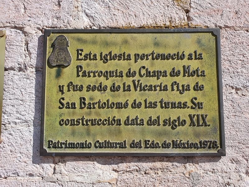
1. Parish Church of San Bartolomé el Apóstol Marker

Patrimonio Cultural del Edo. de México, 1978.
This church belonged to the Parish of Chapa de Mota and was the seat of the fixed Vicarage of San Bartolomé de las Tunas. Its construction dates from the nineteenth century.
Cultural Heritage of the State of Mexico, 1978.
Erected 1978 by Patrimonio Cultural del Estado de México.
Topics. This historical marker is listed in this topic list: Religion & Religious Structures. A significant historical year for this entry is 1978.
Location. 19° 47.157′ N, 99° 40.062′ W. Marker is in San Bartolo Morelos, Estado de Mexico (Mexico State), in Morelos. It is at the intersection of Ricardo Blanco Rodríguez and 8 de Octubre, on the left when traveling south on Ricardo Blanco Rodríguez. Touch for map. Marker is in this post office area: San Bartolo Morelos MEX 50550, Mexico. Touch for directions.

Regionally, this marker is in Central Mexico and specifically in Mexico City Metropolitan Area. Globally, it
this page online
Other nearby markers. At least 8 other markers are within 16 kilometers of this marker, measured as the crow flies: Miguel Hidalgo y Costilla (within shouting distance of this marker); Parish Church of Santiago Acotzilapan (approx. 10.4 kilometers away); Timilpan (approx. 12.2 kilometers away); The Deputies of the Constituent Congress of 1857 (approx. 13.2 kilometers away); Founding and First Government of Xocotitlán (approx. 14.9 kilometers away); Bicentennial of the Battle of Xocotitlán (approx. 14.9 kilometers away); Parish of Jesús Nazareno (approx. 14.9 kilometers away); International Day of the Police (approx. 14.9 kilometers away).
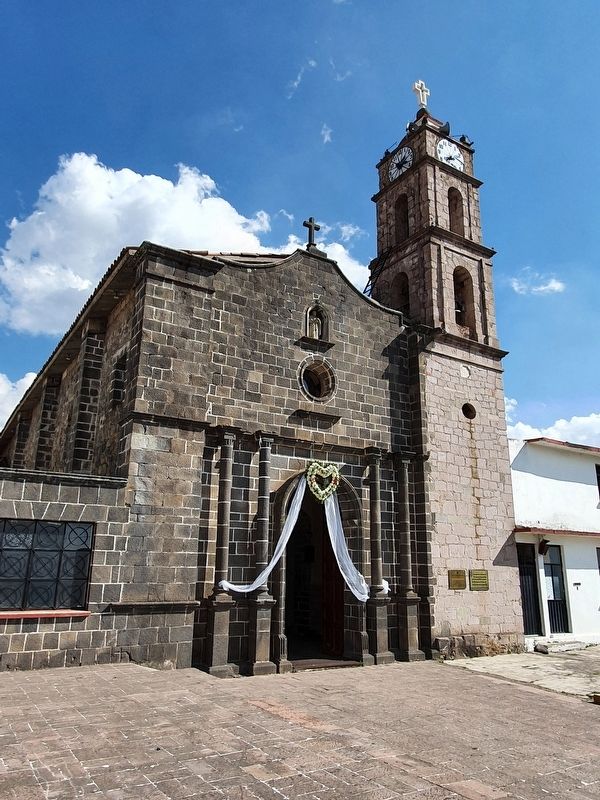
Photographed by J. Makali Bruton, November 27, 2021
2. Parish Church of San Bartolomé el Apóstol and Marker
Credits. This page was last revised on January 11, 2022. It was originally submitted on December 22, 2021, by J. Makali Bruton of Washington, District of Columbia. This page has been viewed 278 times since then and 42 times this year. Photos: 1, 2. submitted on December 22, 2021, by J. Makali Bruton of Washington, District of Columbia.
