Alamo Plaza in San Antonio in Bexar County, Texas — The American South (West South Central)
The Struggle for Independence
1822-1835
As the number of colonists rose, Mexican concerns about American influence grew. Mexico passed a law against further immigration and assessed heavy customs duties on all U.S. goods to discourage trade. In 1833, Antonio López de Santa Anna was elected president and promised to support the Constitution of 1824. The colonists, in turn, adopted the Turtle Bayou Resolutions, which declared their loyalty to Mexico and Santa Anna.
When Santa Anna abolished the constitution, Texians through consultations and conventions, attempted to resolve their differences peacefully. When disputes arose between colonists and authorities in Anahuac, Gonzales, and Goliad, Santa Anna sent troops to Texas. The consequence brought conflict to the Alamo which would forever change the history of Texas.
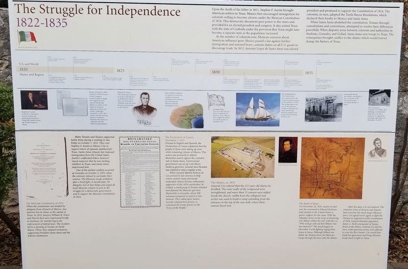
[A time line contrasting events in the U.S. and World and Alamo and Region helps set the stage for undertanding the Struggle for Independence period]
[Diagrams and drawings cover much of the marker and have accompanying text, which is transcribed below]
Stephen F. Austin [see photo #1]
Under the empresario system, Austin was granted permission to bring 300 families from the United States to Texas.
Decree of April 6, 1830 [see photo #2]
Article 11 of the Decree of the Congreso General made it illegal for emigrants from nations bordering Mexico to settle in the states or territory adjacent to their own nation. Although repealed in 1833, this article was the turning point in relations between the American colonists and the Mexican government.
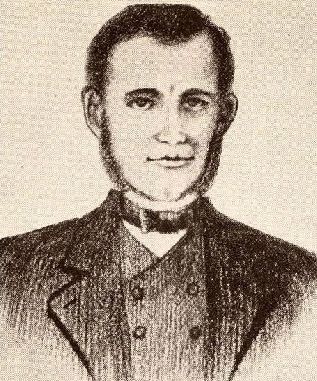
William B. Travis [see photo #3]
This drawing is believed to be the only likeness of William B. Travis, who was arrested in Anahuac and who later became commander at the Alamo.
Sites of Early Conflicts [see photo #4]
As political conditions steadily worsened, problems arose between the colonists and Mexican officials throughout Texas.
Gonzales Flag [see photo #5]
The Gonzales flag was flown in defiance of Mexican army officials who sought the return of a small cannon in October 1835.
The Independence [see photo #6]
The Texian Navy was authorized by the provisional government
on November 25, 1835. The Independence was one of the first two vessels to blockade the coast, preventing Mexican supplies and troops from reaching Texas by sea.
Veramendi House [see photo #7]
Ben Milam was killed in the courtyard of the Veramendi house during the Battle of Bexar.
The Cos House [see photo #8]
Located in La Villita, this building is traditionally believed to be where General Cos signed the surrender agreement on December 10, 1835.
The Mexican Constitution of 1824 [see photo #9]
When the constitution was drafted by delegates from all parts of Mexico, San Antonio lost its status as the capital of Texas. In 1832, lawyers William B. Travis and Patrick Jack were imprisoned briefly in Anahuac, for interferring in the enforcement of federal laws. The incident led to a meeting of Texians at Turtle Bayou. There, they adopted resolutions supporting President Santa Anna and the federal constitution.
Many Texians and Tejanos supported Santa Anna during a meeting in San Felipe on October 1, 1832. They sent Stephen F. Austin to Mexico City to request return of separate statehood for Texas. Santa Anna refused, but reopened immigration from the United States. Austin's confiscated letters, however, raised suspicion that he was inciting rebellion in Texas, and Santa Anna imprisoned him.
One
of the earliest conflicts occurred at Gonzales on October 2, 1835, when the colonists refused to surrender their cannon. The Mexican troops withdrew after a brief fight. A month later, 58 delegates met at San Felipe and urged all loyal Mexican citizens to join in the struggle for a democratic government and to support the Mexican Constitution of 1824.
The Declaration of Causes, November 7, 1835 [see photo #10]
Printed in English and Spanish, the Declaration of Causes explained that the people of Texas were taking up arms while remaining citizens of Mexico. This action was primarily to defend themselves and to oppose the centralist rule of Santa Anna. A provisional government was set up with Henry Smith as governor. General Sam Houston was ordered to raise a regular army.
When General Martin Perfecto de Cós arrived in San Antonio to help restore control, many previously undecided citizens became enthusiastic supporters of the 1824 constitution. In Goliad, a small group of Texians attacked and defeated the Mexican garrison. Meanwhile in Gonzales, about 300 volunteers prepared to march to San Antonio. They called upon Austin, recently released from prison, to command the troops known as the "Army of the People."
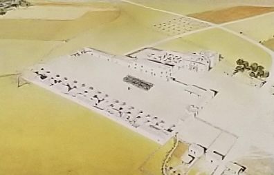
The Alamo, ca. 1835 [see photo #11]
General Cós ordered that the 111-year-old Alamo be fortified. The outer walls of the compound were strengthened, and more than 15 cannon were added. Inside the church, rubble from the collapsed roof arches was used to build a ramp extending from the entrance to the top of the rear wall, where three cannon faced east.
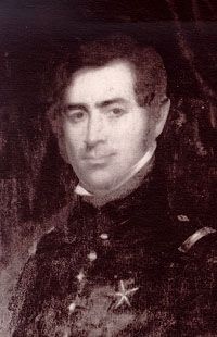
Colonel Benjamin Rush Milam [see photo #12]
The Battle of Béxar [see photo #13]
On November 24, 1835, Austin turned over his command to Edward Burleson and traveled to the United States to garner support for the cause. With the volunteer army on the verge of dissolving, Col. Milam rallied the men with the cry, "Who will go with old Ben Milam into San Antonio?" The attack began on December 5 with fighting raging from house to house. Although Milam was killed, the Texians drove the Mexican troops through the town into the Alamo.
After five days, Cós surrendered. The volunteer army of Texians and Tejanos had overcome the much larger Mexican force. Cós agreed never again to fight the Texians or supporters of the Constitution of 1824. General Houston appointed James C. Neill commander of Texian forces at the Alamo. General Cós and his men, under generous terms, were allowed to cross the Rio Grande. Cós would later break his agreement and bring Mexican troops back to fight in Texas.
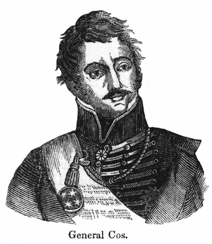
General Martín Perfecto de Cos [see photo #14]
Erected by The Alamo Organization and the Daughters of the Republic of Texas.
Topics. This historical marker is listed in these topic lists: Churches & Religion • Forts and Castles • Hispanic Americans • War, Texas Independence. A significant historical year for this entry is 1821.
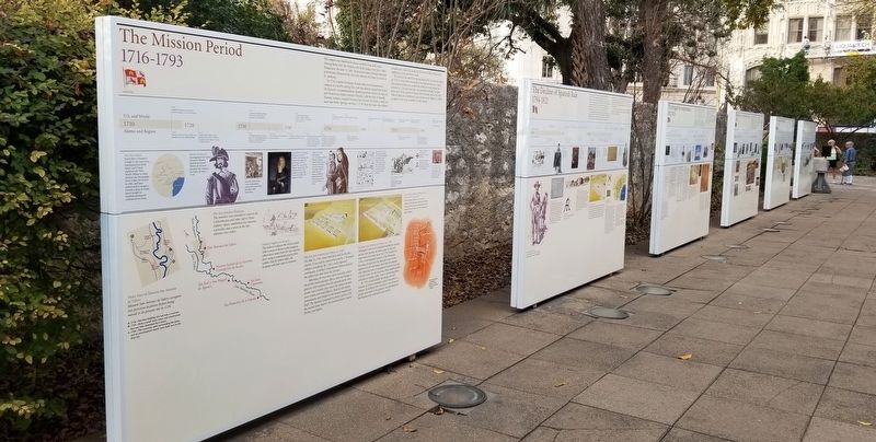
Location. 29° 25.562′ N, 98° 29.162′ W. Marker is in San Antonio, Texas, in Bexar County. It is in Alamo Plaza. Marker can be reached from the intersection of Alamo Plaza and East Houston Street. Marker is one of a series found between the Convento Courtyard and the Gift Shop on the Alamo Mission compound grounds. Touch for map. Marker is at or near this postal address: 300 Alamo Plaza, San Antonio TX 78205, United States of America. Touch for directions.
Other nearby markers. At least 8 other markers are within walking distance of this marker. The Birth of the Republic of Texas (here, next to this marker); The Decline of Spanish Rule (here, next to this marker); The Mission Period (here, next to this marker); From Republic to Early Statehood (here, next to this marker); Japanese Monument to The Heroes of the Alamo (a few steps from this marker); From Warehouse to Shrine (a few steps from this marker); Strong Foundations (a few steps from this marker); Juan Nepomuceno Seguín (a few steps from this marker). Touch for a list and map of all markers in San Antonio.
Credits. This page was last revised on February 2, 2023. It was originally submitted on December 22, 2021, by James Hulse of Medina, Texas. This page has been viewed 426 times since then and 36 times this year. Photos: 1, 2, 3, 4, 5, 6. submitted on December 23, 2021, by James Hulse of Medina, Texas.
