Trinidad in Las Animas County, Colorado — The American Mountains (Southwest)
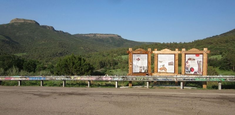
Trinidad: A Place to Explore and Discover… Create and Recreate..... Innovate and Invent
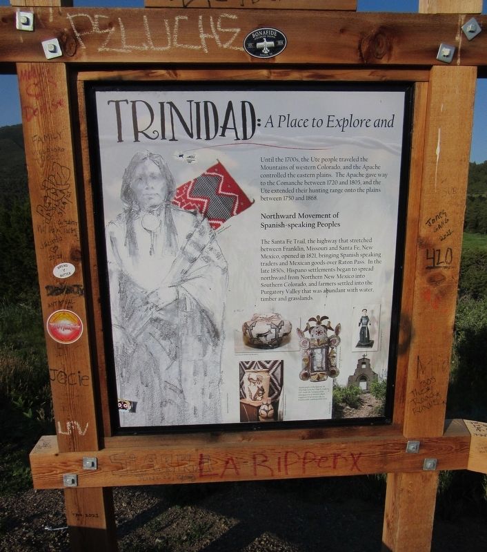
Trinidad: A Place to Explore and
Until the 1700s, the Ute people traveled the Mountains of western Colorado, and the Apache controlled the eastern plains. The Apache gave way to the Comanche between 1720 and 1805, and the Ute extended their hunting range onto the plains between 1750 and 1868.
Northward Movement of Spanish-speaking Peoples
The Santa Fe Trail, the highway that stretched between Franklin, Missouri and Santa Fe, New Mexico, opened in 1821, bringing Spanish speaking traders and Mexican goods over Ration Pass. In the late 1850s, Hispano settlements began to spread northward from Northern New Mexico into Southern Colorado, and farmers settled into the Purgatory Valley that was abundant with water, timber and grasslands.
Discover… Create and Recreate.....
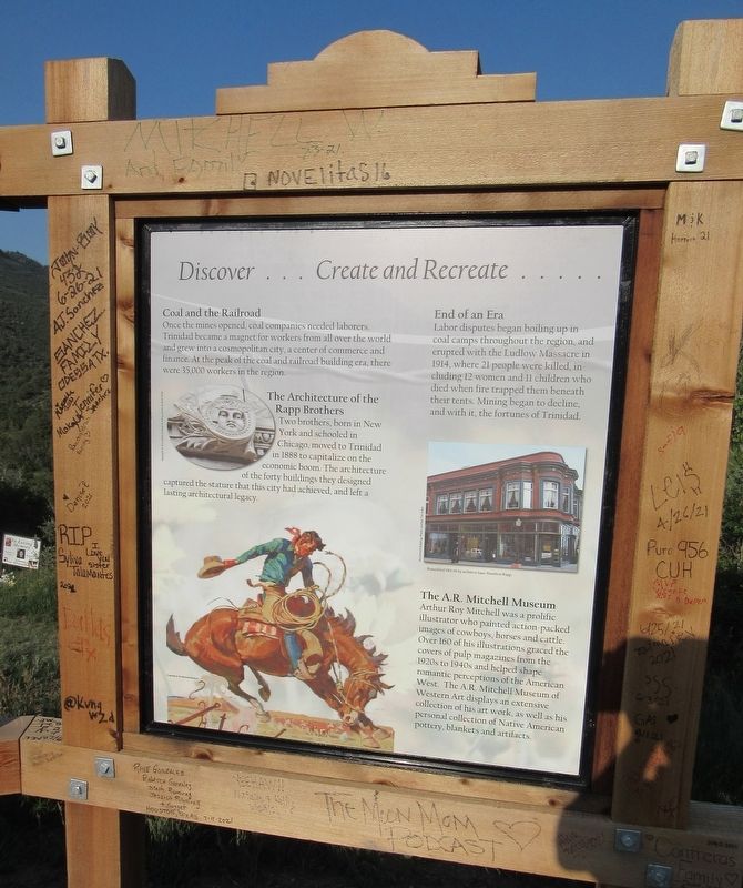
Coal and the Railroad
Once the mines opened, coal companies needed laborers. Trinidad became a magnet for workers from all over the world and grew into a cosmopolitan city, a center of commerce and finance. At the peak of the coal and railroad building era, there were 35,000 workers in the region.
End of an Era
Labor disputes began boiling in coal camps throughout the region, and erupted with the Ludlow Massacre in 1914, where 21 people were killed, including 12 women and 11 children who died when fire trapped them beneath their tents. Mining began to decline, and with it, the fortunes of Trinidad.
The Architecture of the Rapp Brothers
Two brothers, born in New York and schooled in Chicago, moved to Trinidad in 1888 to capitalize on the economic boom. The architecture of the forty buildings they designed captured the stature that this city had achieved, and left a lasting architectural legacy.
The A.R. Mitchell Museum
Arthur Roy Mitchell was a prolific illustrator who painted action-packed images of cowboys, horses and cattle. Over 160 of his illustrations graced the covers of pulp magazines from the 1920s to 1940s and helped shape romantic perceptions of the American West. The A.R. Mitchell Museum of Western Art displays an extensive collection of his art work, as well as his personal collection of Native American pottery, blankets and artifacts.
…Innovate and Invent
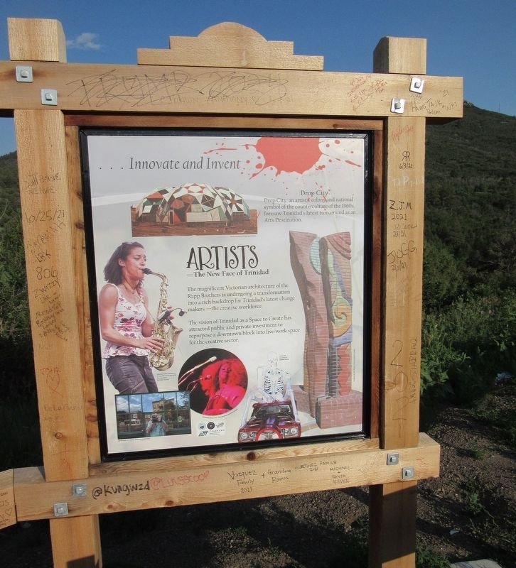
Drop City
Drop City, an artists colony and national symbol of the counterculture of the 1960s, foresaw Trinidad's latest turnaround as an Arts Destination.
Artists
The New Face of Trinidad
The magnificent Victorian architecture of the Rapp Brothers is undergoing a transformation into a rich backdrop for Trinidad's latest change makers - the creative workforce.
The vision of Trinidad as a Space to Create has attracted public and private investment to repurpose a downtown block into live/work space for the creative sector.
Erected by Colorado Department of Transportation.
Topics. This historical marker is listed in these topic lists: Architecture • Arts, Letters, Music • Industry & Commerce • Native Americans • Settlements & Settlers. A significant historical year for this entry is 1700.
Location. 37° 0.454′ N, 104° 28.782′ W. Marker is in Trinidad, Colorado, in Las Animas County. Marker is on Interstate 25, 8 miles State Route 72, on the right. Located 1 mile north of the Colorado stateline. Touch for map. Marker is in this post office area: Trinidad CO 81082, United States of America. Touch for directions.
Other nearby markers. At least 8 other markers are within 12 miles of this marker, measured as the crow flies. Raton Pass (approx. 0.9 miles away); Road to Santa Fe - Over the Pass / Santa Fe Trail Country - "Uncle Dick" Wootton (approx. 0.9 miles away); Palace Hotel (approx. 7.7 miles away in New Mexico); The Mountain Route (approx. 8.7 miles away in New Mexico); First Automobile in New Mexico (approx. 8.8 miles away in New Mexico); Raton (approx. 9.1 miles away in New Mexico); Temple Aaron 1889 (approx. 11.1 miles away); A Clash of Cultures (approx. 11.2 miles away). Touch for a list and map of all markers in Trinidad.
Credits. This page was last revised on December 25, 2021. It was originally submitted on December 23, 2021, by Jason Armstrong of Talihina, Oklahoma. This page has been viewed 421 times since then and 15 times this year. Photos: 1, 2, 3, 4. submitted on December 23, 2021, by Jason Armstrong of Talihina, Oklahoma. • Andrew Ruppenstein was the editor who published this page.


