Toston in Broadwater County, Montana — The American West (Mountains)
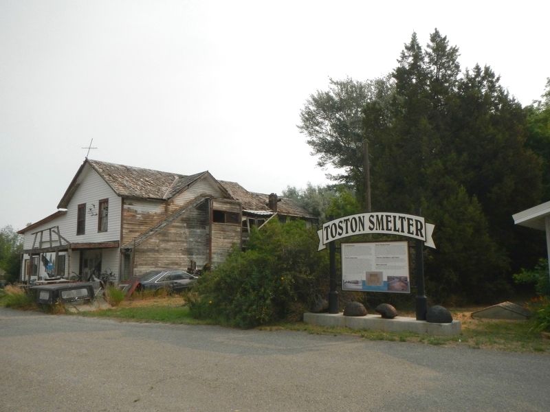
Toston Smelter
Inscription.
Its Beginning
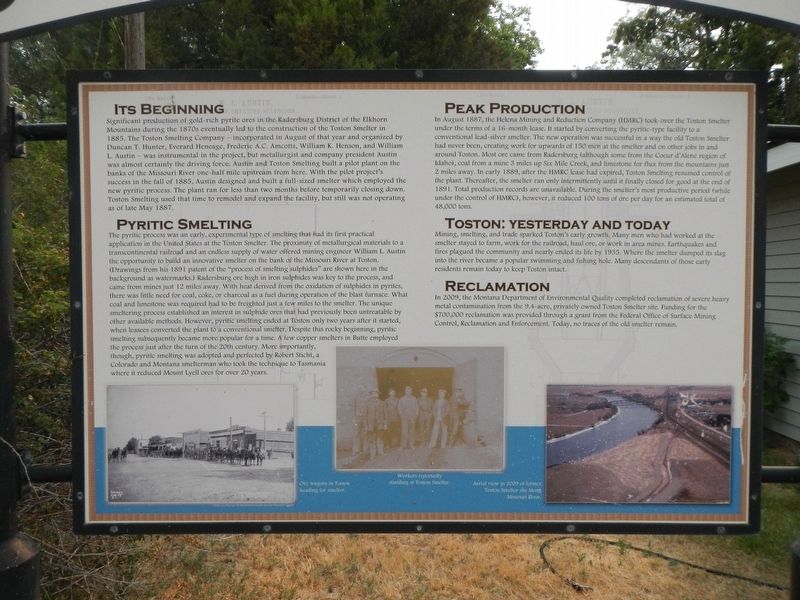
Significant production of gold-rich pyrite ores in the Radersburg District of the Elkhorn Mountains during the 1870s eventually lento the construction of the Toston Smelter in 1885. The Toston Smelter Company - incorporated in August of that year and organized by Duncan T. Hunter, Everard Heneage, Frederick A.C. Amcotts, William K. Henson, and William L, Austin - was instrumental in the project, but metallurgist and company president Austin was almost certainly the driving force. Austin and Toston Smelting built a pilot plant on the banks of the Missouri River one-half mile upstream from here. With the pilot project's success in the fall of 1885, Austin designed and built a full-sized smelter which employed the new pyrite process. The plant ran for less than two months before temporarily closing down. Toston Smelting used that time to remodel and expand the facility, but still was not operating as of late May 1887.
Pyritic Smelting
The pyritic process was an early, experimental type of smelting that had its first practical application in the United States as the Toston Smelter. The proximity of metallurgical materials to a transcontinental railroad and an endless supply of water offered mining engineer William L. Austin the opportunity to build an innovative smelter on the banks of the Missouri River at Toton. (Drawings from his 1891 patent of the "process of smelting sulphide" are shown here in the background as watermarks.) Radersburg ore high in iron sulphide was key to the process, and came from mines just 12 miles away. With heat derived from the oxidation of sulphide in pyrites, there was little need for coal, coke, or charcoal as a fuel during the operation of the blast furnace. What coal and limestone was required had to be freighted just a few miles to the smelter. The unique smeltering process established an interest in sulphide ores that had perviously been untreatable by other methods. However, pyritic smelting ended at Toston only two years after it started, when leasees converted the plant to a conventual smelter. Despite this rocky beginning, pyritic smelting subsequently became more popular for a time. A few copper smelter in Butte employed the process just after the turn of the century. More importantly, though, pyritic smelting was adopted and perfected by Robert Sticht, a Colorado and Montana smelterman who toke the technique to Tasmania where it reduced Mount Lyell ores for over 20 years.
Peak Producrtion
In August 1887, the Helena Mining and Reduction Company (HMRC) took over the Toston Smelter under terms of a 16-month lease. It started by converting the pyritic-type facility to a conventional lead-silver smelter. The new operation was successful in a way the old Toston Smelter had never been, creating work for up to 150 men at the smelter and on other jobs in and around Toston. Most ore came from Raderburg (although some from the Coeur d'Alene region of Idaho), coal from a mine 3 miles up Six Mile Creek, and limestone for flux from the mountains just 2 miles away. In early 1889, after the HMRC lease had expired, Toston Smelting resumed control of the plant. Thereafter, the smelter ran only intermittently until it finally closed for good as the end to 1891. Total production records are unavailable. During the smelter's most productive period (while under control of HMRC), however, it reduced 100 tons of ore per day for an estimated total of 48,000 tons.
Toston: Yesterday and Today
Mining, smelting, and trade sparked Toston's early growth. Many men who had worked at the smelter stayed to farm, work for the railroad, haul ore, or work in the area mines. Earthquakes and fires plagued the community and nearly ended its life by 1935. Where the smelter dumped its slag into the river became a popular swimming and fishing hole. Many, descendants of those early residents remain today to keep Toston intact.
Reclamation
In 2009, the Montana Department of Environmental Quality completed reclamation of severe heavy metal contamination from the

via Montana's Historic Landscapes, unknown
3. Toston: Another Northern Pacific Town in Broadwater County
Montana's Historic Landscapes blog entry
Click for more information.
Click for more information.
Topics. This historical marker is listed in these topic lists: Industry & Commerce • Natural Resources • Science & Medicine.
Location. 46° 10.348′ N, 111° 26.468′ W. Marker is in Toston, Montana, in Broadwater County. Marker is at the intersection of Lombard Road and Bypass State Highway 287, on the right when traveling north on Lombard Road. Touch for map. Marker is at or near this postal address: 509 Lombard Road, Toston MT 59643, United States of America. Touch for directions.
Other nearby markers. At least 8 other markers are within 14 miles of this marker, measured as the crow flies. Toston Bridge (about 300 feet away, measured in a direct line); Lorentz Homestead (approx. 0.2 miles away); Lewis and Clark Trail (approx. 3.8 miles away); Yorks Islands (approx. 6.9 miles away); Valley Masonic Lodge No. 21 (approx. 10.8 miles away); State Bank of Townsend (approx. 10.9 miles away); Crimson Bluffs (approx. 10.9 miles away); Thar's Gold in Them Thar Hills (approx. 13.7 miles away). Touch for a list and map of all markers in Toston.
Regarding Toston Smelter. Toston has become a forgotten town of the Northern Pacific Railroad line as it stretched from Logan, in Gallatin County, through the headwaters of the Missouri River and into the broad Missouri River valley of Broadwater County. Today Toston is best known to travelers of U.S. 287 as a scenic stop on the Missouri River, and the access to Toston Dam reservoir, a project of the U.S. Bureau of Reclamation.
Credits. This page was last revised on December 24, 2021. It was originally submitted on December 24, 2021, by Barry Swackhamer of Brentwood, California. This page has been viewed 173 times since then and 19 times this year. Photos: 1, 2. submitted on December 24, 2021, by Barry Swackhamer of Brentwood, California. 3. submitted on December 24, 2021, by Larry Gertner of New York, New York.

