Springfield in Sangamon County, Illinois — The American Midwest (Great Lakes)
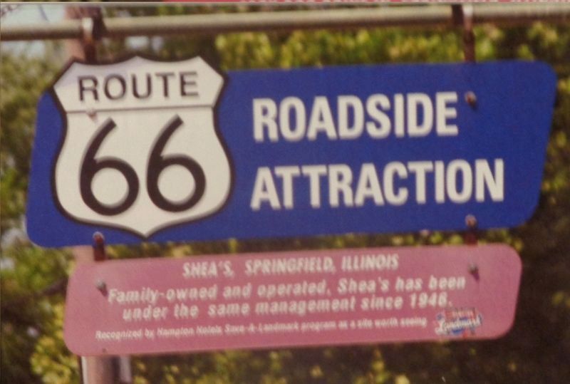
Shea's, Springfield, Illinois
Route 66 Roadside Attraction
Recognized by Hampton Hotels Save-A-Landmark program as a site worth seeing
Erected 2003 by Hampton Hotels Save-A-Landmark program.
Topics and series. This historical marker is listed in this topic list: Industry & Commerce. In addition, it is included in the Route 66 Roadside Attractions, and the U.S. Route 66 series lists. A significant historical year for this entry is 1946.
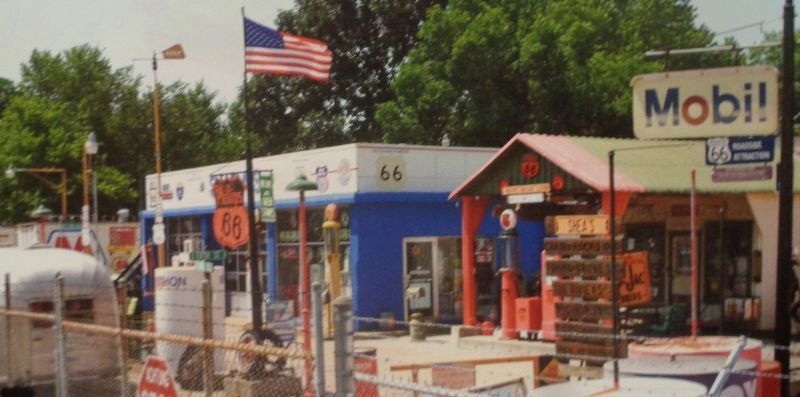
Location. Marker has been permanently removed. It was located near 39° 49.849′ N, 89° 38.23′ W. Marker was in Springfield, Illinois, in Sangamon County. Marker was on East Sangamon Avenue west of North Peoria Road (Business Interstate 55), on the right when traveling east. Marker was outside Shea's Gas Station Museum. Touch for map. Marker was at or near this postal address: 1236 E Sangamon Ave, Springfield IL 62702, United States of America.
We have been informed that this sign or monument is no longer there and will not be replaced. This page is an archival view of what was.
Other nearby markers. At least 8 other markers are within walking distance of this location. Illinois - Where The Mother Road Begins! (about 500 feet away, measured in a direct line); Chain of Rocks Bridge (about 500 feet away); The Coliseum (about 600 feet away); Chain of Rocks Motel (about 600 feet away); Bel-Air Drive-In (about 600 feet away); A. Lincoln Motel (about 600 feet away); Route 66 Experience (about 600 feet away); Reservoir Park and Lanphier High School (approx. 0.9 miles away). Touch for a list and map of all markers in Springfield.
Regarding Shea's, Springfield, Illinois. Photos were taken by Route 66 photographer David Wickline, from his book Images of 66, Volume 2: Digging Deeper. Used with Mr. Wickline's permission.
Also see . . . Shea's Gas Station Museum on Wikipedia. Owner Bill Shea ran a classic gas station on old Route 66 while at the same time, displaying several pieces of old gas station and Route 66 memorabilia. It was a popular stop for Mother Road travelers all over the world. However, after Shea passed away in 2013, the gas station closed and was sold. All pieces of memorabilia were later auctioned off. As of late 2021, the place
is now Fulgenzi's Pizza & Pasta. (Submitted on December 28, 2021, by Jason Voigt of Glen Carbon, Illinois.)
Credits. This page was last revised on December 28, 2021. It was originally submitted on December 28, 2021, by Jason Voigt of Glen Carbon, Illinois. This page has been viewed 183 times since then and 11 times this year. Photos: 1, 2. submitted on December 28, 2021, by Jason Voigt of Glen Carbon, Illinois.

