Warwick in Lincoln County, Oklahoma — The American South (West South Central)
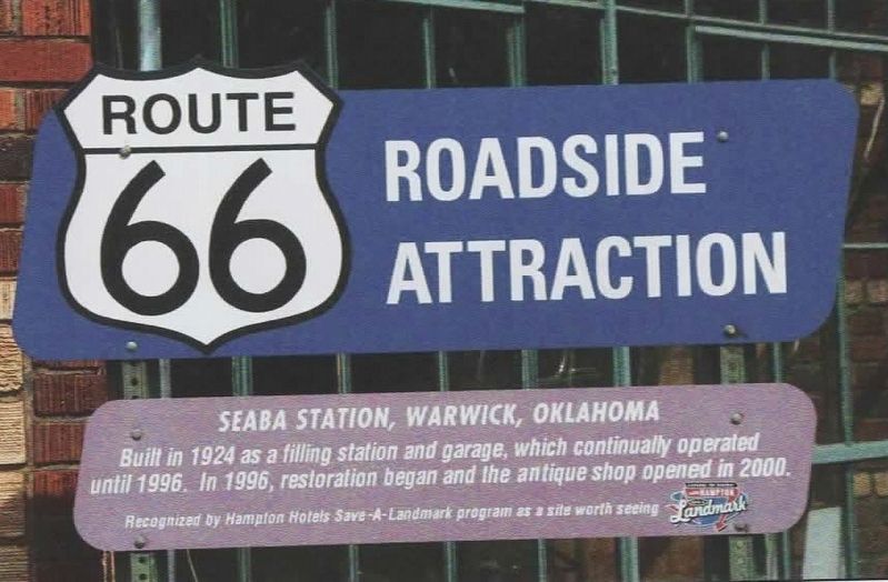
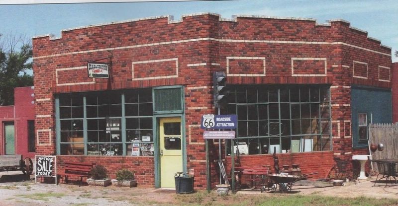
Seaba Station, Warwick, Oklahoma
Route 66 Roadside Attraction
Photographed by David Wickline
1. Seaba Station, Warwick, Oklahoma Marker
Built in 1924 as a filling station and garage, which continually operated until 1996. In 1996, restoration began and the antique shop opened in 2000.
Recognized by Hampton Hotels Save-a-Landmark program as a site worth seeing
Erected 2003 by Hampton Hotels Save-a-Landmark program.
Topics and series. This historical marker is listed in this topic list: Industry & Commerce. In addition, it is included in the Route 66 Roadside Attractions, and the U.S. Route 66 series lists. A significant historical year for this entry is 1924.
Location. 35° 41.19′ N, 97° 0.006′ W. Marker is in Warwick, Oklahoma, in Lincoln County. It is on State Highway 66 east of Commercial Street, on the right when traveling west. Marker was originally located outside the building, but was later placed indoors, visible from a window. Touch for map. Marker is at or near this postal address: 71 U.S Rte 66, Chandler OK 74834, United States of America. Touch for directions.

Regionally, this marker is in Central Oklahoma — Frontier Country. It is also in the American South, specifically on the prairies, and on the Southern Plains. Globally, it is
this page online
Other nearby markers. At least 8 other markers are within 7 miles of this marker, measured as the crow flies: William Matthew Tilghman (approx. 5½ miles away); Oklahoma National Guard Statistical Building (approx. 6½ miles away); Lincoln County War Memorial (approx. 6.7 miles away); Wolcott Building (approx. 6.8 miles away); Oleson-Crane Building (approx. 6.8 miles away); Chandler Brick Paving (approx. 6.8 miles away); Phillips 66 Filling Station (approx. 6.8 miles away); Crane Motor Company (approx. 6.8 miles away).
Regarding Seaba Station, Warwick, Oklahoma. Photos were taken by Route 66 photographer David Wickline, from his book Images of 66, Volume 2: Digging Deeper. Used with Mr. Wickline's permission.
Also see . . . Oklahoma: Seaba Station. National Park Service website entry (Submitted on July 1, 2023, by Larry Gertner of New York, New York.)
Photographed by David Wickline
2. Seaba Station, Warwick, Oklahoma Marker
Photographed by Google Maps, 2018
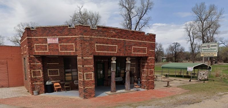
3. Seaba Station, Warwick, Oklahoma Marker
Marker has since moved indoors, visible from a window.
Credits. This page was last revised on July 1, 2023. It was originally submitted on December 29, 2021, by Jason Voigt of Glen Carbon, Illinois. This page has been viewed 458 times since then and 35 times this year. Photos: 1, 2. submitted on December 29, 2021, by Jason Voigt of Glen Carbon, Illinois. 3. submitted on December 30, 2021, by Jason Voigt of Glen Carbon, Illinois.
