Birmingham in Jefferson County, Alabama — The American South (East South Central)
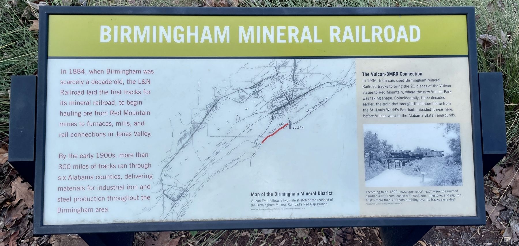
Birmingham Mineral Railroad
By the early 1900s, more than 300 miles of tracks ran through six Alabama counties, delivering materials for industrial iron and steel production throughout the Birmingham area.
[Inset]
The Vulcan-BMRR Connection
In 1936, train cars used Birmingham Mineral Railroad tracks to bring the 21 pieces of the Vulcan statue to Red Mountain, where the new Vulcan Park was taking shape. Coincidentally, three decades earlier, the train that brought the statue home from the St. Louis World's Fair had unloaded it near here, before Vulcan went to the Alabama State Fairgrounds.
[Captions]
Map of the Birmingham Mineral District
Vulcan Trail follows a two-mile stretch of the roadbed of the Birmingham Mineral Railroad's Red Gap Branch.
Map of the Birmingham-Bessemer Terminal Area Co-ordinating Committee, 1935
According to an 1890 newspaper report, each week the railroad handled 4,000 cars loaded with coal, ore, limestone, and pig iron. That's more than 700 cars rumbling over its tracks every day!
Photo by Mall Lawson, courtesy of Marvin Clemons, Jr.
Topics. This historical marker is listed in these topic lists: Industry & Commerce • Railroads & Streetcars. A significant historical year for this entry is 1884.
Location. 33° 29.526′ N, 86° 47.764′ W. Marker is in Birmingham, Alabama, in Jefferson County. Marker can be reached from Richard Arrington Jr. Boulevard South, 0.4 miles south of 16th Avenue South, on the right when traveling south. Located above the north parking lot of Vulcan Park. Touch for map. Marker is at or near this postal address: 1852 Richard Arrington Jr Blvd S, Birmingham AL 35205, United States of America. Touch for directions.
Other nearby markers. At least 8 other markers are within walking distance of this marker. Mining Red Mountain (within shouting distance of this marker); The Works Progress Administration (within shouting distance of this marker); The Lone Pine Mine (within shouting distance of this marker); Birmingham District Minerals (within shouting distance of this marker); Industry (within shouting distance of this marker); Kiwanis and Vulcan (within shouting distance of this marker); Building The Park (within shouting distance of this marker); A New City (within shouting distance of this marker). Touch for a list and map of all markers in Birmingham.
Also see . . . Bhamwiki on the Birmingham Mineral Railroad. (Submitted on December 31, 2021, by Mark Hilton of Montgomery, Alabama.)
Credits. This page was last revised on January 1, 2022. It was originally submitted on December 31, 2021, by Mark Hilton of Montgomery, Alabama. This page has been viewed 397 times since then and 60 times this year. Photo 1. submitted on December 31, 2021, by Mark Hilton of Montgomery, Alabama.
Editor’s want-list for this marker. A wide shot of the marker and its surroundings. • Can you help?
