
Kennett Township near Kennett Square in Chester County, Pennsylvania — The American Northeast (Mid-Atlantic)
Battle of Brandywine
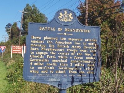
Photographed by Roger Dean Meyer, October 8, 2006
1. Battle of Brandywine Marker
Erected 1952 by Pennsylvania Historical and Museum Commission. (Marker Number A48.)
Topics and series. This historical marker is listed in this topic list: War, US Revolutionary. In addition, it is included in the Pennsylvania Historical and Museum Commission (PHMC) series list.
Location. 39° 51.49′ N, 75° 41.387′ W. Marker is near Kennett Square, Pennsylvania, in Chester County. It is in Kennett Township. It is on East Baltimore Pike (U.S. 1) 0.2 miles east of McFarlan Road, on the right when traveling east. Located at the merge of the Kennett Square By-pass. Touch for map. Marker is in this post office area: Kennett Square PA 19348, United States of America. Touch for directions.

Regionally, this marker is in Southeast Pennsylvania
this page online
Other nearby markers. At least 8 other markers are within 2 miles of this marker, measured as the crow flies: A different marker also named Battle of Brandywine (here, next to this marker); Longwood's Carillon (approx. one mile away); Historic Pumphouse (approx. 1.1 miles away); London Plane-Tree (approx. 1.1 miles away); State Fencibles of Philadelphia Campsite (approx. 1.1 miles away); Bonsai Courtyard (approx. 1.1 miles away); Historic Potting Shed (approx. 1.1 miles away); Waterlily Court (approx. 1.2 miles away). Touch for a list and map of all markers in Kennett Square.
Another marker is no longer nearby. Main Fountain Garden (was approx. 1.2 miles away but has been permanently removed).
Also see . . .
1. Brandywine Battlefield. (Submitted on August 15, 2007, by Roger Dean Meyer of Yankton, South Dakota.)
2. Battle of Brandywine (Army Divides) - Behind the Marker.
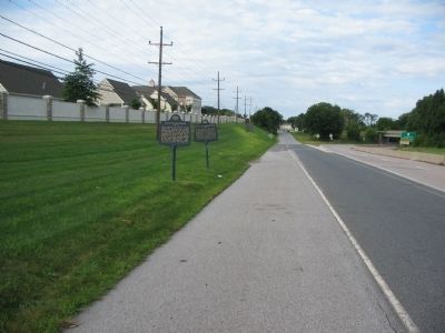
Photographed by Craig Swain, August 14, 2010
2. Battle of Brandywine Markers
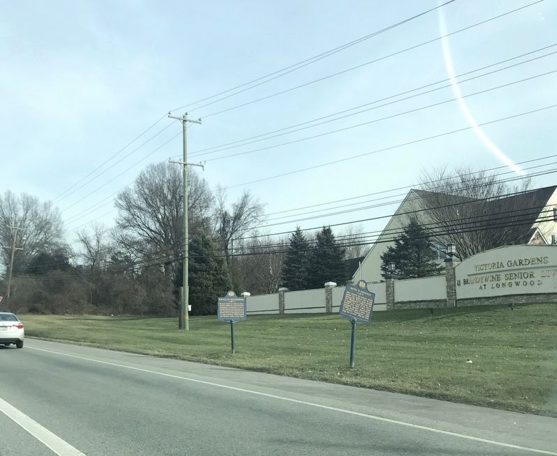
Photographed by Adam Margolis, January 13, 2022
3. Battle of Brandywine Marker
Credits. This page was last revised on February 7, 2023. It was originally submitted on August 15, 2007, by Roger Dean Meyer of Yankton, South Dakota. This page has been viewed 2,048 times since then and 36 times this year. Last updated on January 3, 2022, by Carl Gordon Moore Jr. of North East, Maryland. Photos: 1. submitted on August 15, 2007, by Roger Dean Meyer of Yankton, South Dakota. 2. submitted on January 9, 2011, by Craig Swain of Leesburg, Virginia. 3. submitted on January 13, 2022, by Adam Margolis of Mission Viejo, California. • Mark Hilton was the editor who published this page.
