Fort Lee in Bergen County, New Jersey — The American Northeast (Mid-Atlantic)
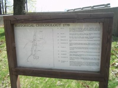
Historical Chronology 1776
Photographed by Bill Coughlin, April 25, 2008
1. Historical Chronology Marker
(1) July 12 - Fort Lee’s fortifications laid out. Together with Fort Washington on the opposite bank and aided by a river barrier, the twin fortresses are intended to thwart British control of the Hudson.
(2) July 12 - General Howe’s forces land on Staten Island and through late-August amass 31,000 men.
(3) August 22 - British cross the Bay and engage Washington’s army five days later in the Battle of Long Island.
(4) September 15 - Howe’s troops, in pursuit of the Americans, land at Kip’s Bay.
(5) September 16 - Battle of Harlem Heights begins. After a month, Washington moves north while the British head for the East River.
(6) October 9 - Three British warships attempting to penetrate the river blockade and silence the protective batteries are repulsed.
(7) October 18 - After being repulsed at Throgs Neck, Howe’s forces land at Pell’s Point.
(8) October 28 - After regrouping, American and British armies fight the Battle of White Plains.
(9
Erected by Fort Lee Historic Park.
Topics and series. This historical marker is listed in these topic lists: Forts and Castles • War, US Revolutionary. In
this page online
Location. 40° 50.851′ N, 73° 57.848′ W. Marker is in Fort Lee, New Jersey, in Bergen County. It can be reached from Hudson Terrace. Marker is in Fort Lee Historic Park on a walking trail to the south of the Visitor Center. Touch for map. Marker is at or near this postal address: Fort Lee Historic Park, Fort Lee NJ 07024, United States of America. Touch for directions.

Regionally, this marker is in New Jersey’s North Jersey, in Greater Newark, and in the New York City Metropolitan Area. It is also in the American Northeast, in the Mid-Atlantic, and on the Eastern Seaboard. Globally, it is in the North Atlantic Region, North America, the Western Hemisphere, the Western World, and the Anglosphere. Historically, it finds itself in what was once New Netherland and also one of the original Thirteen Colonies.
Other nearby markers. At least 8 other markers are within walking distance of this marker: Cannons (a few steps from this marker); The Barbette Battery (about 400 feet away, measured
Photographed by Bill Coughlin, April 25, 2008
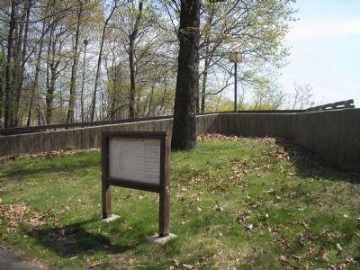
2. Marker at Fort Lee Historic Park
The marker is located on the walking trail south of the Visitor Center.
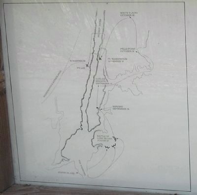
More about this marker. The left side of the marker contains a map showing the events mentioned on the marker.
Related markers. Click here for a list of markers that are related to this marker. This series of markers follows the walking tour of Fort Lee Historic Park.
Also see . . .
1. Battle of Fort Washington. American Revolutionary War website entry (Submitted on August 30, 2021, by Larry Gertner of New York, New York.)
2. Washington's Retreat Through Jersey. General Atomic website entry (Submitted on May 16, 2008, by Bill Coughlin of Woodland Park, New Jersey.)
Photographed by Bill Coughlin, April 25, 2008
3. Detail of Battle Map
Photographed by Bill Coughlin, April 25, 2008
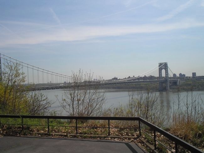
4. Hudson River Overlook
This photo, taken from the observation deck in front of the marker, looks toward Fort Washington in Manhattan. The bridge which connects the sites of these twin forts is named for George Washington.
Credits. This page was last revised on January 7, 2025. It was originally submitted on May 16, 2008, by Bill Coughlin of Woodland Park, New Jersey. This page has been viewed 1,984 times since then and 34 times this year. Last updated on January 3, 2022, by Carl Gordon Moore Jr. of North East, Maryland. Photos: 1, 2, 3, 4. submitted on May 16, 2008, by Bill Coughlin of Woodland Park, New Jersey. • Michael Herrick was the editor who published this page.
